
High pressure could hang around for much of the rest of this month, with only temporary unsettled conditions. Looking further ahead, the ECMWF seasonal update indicates a +NAO pattern dominating through the winter, which means a mild winter.
High pressure looks to remain in control of UK weather for the rest of this week, A blocking high will build just to the east of the UK from today, which will linger for the rest of the week over southern Scandinavia and the Baltic Sea. High pressure at the surface covering much of northern, central and eastern Europe for the rest of the week will keep the UK mostly dry and settled, but like recent days, there will be a lot of cloud around trapped underneath a high pressure inversion along with some fog forming in places overnight. The cloud will be thick enough for the odd spot of drizzle too, but there will be some breaks in the cloud, especially across northern and eastern areas.
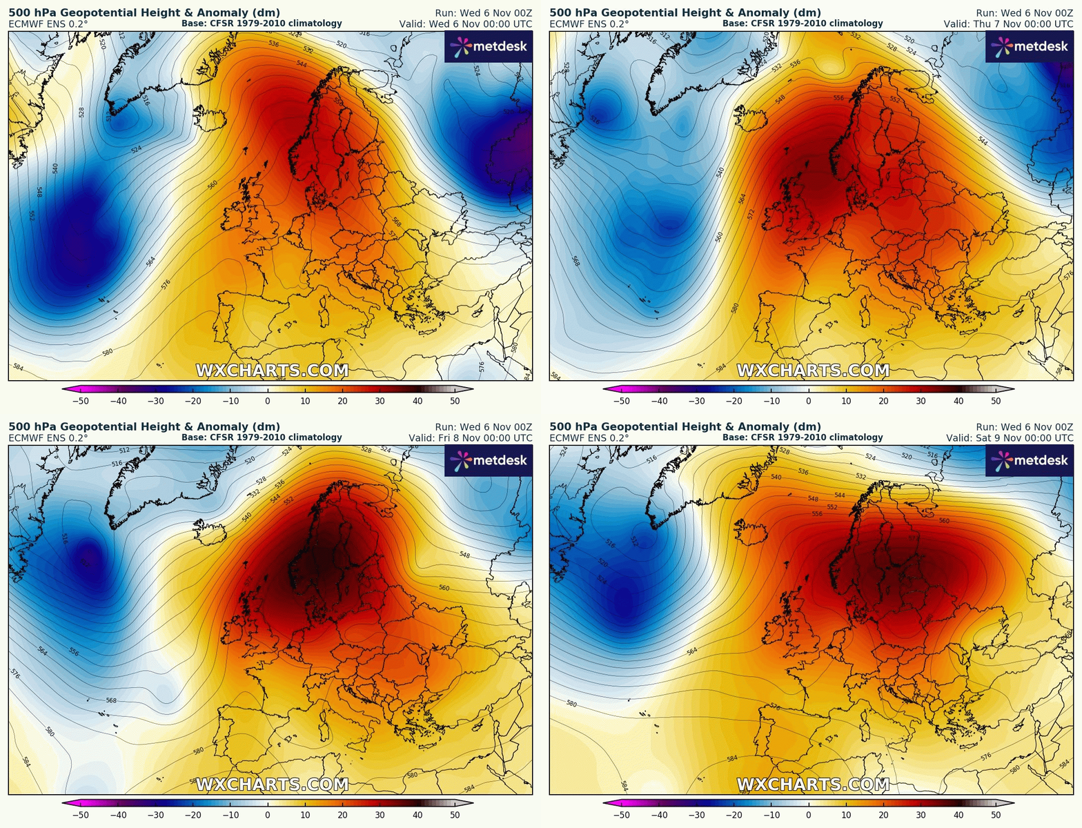
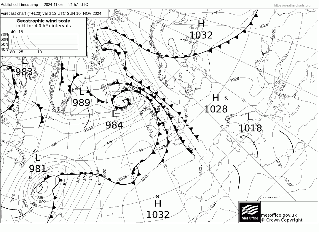
Over the weekend, we see high pressure relax a bit to allow a weakening trough to extend east from the Atlantic across western Europe, which will allow weakening weather fronts to spread east across the UK on Sunday. The fronts will bring thicker cloud from the west, with outbreaks of mainly light rain or drizzle eastwards.
High pressure looks to build back from the southwest from early next week, this time the models indicate a blocking high will build close to western Britain over the Atlantic through to Thursday, with predominantly dry and settled conditions. From Thursday next week, some uncertainty, as is normal over a week out, but models broadly agree on the blocking high close to the west retrograding west, allowing an upper trough to extend south into Europe to the east of the UK. The trough eventually forming a cut-off low. How close to the UK the upper trough and eventual cut-off low is, when it extends south, is uncertain. The closer the trough is to the east, the more likely we will see a change to more unsettled conditions during the second half of next week. But potential change to more unsettled conditions may not last long. With hints that high pressure may move back in.
High pressure blocking rebuilds close to the west next week
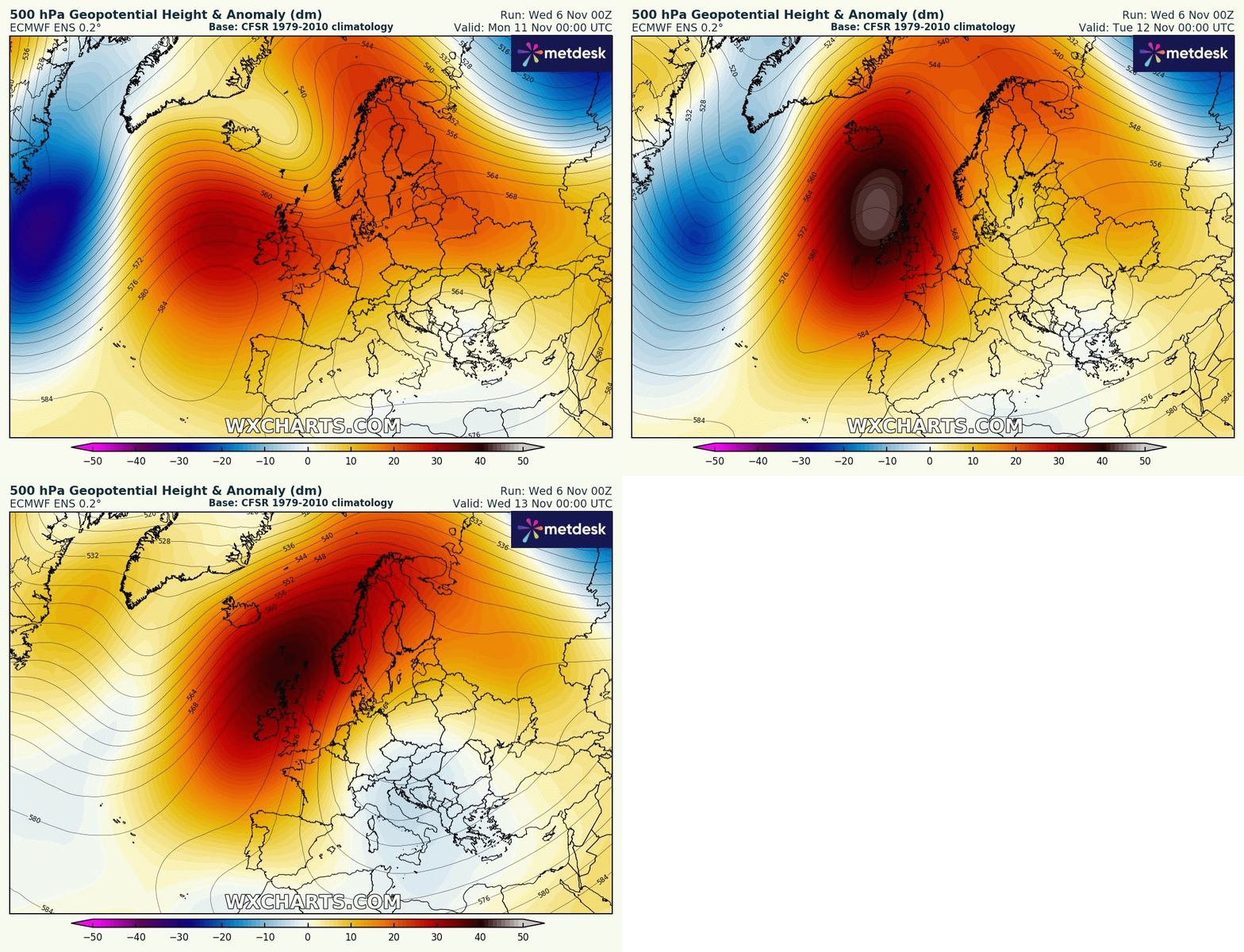
But by Thursday high pressure may weaken to allow more unsettled conditions to take over
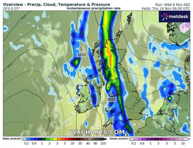
For the second half of the month, extended modelling from ECMWF indicates high pressure to the west and southwest of the UK and troughing to the northeast. This indicates cooler or colder conditions are more likely at times, with winds from the northwest or west, which could bring polar air at times with an increased risk of overnight frosts and wintry precipitation for high ground in the north. High pressure may remain close enough to the southwest to bring often dry and settled weather in the south, but with polar air at times, less cloud and more sunny than we’ve seen recently.
Looking further ahead into the start of the winter season, the November update of the ECMWF seasonal model forecast indicates a positive North Atlantic Oscillation (+NAO) flow pattern in the means across December, January and February – with lower heights/pressure towards Greenland and higher heights/pressure over Europe. This would mean a greater probability for a mobile westerly or southwesterly flow dominating through large parts of the winter, bringing above average temperatures and also average rainfall, with exception of northwest Britian – where rainfall is forecast to be above average.
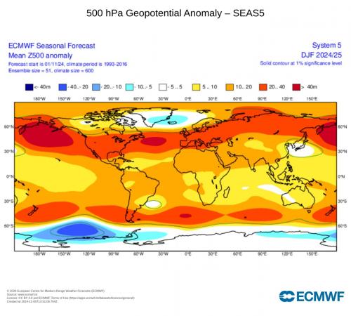
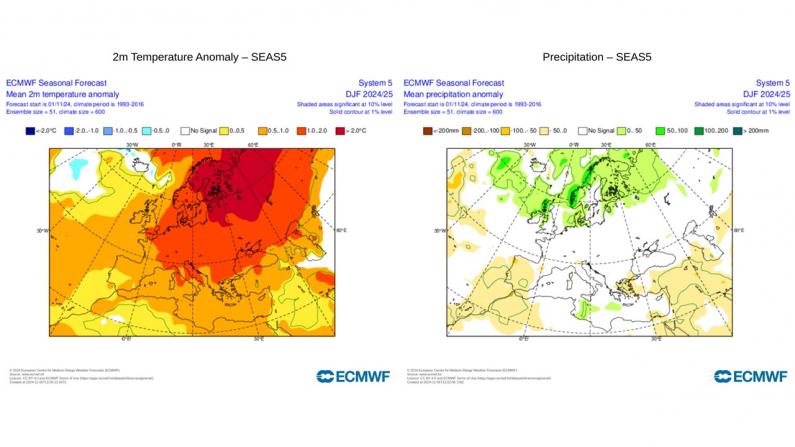
The +NAO pattern forecast by ECMWF does tie in with the context of the global weather patterns that tend to manifest as a result of the likely phases of key drivers mentioned below
· Westerly phase of the Quasi-Biennial Oscillation (QBO) during winter 2024-25 – which tends to promote a +NAO and westerly winds over the North Atlantic and UK
· Developing weak La Nina tends to favour northwesterly winds at the beginning of winter before turning westerly, so a front-loaded winter for any cold weather.
· Solar maximum tends to encourage a stronger polar vortex in winter, thus increased chance of a +NAO
· Widespread warm anomalies over the Pacific and North Atlantic oceans which favours milder conditions across large parts of Europe.
· Global warming – which also favours milder winters.
The Met Office 3-month contingency covers December and January and indicates only a 5% chance of being colder than average, 65% average and 30% above average temperatures. This perhaps highlights that it may not be anomalously mild throughout these two months, but any prolonged cold is unlikely.
The Netweather full winter forecast will be issued later this month.
Loading recent activity...