As we move into the second half of October thoughts turn to our autumn storm season. The UK Met Office issued their new storm name list back at the start of September in conjunction with Met Eireann and the Dutch KNMI. First up would be Storm Ashley when one of the national meteorological services decides that significant impacts are likely from a low pressure and that the public will need time to prepare for an event. National newspapers should remember that they are not in charge of naming storms. There is still some uncertainty around the development of this low pressure.
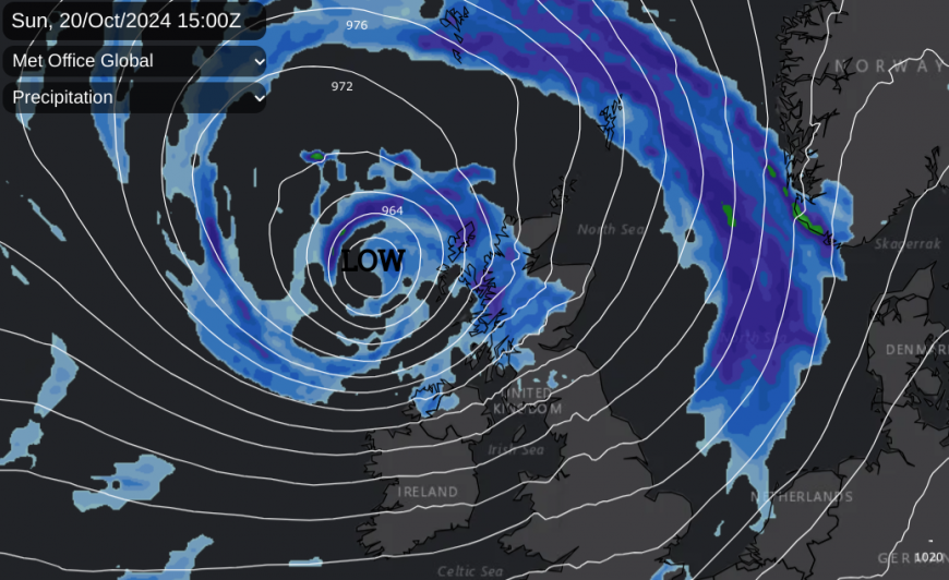
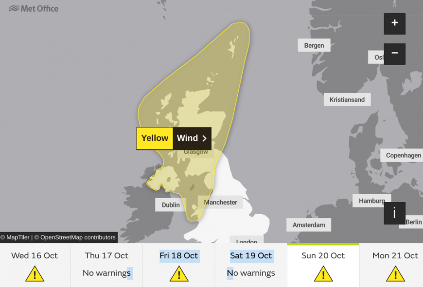
There is a juicy-looking low pressure showing on the weather charts for Sunday 20th October with wet and windy weather across the UK and overnight into early Monday with potentially wild conditions for Scotland. There is uncertainty at this stage with different models showing various solutions but the UK Met Office has issued a yellow wind warning as an early heads up. It is half term in some parts of Scotland this week and the October break for others next week so more people could be travelling or planning to visit areas that they are unfamiliar with. Or trying to travel by ferry or on small island planes. There are also high spring tides later this week so that could bring the risk of coastal flooding.
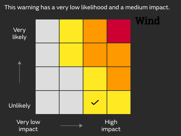
The weather warnings give specific details about where and when severe weather is expected to occur. A storm name raises awareness of a low pressure event. For a warning colour level is arrived at when Likelihood is matched against Impacts. Currently, the likelihood is ‘Unlikely’ due to the uncertainty of four days ahead but impacts have been judged as Moderate.
“A spell of strong winds could cause disruption on Sunday and into Monday” Sunday 3am until Monday 12noon. Met Office
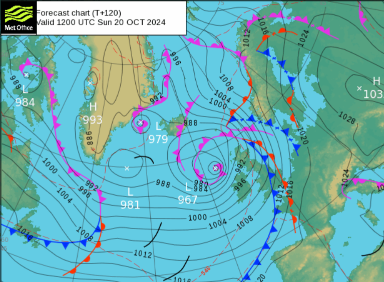
After a fine Thursday, Friday will be fine for eastern Britain in the morning but will turn wet and windy from the west. Various weather fronts will swing in from the Atlantic as a low centre heads up towards Iceland. During Friday evening there could be squally downpours along a cold front moving from Belfast across the Irish Sea into western Britain. All that clears leaving a fine Saturday.
The rest of this week seems to be a progress of varying days; Thursday fine, Friday turning wet and windy later, Saturday fine and then Sunday looks very unsettled as this low heads in.
This week has already seen some heavy rain. Another set of frontal bands from this low pressure could leave standing water and localised flooding as they move through on Sunday morning but they won’t be hanging about. This is only the warm-up bout of wet and windy weather for Sunday. The wrap-round occlusion will bring more heavy rain to western and NW Scotland on Sunday afternoon as the strongest winds arrive.
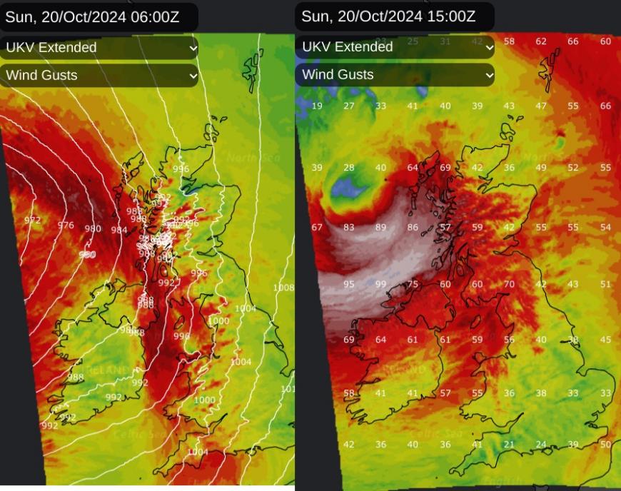
Currently, the focus for S then SW gales will be later on Sunday afternoon and well into the evening over northern Britain and Northern Ireland with gusts over 70mph showing on the UKV model for exposed parts of Scotland. The wild conditions will continue through the night over Scotland with the wind from the SW then West.
Loading recent activity...