
Pulses of heavy rain will continue to edge northwards over parts of Britain on Wednesday in a warm, moist airflow. Thursday will be better, brighter and drier.
There is mild, moist air flowing up from the south over the UK for the middle of the week. Wednesday sees more heavy rain surging northwards but Thursday will bring an improvement with sunshine. With high pressure over central Europe and a low pressure out west over the Atlantic, there is a flow of warm air from the south. Eastern England and northeast Britain have started the day with blustery winds whereas it has been calm for Wales and SW England. It has also been very wet in places.
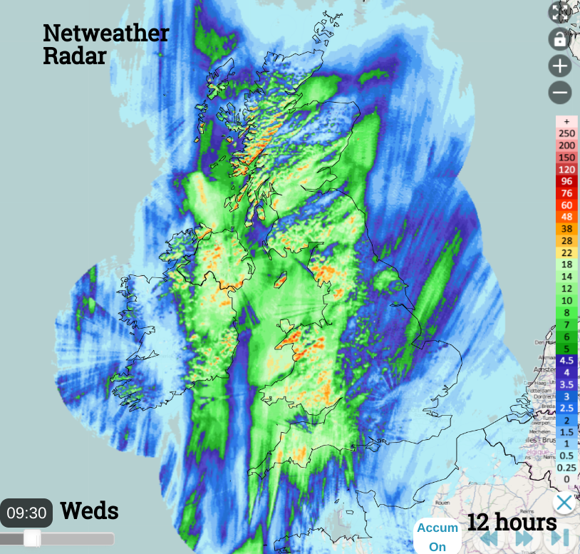
12 hour rainfall totals from the Netweather Radar
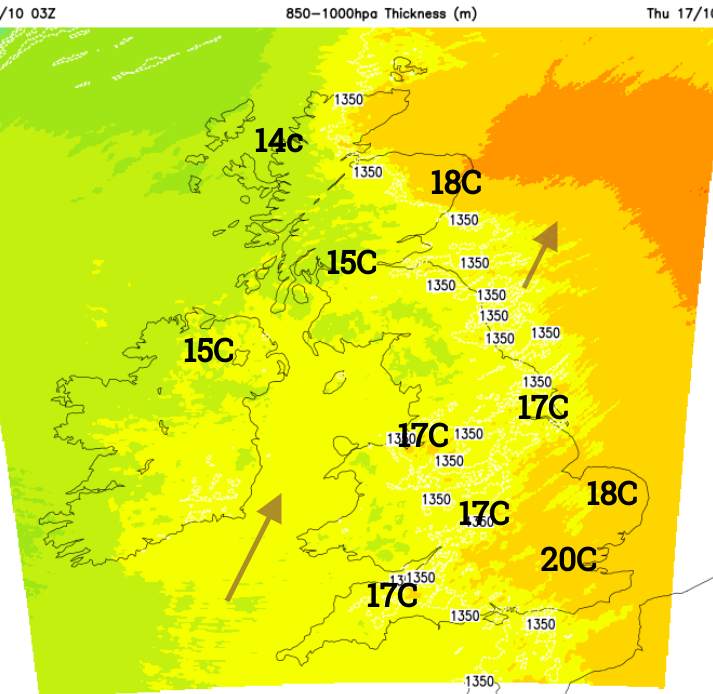
There has been a corridor of rain in this southerly flow, soaking Northern Ireland, the Irish Sea, Wales, the West Country, northwest England and up into Scotland but with some good shelter to the lee of high ground. There are further large, heavy pulses working their way up from Cheshire and Cumbria over southeast Scotland towards Aberdeen by mid-afternoon. On either side of this zone of rain, there is the potential for warm and humid conditions where the sun appears. Temperatures will reach the high teens which will feel warm for mid-October.
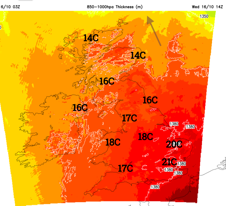
East Anglia or SE England including London could see 21 or 22C in the odd sunny spot. This warm air is not hanging around for long but with more sunshine tomorrow it will feel fine as the worst of the rain edges away from the Northern Isles early on Thursday.
Today’s main issue is further pulses of heavy rain. There is a yellow rain warning stretching from Cornwall over Cardiff and Birmingham up to Manchester. The text is rather confusing (mentioning "this morning" ) considering that the warning started on Tuesday 15th at 6pm, but as it runs until 9pm Weds we should assume the Met Office has updated the warning at some point.
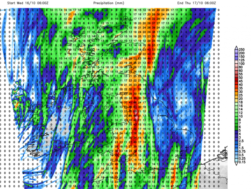
Forecast rainfall totals for 24 hours til 6am on Thursday
‘Areas of heavy rain are expected to develop and push north across the warning area. The first area of rain will continue north this morning (Weds?), then a second area pushes northeastwards this afternoon before clearing during the evening...A few places may see 50-80 mm of rainfall in 6 hours. Isolated thunderstorms are also possible in the south of the warning area, with lightning an additional hazard.’
There are numerous Flood Alerts over SW Britain and the West Midlands.
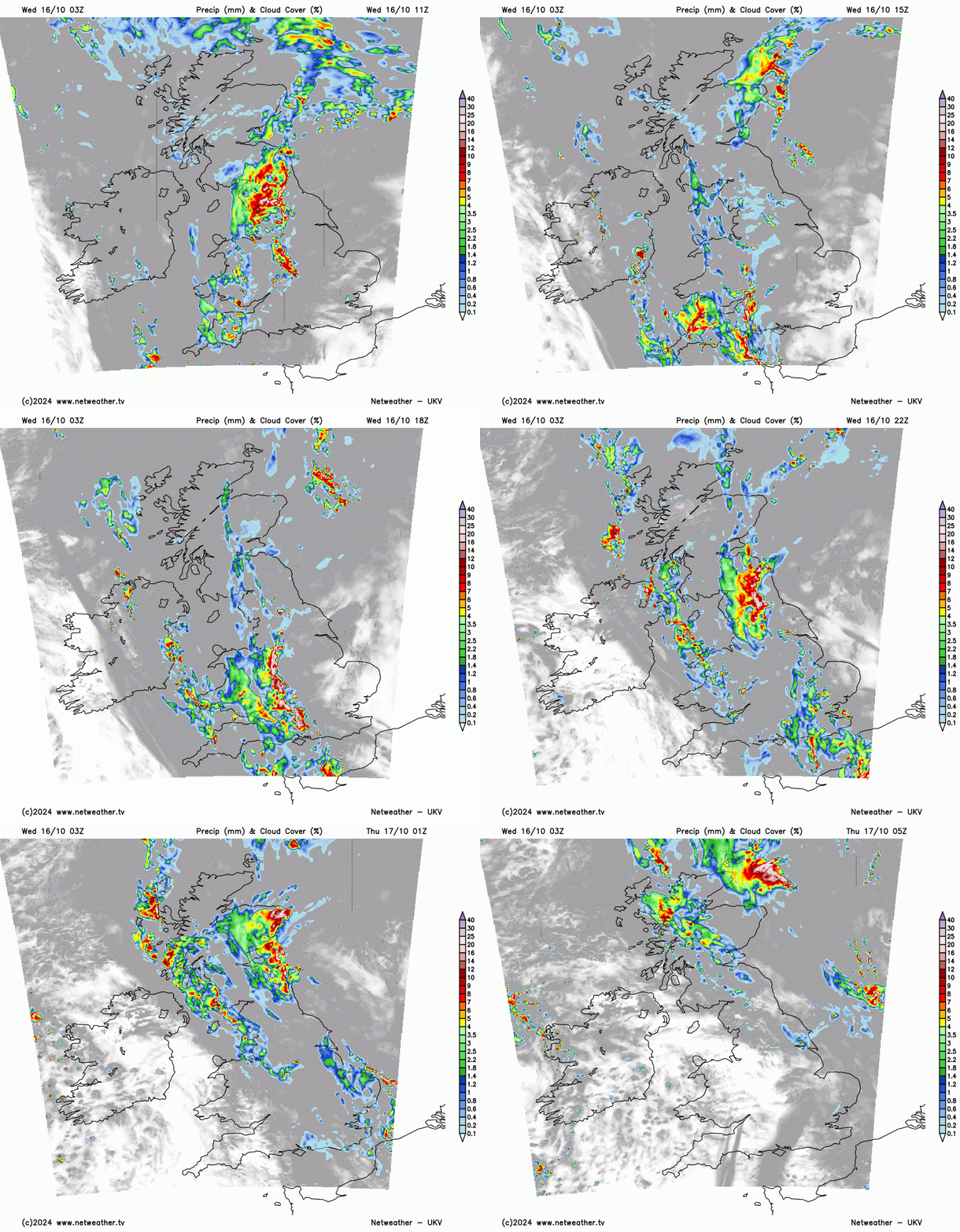
The Netweather radar will show you where the heaviest rain is currently and its motion will continue northwards through Wednesday. As the rain from northwestern England moves over eastern Scotland another area of heavy rain will arrive from the far southwest. Around teatime, this rain becomes heavier leading to tricky driving conditions for evening commuters with plenty of surface water and spray. Also, poor visibility as the cloud cover leads to early darkness. The UKV model takes the heavy rain from Dorset up through the West Midlands towards the Yorkshire Dales by Wednesday evening. The ECM model holds the focus further west for the evening rush hour, over Wales before edging into the West Midlands and Cumbria later in the evening. That leads to a similar wet night for the Pennines, Cheviots and the eastern half of Scotland.
A showery band will follow from the west over Northern Ireland and western Scotland tonight and another showery pulse will arrive from the English Channel this evening and spread eastwards over SE Britain tonight. So, many areas of rain are still to come.
Thursday
There will be a few scattered showers about over northern Scotland by mid-morning on Thursday but for most, it will be a fine, bright day with light winds and a mild feeling in the air. Cooler air from the west will move in later in the day Overnight temperatures will dip down into single figures but for anyone trying to view the Comet, at least there will be clear skies for many between 7 and 8pm.
Loading recent activity...