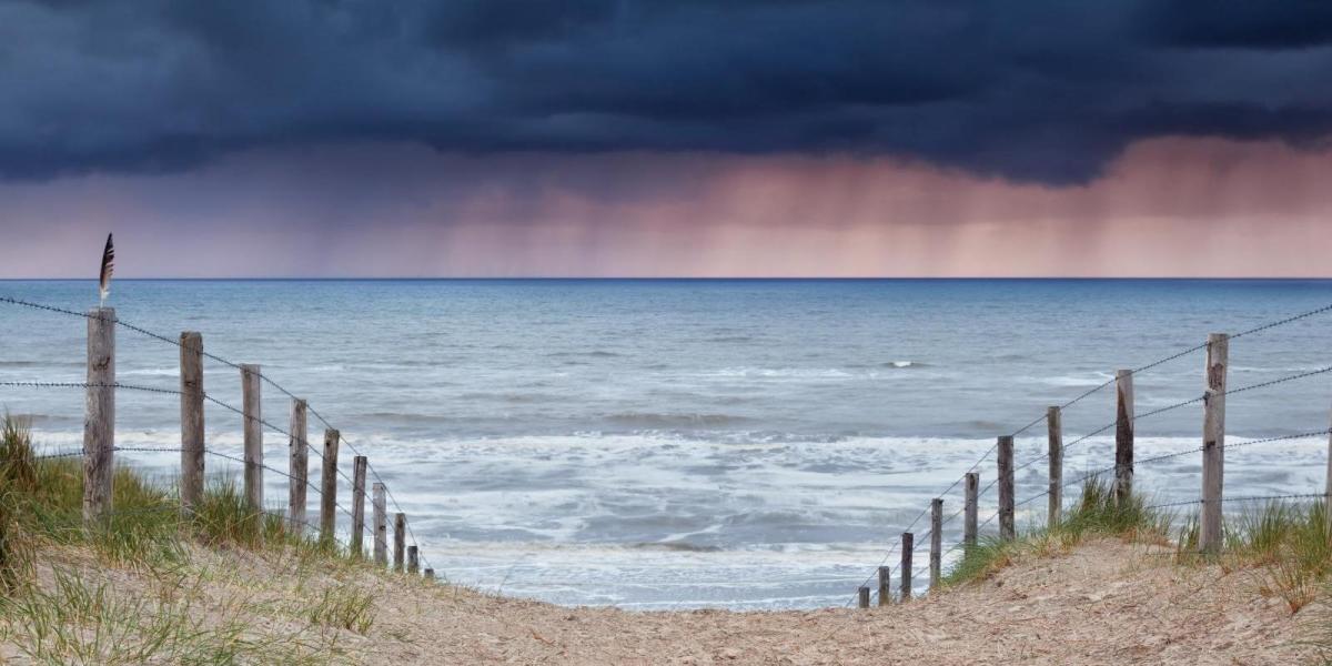
The last few days have been on the cool side by day and cold at night when skies have cleared, thanks to northerly winds bringing in polar air, today no exception, cooler than average for the time of year, with temperatures struggling to get into double figures at best.
Turning wetter this coming new week, but also warmer for a time

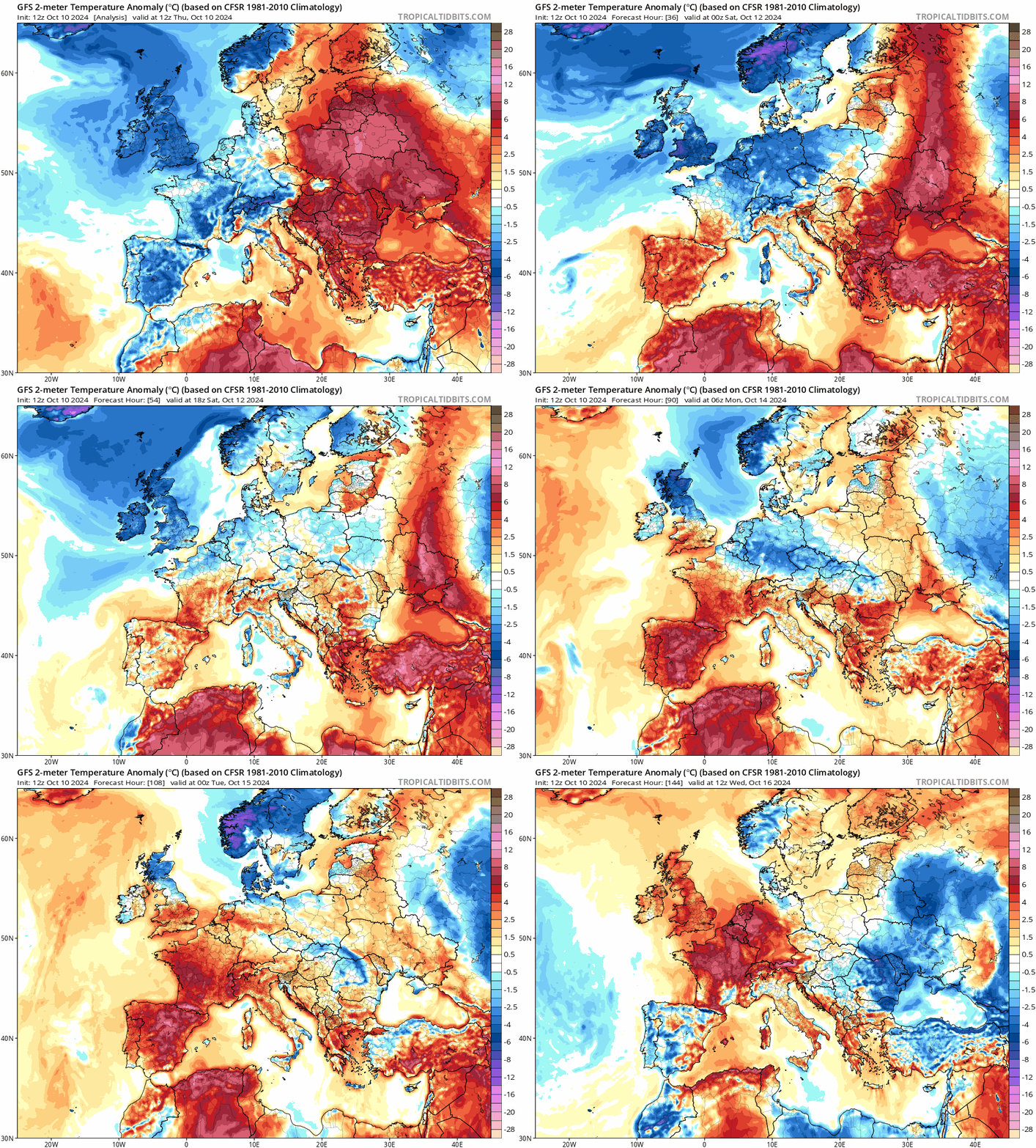
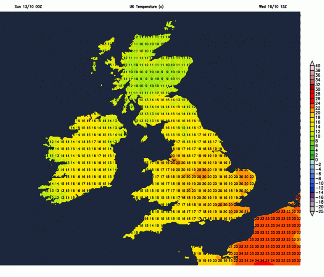
However, through the coming new week, it will turn warmer, as winds turn southerly, temperatures could reach 21C across eastern England on Wednesday, which is above average for the time of year. But with the warmer air will be increasingly unsettled conditions, with outbreaks of heavy rain spreading north at times across many parts of the UK. Turing cooler from the west on Thursday, with sunny spells and a few showers, before wet and windy weather spread east on Friday.
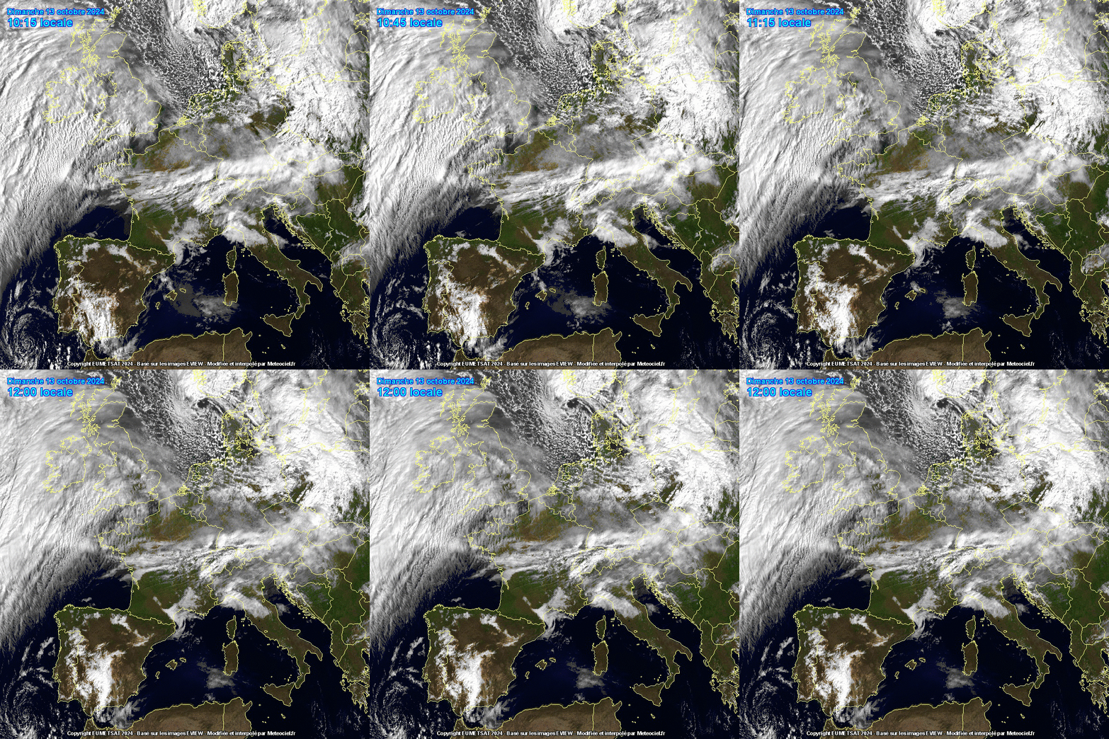
For now, a cold start this morning, thanks to clear skies overnight and a northerly flow, temperatures fell widely into low single figures, just below freezing in some sheltered spots across Scotland and the far north of England – leading to an air frost. Sunday is looking largely dry and settled, thanks to a ridge of high pressure across the UK, however, it will be often overcast, thanks to a lot of cloud spilling in from the west, though some breaks across eastern parts will allow some sunshine. As a result, temperatures will remain rather supressed after the cold start. Temperatures 8-9C at best across Scotland, 9-11C across much of England, Wales and N. Ireland. Milder in the far southwest, where it could reach 14C in Cornwall.
A lot of cloud spilling in from the west off the Atlantic today, but some breaks may allow some sunshine
Cloud will thicken with outbreaks of rain spreading in from the west across Ireland, N. Ireland and Irish Sea coasts of mainland UK this afternoon and through the evening, before a small area of low pressure tracking east brings an area of heavy rain east across Wales, southern England, Midlands and East Anglia tonight. Remaining cloudy and damp across the west further north, drier with clear spells across eastern Scotland and NE England.
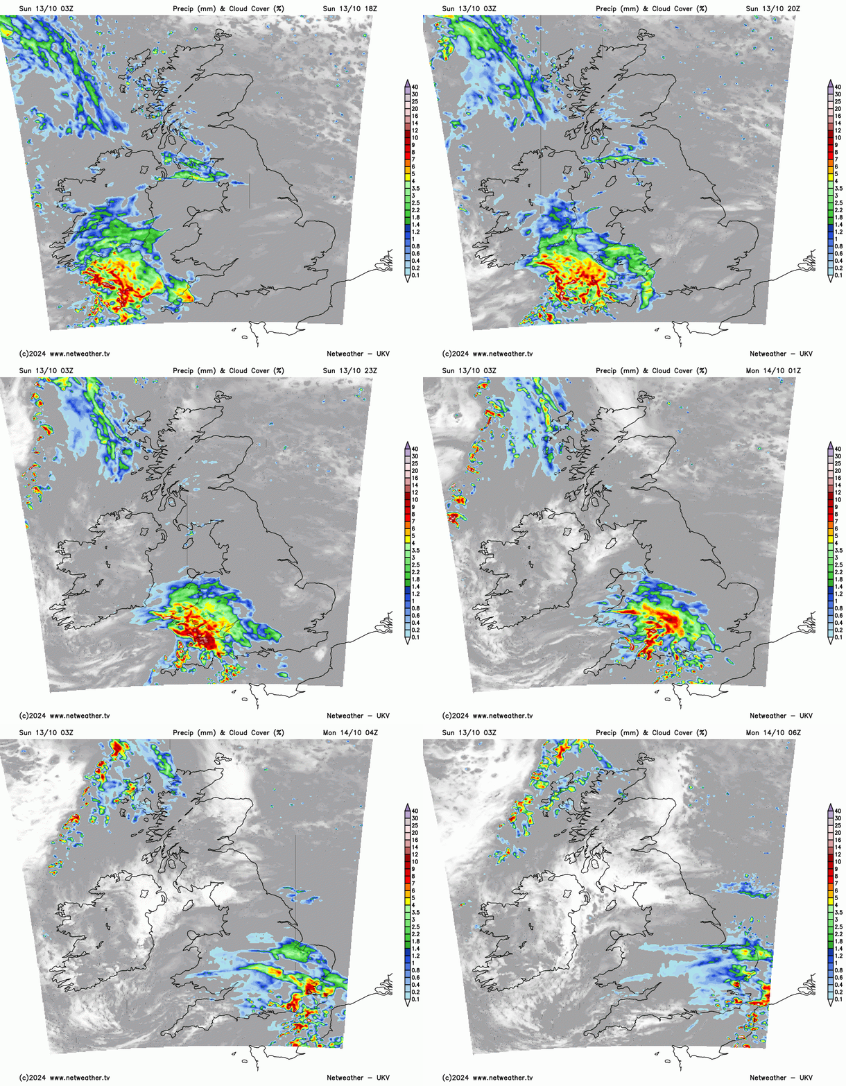
Cloud and rain clearing SE England and East Anglia Monday morning, but leaving largely cloudy conditions across southern England for much of the day, bit milder than today though, with temperatures reaching the mid-teens. Further north, mostly dry and bright, a little milder than today, temperatures reaching 11-13C. Best of the sunshine across Scotland and northern England.
Temperatures rising further still on Tuesday, with a southerly wind developing. High pressure close to the east will keep eastern areas largely dry with some sunshine – more especially in the morning. However, western areas will see strengthening winds from the south, with increasing cloud and outbreaks of rain spreading north in the afternoon and evening after a dry and bright start. Temperatures reaching 15-17C across the south, 12-15C in the north.
Some uncertainty over timings by mid-week of the advance eastwards of weather fronts bringing outbreaks of rain which will be moving in from the southwest. Ahead of the rain moving in across SW England and Wales, which could be thundery, a strong southerly wind will bring in warm air for the time of year across eastern England, so temperatures may reach 21C across East Anglia Wednesday afternoon. However, this depends on how far northeast outbreaks of rain, locally heavy and thundery, spread during Wednesday. It is likely most areas will see a spell or two of heavy rain spread through from the southwest by the end of the day.
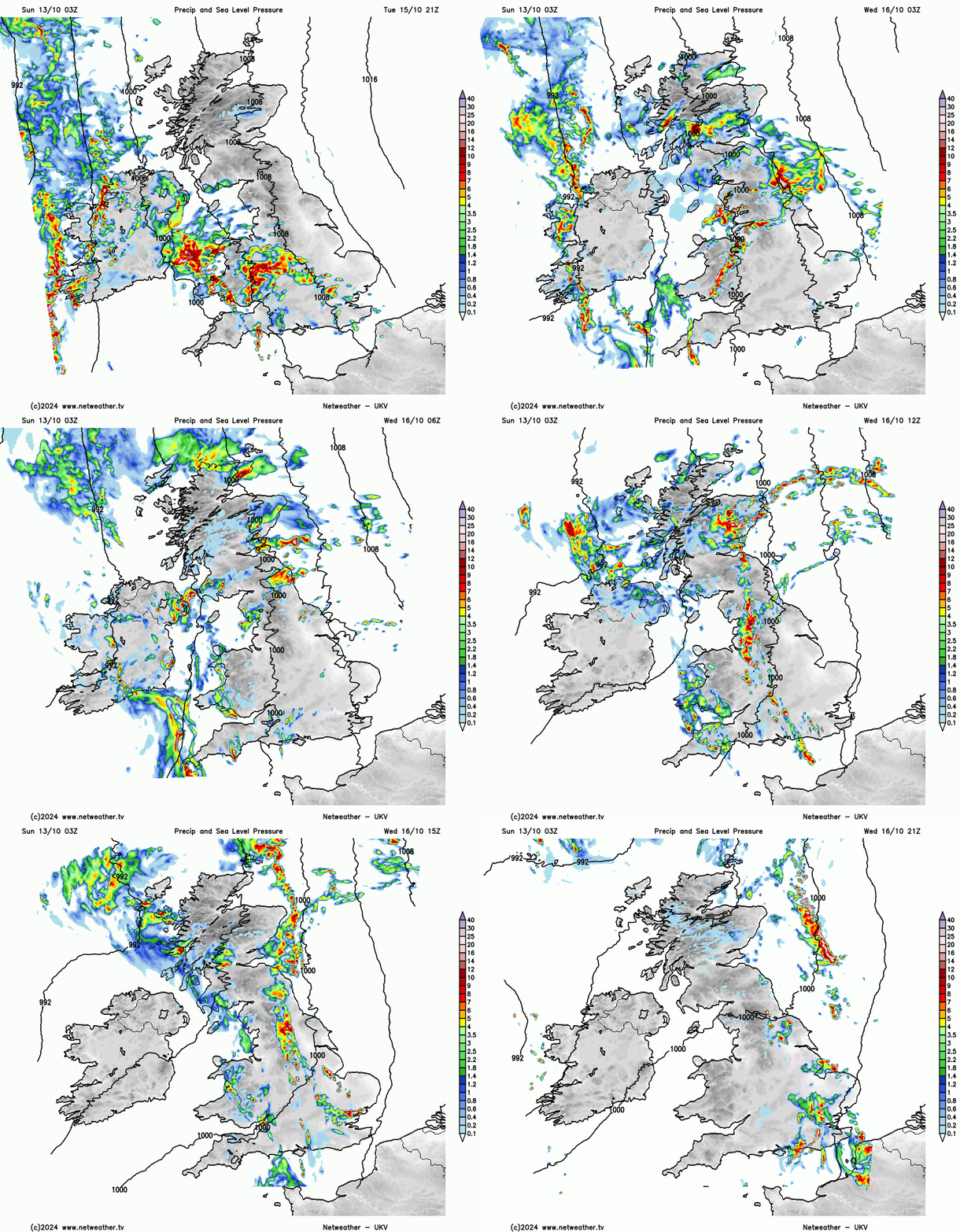
Thursday looks to turn cooler from the west, with sunny spells and scattered showers – most of which will be in the west, with some eastern areas staying dry and sunny. Increasing uncertainty by Friday, with models disagreeing by then, but Friday may start dry and bright away from southern areas – which may see a few showers, perhaps turning wet and windy in the west later in the day or well before then and across all parts by the end of the day. We will firm up on what happens later in the week over the next few days.
Loading recent activity...