Much of the UK has enjoyed a taste of summer over the last few days, thanks to a strong ridge of high pressure extending from the UK across to Scandinavia. Temperatures were widely in the low to mid twenties on Wednesday, the warmest place in the UK was in the north of Scotland, with 25.5C at Kinlochewe and Aviemore, but central London reached 24.8C too. The UK will generally see another fine, sunny and warm day today, once morning cloud over parts of England and Wales burns back. Highest temperatures across southern England – perhaps reaching 25-26C here.
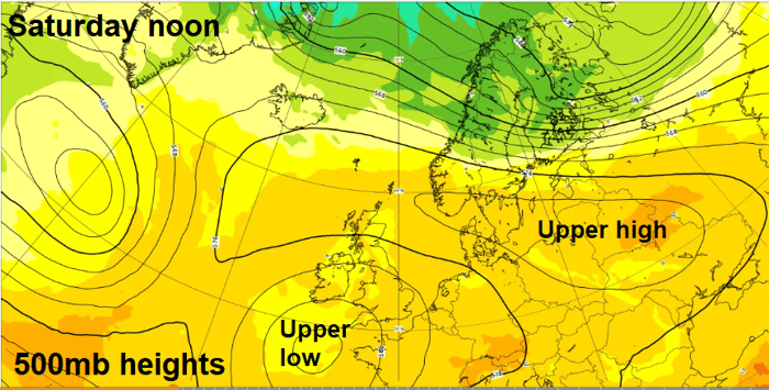
But, changes are afoot for England and Wales though as we end the week and head through the weekend, as the ridge of high pressure over the UK begins to retreat north and northeast. This will allow a shortwave trough over Germany today to move west over southern UK on Friday, bringing a risk of thunderstorms to southern areas during the day. As the shortwave trough moves in close to the southwest and stalls at the weekend, an upper low will develop and deepen. This, combined with a surface low moving up from Spain, will bring increased instability and large-scale ascent in the atmosphere to support waves of showers and thunderstorms to push north and northwest to affect parts of England and Wales through the weekend. On Sunday, the showers and storms may merge into longer spells of heavy rain, as low pressure becomes slow-moving across the south.
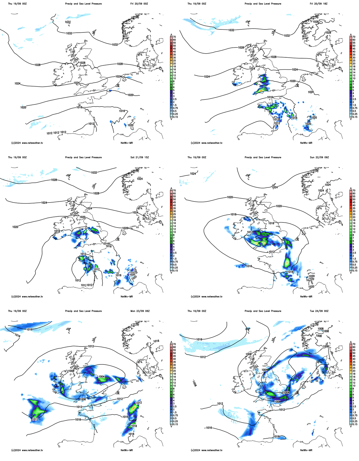
Initially, the thunderstorm risk will be generally to the west of London across to Wales and the West Country – then later on Saturday and through Sunday a more widespread risk of thundery downpours looks to push up from the south.
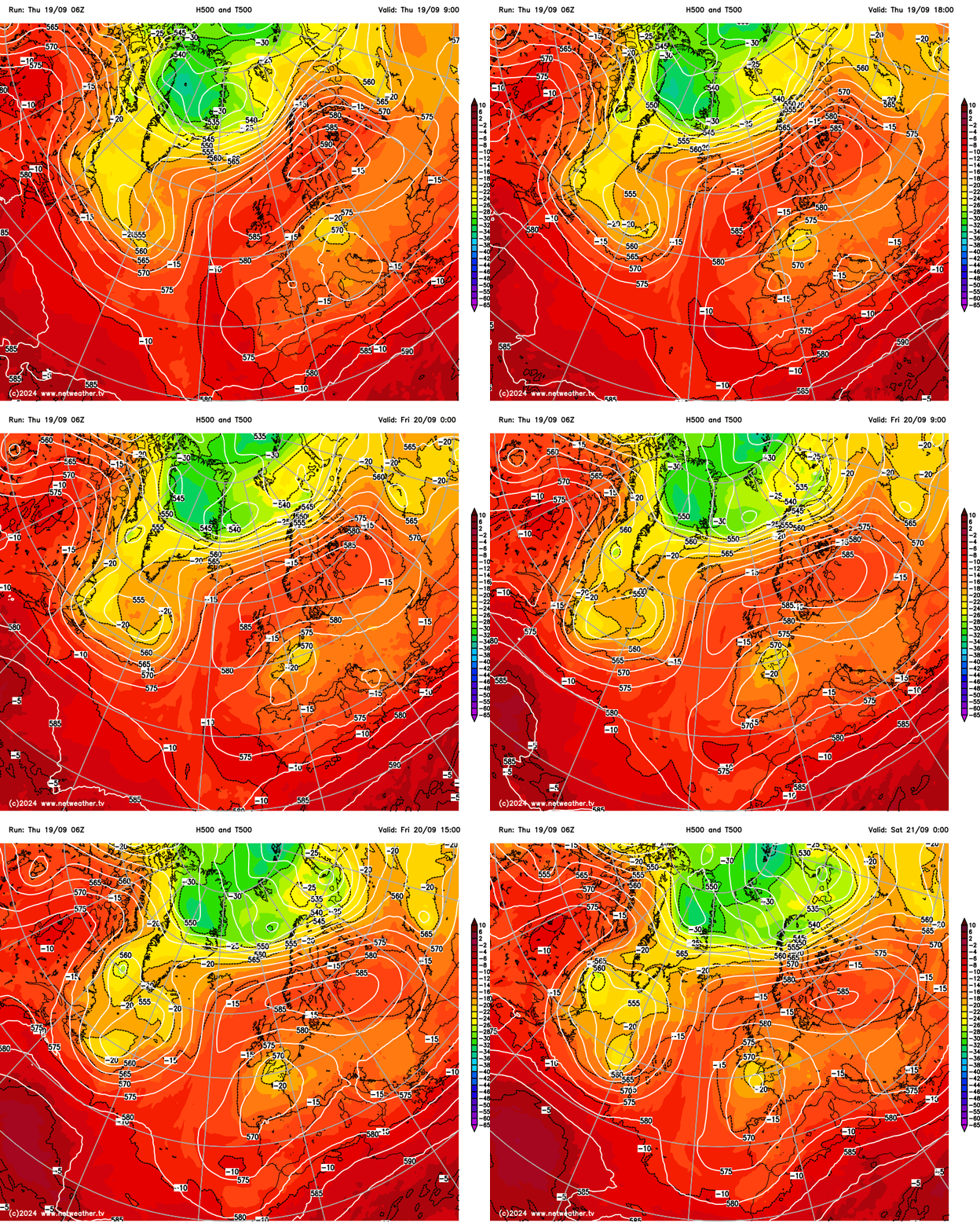
A shortwave trough and associated mid-level cold pool (500 hPa temperatures of -20C) over Germany today will track west across southern Britain on Friday, as can be seen on the 500 hPa heights and temperature chart loop below.
500 hPa temperature chart below shows shortwave trough and associated cold pool in mid-levels moving west over southern UK
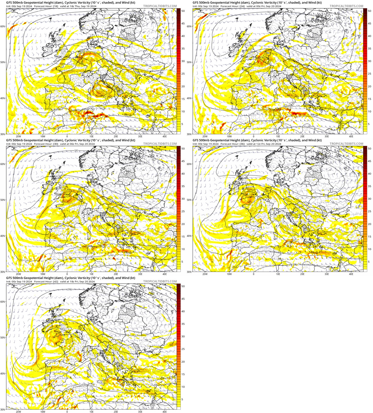
500 hPa cyclonic vorticity chart shows enhanced vorticity associated with shortwave trough, which creates lift in the atmosphere, moving west tomorrow:
Cooling temperatures in the mid-levels associated with the shortwave will steepen lapse rates in deep warm and humid airmass advecting west, creating an area of unstable atmosphere moving west with the trough. Convective Available Potential Energy (CAPE) is forecast around 500-750 j/kg in the unstable airmass as it arrives from the east across SE England and East Anglia early Friday morning before spreading west across southern England, Midlands and over to Wales through the day. As surface heating builds in sunny spells, CAPE values could reach or exceed 1000 j/kg across southern England and South Midlands in the afternoon.
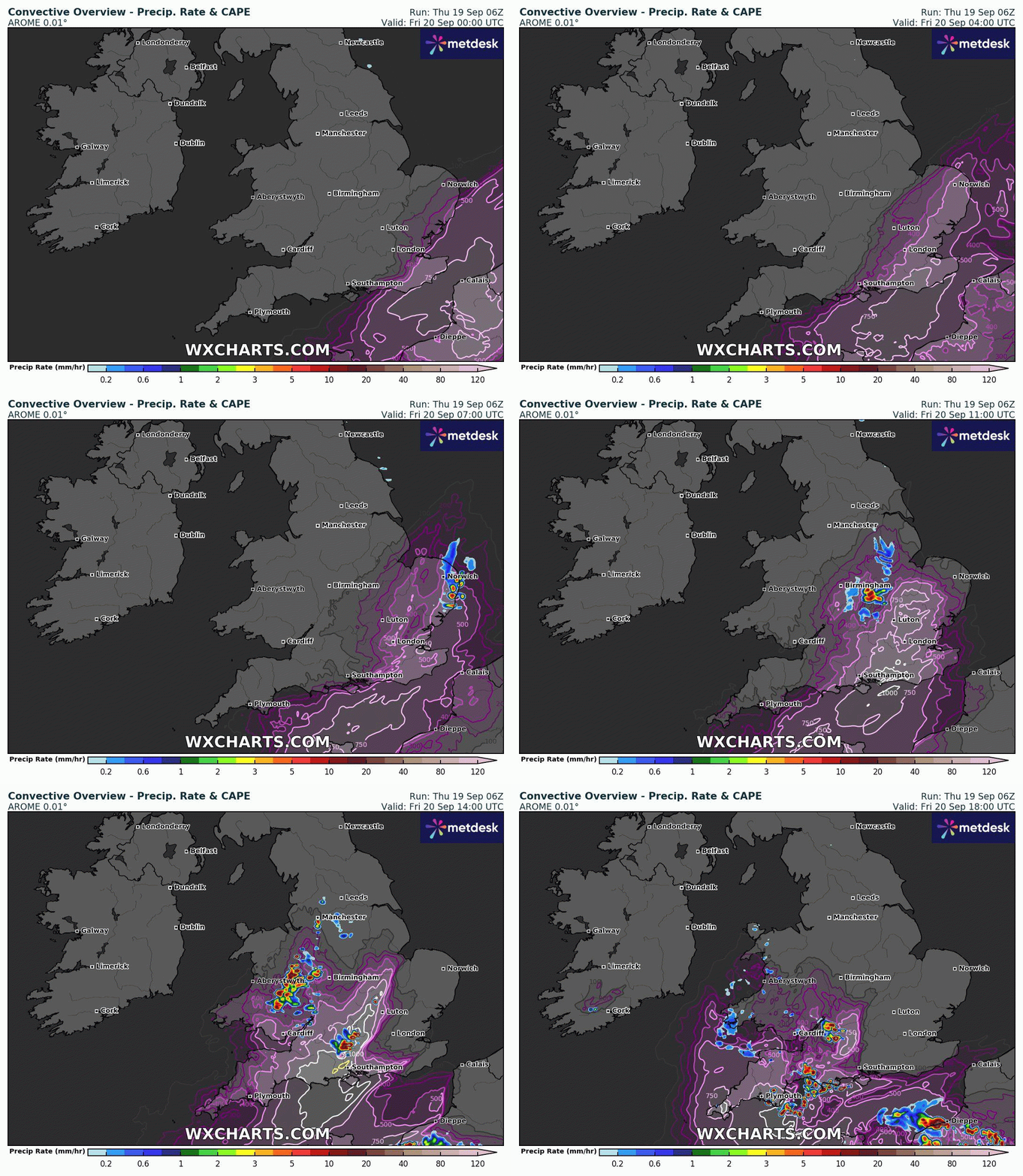
Some elevated heavy showers with isolated lightning may push west across East Anglia Friday morning, but a greater chance of heavy showers and thunderstorms looks to develop west of London over to the West Country, south Midlands and Wales through the day, as surface heating and large scale ascent of air with the passing shortwave trough supports the growth of cumulonimbus clouds. Showers and storms drifting west. Hail and frequent lightning are possible with storms, while locally intense downpours may bring 20-40mm in less than hour, bringing a risk of flash-flooding.
The shortwave upper trough moving west across southern UK on Friday will slow as it moves over Atlantic SW approaches to the UK, where a slow-moving upper low will form and deepen for a time over the weekend. This upper low will combine with a developing surface low moving north from Spain over the Bay of Biscay to bring areas of enhanced cyclonic vorticity northwards towards southern Britain, bringing areas of heavy showers and thunderstorms north and northwestwards across England and Wales through the day, perhaps starting early morning across southern England before extending to other areas of England and Wales through the day, though northern England likely staying dry and sunny with more high pressure influence. Again, a risk of hail, frequent lightning and torrential rain leading to flooding is possible with any storms.
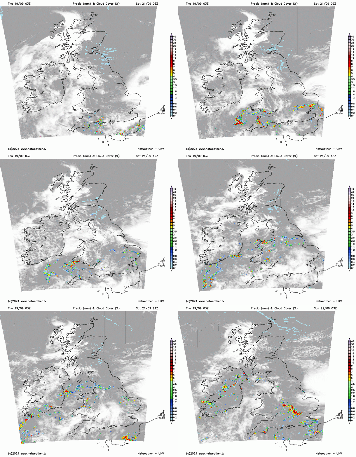
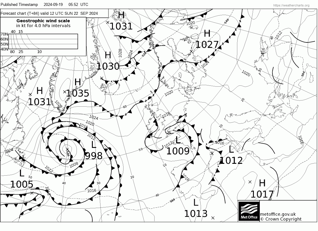
Surface low pressure over western France is forecast to reach southern England on Sunday – where it looks to become slow-moving. Frontagenesis looks to develop with the low, where a frontal system develops, which could bring a more organised area of heavy rain, with embedded thunder, across parts of England and Wales, though uncertainty how far north the rain will be for now.
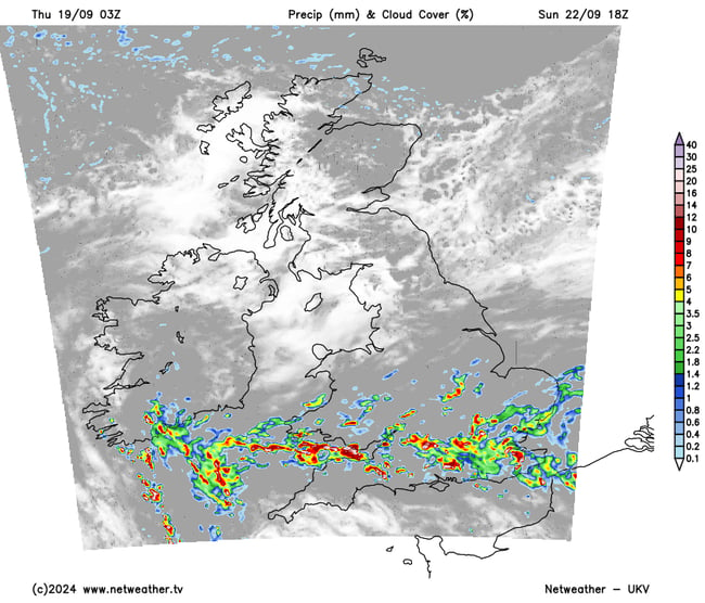
Low pressure will then ease away northeast over the North Sea on Monday, but further showers, perhaps thundery, or longer spells of rain look likely across England and Wales. Drier, cooler and fresher on Tuesday, then turning unsettled again from Wednesday, potentially wet and windy for a time too.
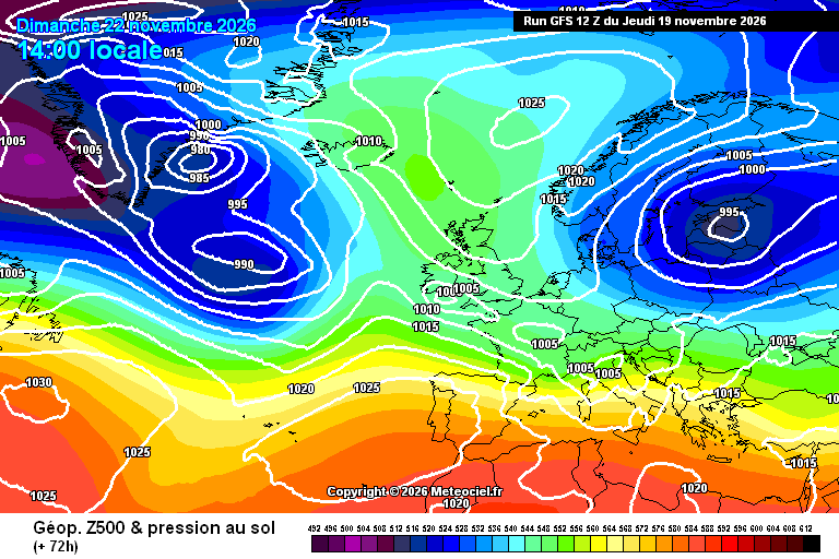
Are we seeing the first signs of the winter pattern showing themselves. I've seen a lot of interesting charts just on the recent GFS run with blocking highs to our north or east and lows sliding underneath or failing to get through us at all...
1 hour ago, Mike Poole said: All of those look like proper reversals…which is what we need to see for round 2. Is that guy on twitter going to be correct again?
25 minutes ago, Don said: I'd go with that, perhaps something more promising in the New Year, similar to last year? EDIT are you referring to the zonal wind forecast? Yes, the chart I posted from EC46. It's the most promising chart I have seen...
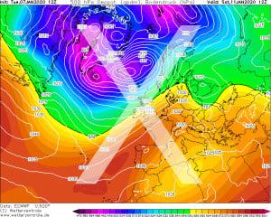
The big battles both the Atlantic and North-Eastern UK blocking keep having continue to amuse. And while we might not quite be into the main Winter months yet, am glad at least this isn’t happening at the moment!
A beautiful sunny start here in Czechia was soon replaced by cloud then rain for most of the day. Now it’s very blustery. Not cold with temperatures reaching 10°C.
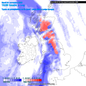
The ICON 18hrs run has moved towards the ECM with the trough set up to the nw . It also develops some snow to higher ground to the north and ne at T114hrs. The set up is very sensitive to small changes and there is a way to expand this snow to...