September so far is shaping up to be a month of contrasting weather. It started warm, then we had that cold snap last week which brought some unusually low temperatures for early to mid- September, especially overnight. Perhaps surprisingly, this colder weather last week brought some notable thunderstorms in places as well, with large hail locally, for example there was a substantial thunderstorm on the evening of the 11th that affected west Lincolnshire and Nottinghamshire.
This was down to instability: while Arctic air is fundamentally dry, the sun is still relatively strong at this time of the year, and so although many areas started off dry and sunny away from the usual “Cheshire Gap” feed of showers, the large temperature gradient between the sun-heated ground and the very cold air aloft was enough to kick off convection and trigger heavy showers and thunderstorms over the land mass.
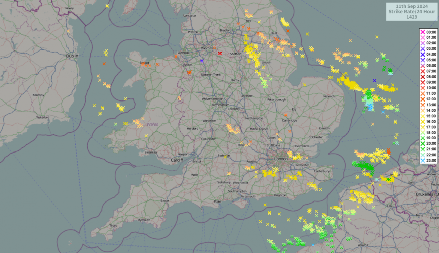
Generally this happens from early March through to mid-October, and a similar synoptic setup in winter would bring generally dry sunny weather away from windward coasts and the Cheshire Gap. It was an unusually cold air mass, so the chances are that had this setup happened in the winter months, any showers would have been predominantly of snow, and parts of north-west England in particular could have seen substantial accumulations of snow.
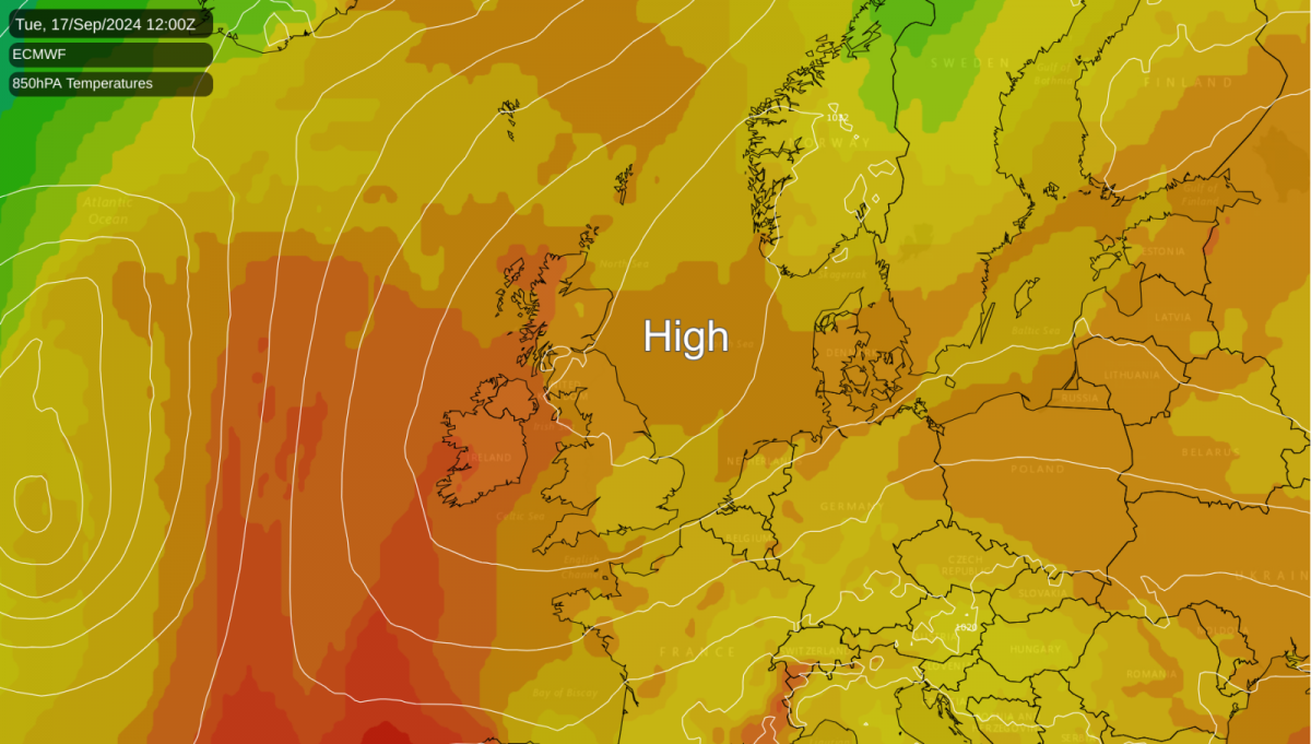
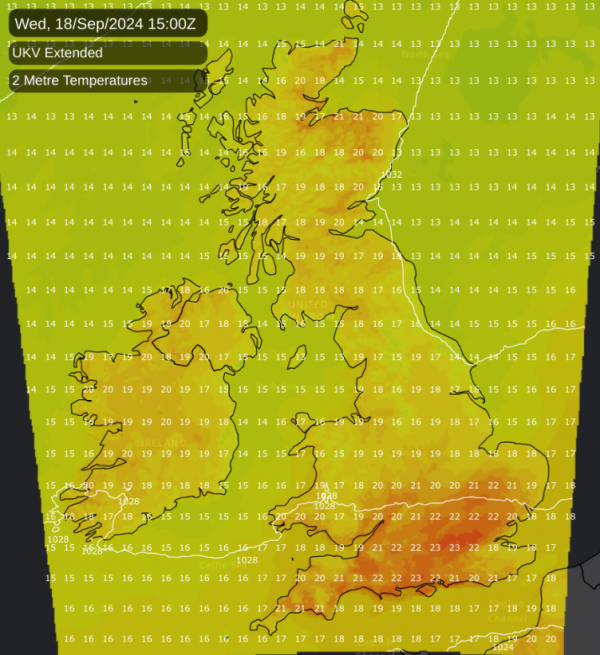
Next week will see the return of high pressure, bringing generally dry weather and somewhat warmer temperatures.

The distribution of cloud cover will change as the week progresses. Early in the week, with high pressure centred to the south of Britain, it will especially be central, southern and eastern England that will see the most sunshine. This will tend to reverse late in the week, as high pressure will move to the north resulting in an easterly flow developing. This has potential to bring cloud in off the North Sea into eastern parts of Britain, and some rain or showers into the south and especially south-west of Britain, while western Scotland, north-west England and Northern Ireland can especially expect plenty of warm and sunny weather.
By the latter part of next week we can expect temperatures to widely reach the low to mid-20s Celsius in western and northern Scotland. It looks likely that the easterly winds may slacken towards next weekend, allowing similarly high or higher temperatures to develop over England and Wales, possibly into the high 20s Celsius. This does not compare with the hot weather that we saw in early September 2023, but with the advancing season, these sort of temperatures are still well above average for the time of year.
It looks probable that this settled and anticyclonic weather will break down into the following week with changeable westerlies coming in during the last week of September, but this is a long way off and we are probably looking at at least a week with high pressure over or very close to the British Isles - an unusual event in 2024 so far. In particular, for the north-western regions that had a cloudy and wet July and August and missed out on the ridges of high pressure that affected other areas during late July and August 2024, this upcoming September fine spell may well stand out somewhat.
Potential for severe flooding remains a major talking point over central and eastern parts of Europe. An area of moderate to heavy and persistent rain is forecast to persist around parts of eastern Germany, Czechia, Austria and Hungary during the weekend, and there is potential for a substantial area to see rainfall totals in excess of 150mm during the weekend, and maybe in excess of 200mm locally. This is two to three times the amount of rain that these regions would normally expect during the entire month of September, in just two days. The persistent rain is forecast to hang around on Monday as well, but on Monday it will become lighter and will probably become concentrated mainly in southern Germany.
The culprit is a slow-moving cut-off low pressure system that has become entrenched over the Balkans, while high pressure builds to the north and west of this system. Strong winds will also be an issue over the affected region due to the strong pressure gradient between this low and the high pressure building around it. Starting on Monday this low pressure system will slacken considerably, resulting in the associated rain losing its strength, though there will continue to be some showers in the affected region until Tuesday. It looks probable that mid to late next week, the high pressure to the north will play a larger role in the region’s weather and bring relief from the rain and flooding, but there is potential for some areas to experience considerable flooding that may take a while to get back under control.
Loading recent activity...