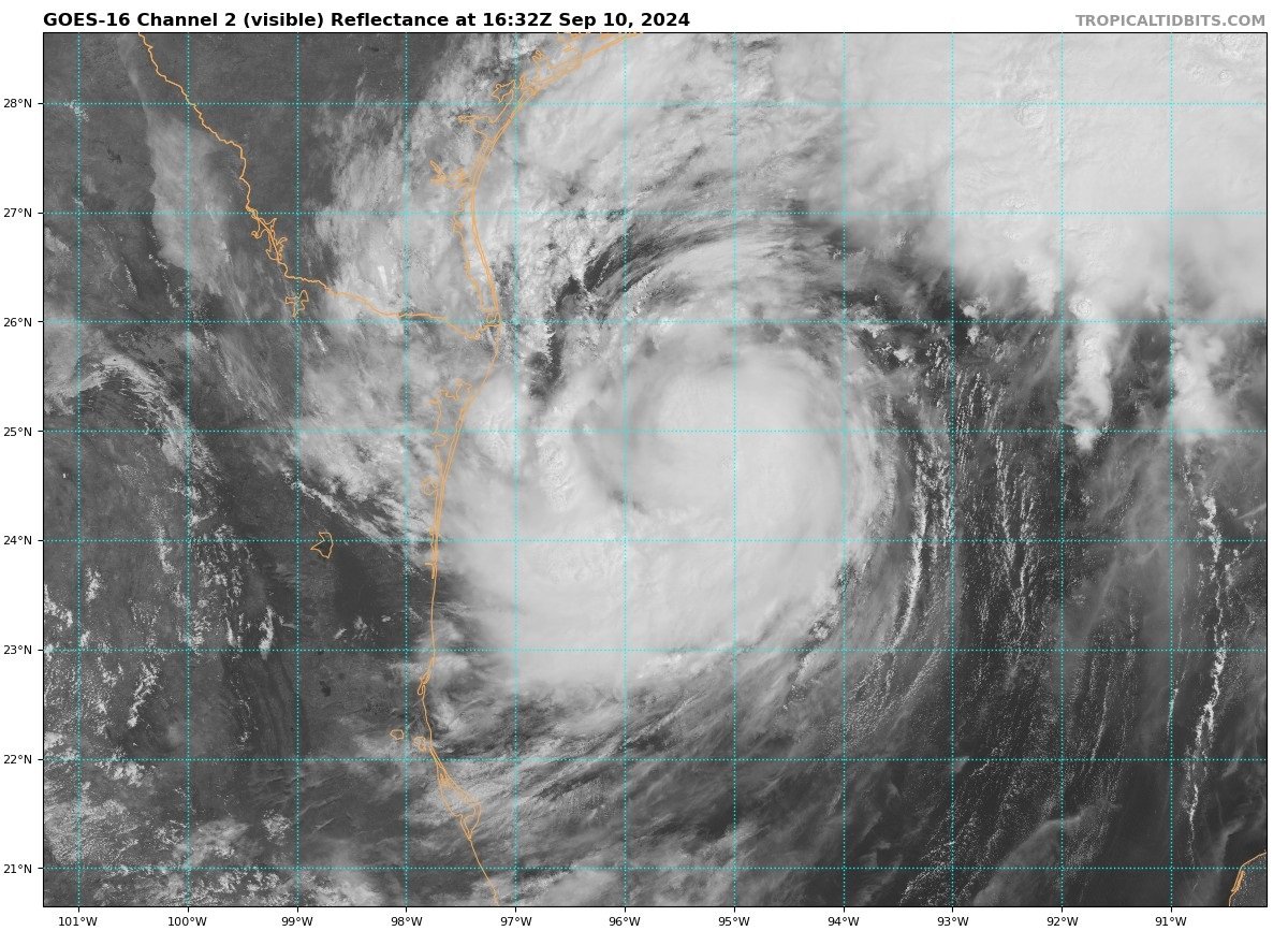
Tropical Storm Francine is expected to become a hurricane in the Gulf of Mexico today ahead of making landfall in Louisiana tomorrow. This ends a long streak of no named Atlantic storms since Ernesto in mid-August – unmatched in duration in 56 years. This despite the US NOAA outlook for the 2024 Atlantic Hurricane Season that indicated that an above-normal season is most likely (90% chance), with 17-24 named storms.
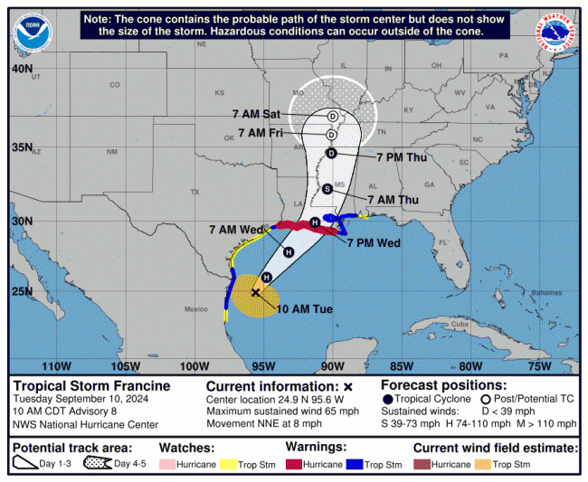
A tropical cyclone that formed over the southwest Gulf of Mexico developed into a Tropical Storm Francine on Monday and it has been moving slowly north just off the coast of northeastern Mexico today, but more recently it has begun to turn north-northeastwards.
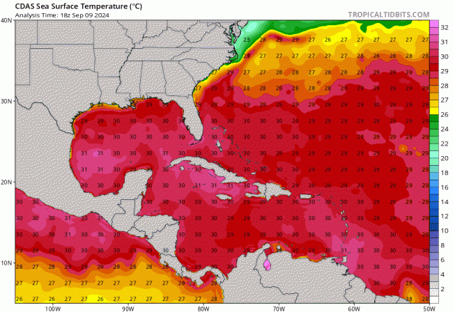
Conditions will remain favourable for further strengthening of Francine over the next 24 hours, is it crosses over near record sea surface temperatures of 30-31C and moves into an environment of low wind shear in the northwest Gulf of Mexico. Francine currently has maximum sustained winds of 65mph, just 9mph short of reaching category one hurricane wind speeds. Francine is forecast to become a cat 1 hurricane in the next 12 hours and will probably remain this strength before landfall tomorrow.
Although Francine is crawling north-northeast at 7 mph this afternoon, the storm is expected to pick up speed later today, as an upper trough over Texas approaches the system tonight, which combined with a mid-level ridge over the southeastern Gulf of Mexico, looks to strengthen the flow and increase the forward speed of Francine, while turning the track of the storm more towards the northeast - with a track towards landfall over the coast of Louisiana on Wednesday.
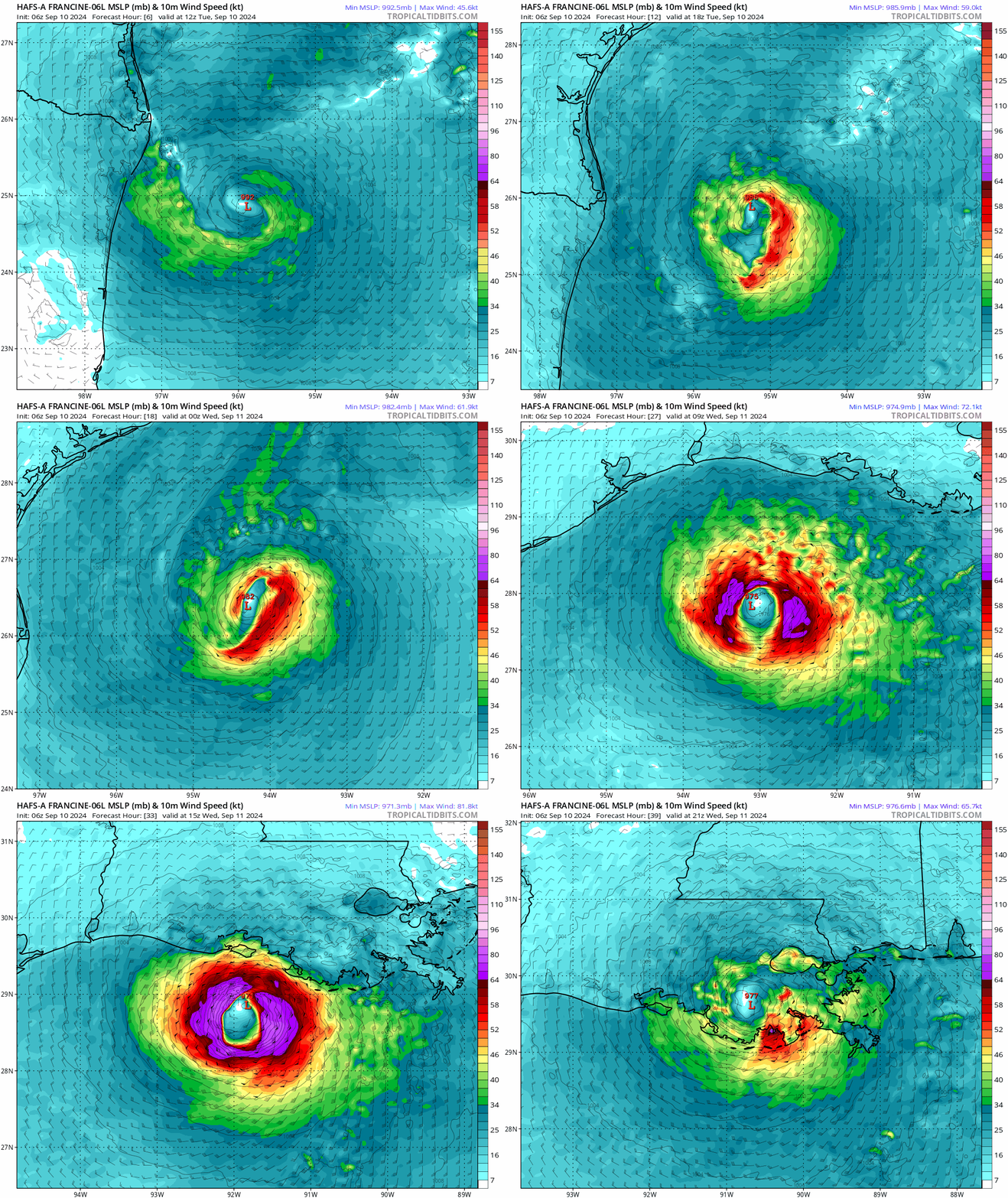
Forecasts have generally kept Francine a cat. 1 hurricane, with around 85-90mph max sustained winds. The National Hurricane Center did, for a time earlier today, predict Francine may reach a cat 2, with a forecast of highest max winds reaching 100mph, but on the most recent update max sustained winds look to top out at 90mph in next 24 hours before landfall. Dry air entrainment may reduce the intensification rate, but a steady to
rapid strengthening in the next 24 hours still seems likely based on the otherwise favourable conditions. Francine could reach a peak intensity near 85 kt between the 24 h point and landfall. Intensification is expected to
stop before landfall, and rapid weakening is expected after landfall.
Category One Hurricane have max sustained winds of 74-95 mph, Category Two Hurricane winds 96-110 mph:
FORECAST POSITIONS AND MAX WINDS
INIT 10/1500Z 24.9N 95.6W 55 KT 65 MPH
12H 11/0000Z 26.0N 94.8W 65 KT 75 MPH
24H 11/1200Z 27.8N 93.2W 80 KT 90 MPH
36H 12/0000Z 29.9N 91.3W 75 KT 85 MPH...INLAND
48H 12/1200Z 32.2N 90.4W 40 KT 45 MPH...INLAND
60H 13/0000Z 34.6N 90.1W 30 KT 35 MPH...INLAND
72H 13/1200Z 35.8N 90.1W 25 KT 30 MPH...POST-TROP/REMNT LOW
96H 14/1200Z 37.0N 90.0W 20 KT 25 MPH...POST-TROP/REMNT LOW
120H 15/1200Z...DISSIPATED
A hurricane warning is in effect for the Louisiana coast from Sabine Pass east to Grand Isle. A storm surge warning has been issued from the mouth of the Mississippi River east to the Mississippi and Alabama border.. Louisiana Governor Jeff Landry has declared a state of emergency. The most recent hurricane to hit Louisiana was Ida in 2021.
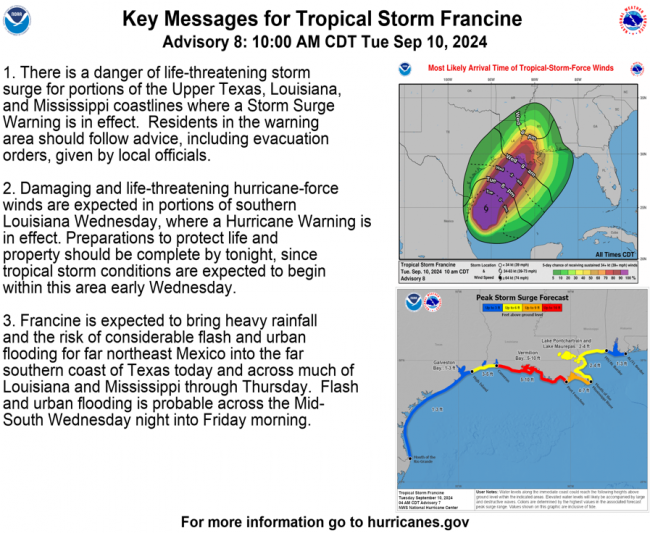
As well as damaging winds reaching up to 85mph for a time, Francine is also expected to bring 4 to 12 inches of rain. A few tornadoes are also possible on Wednesday near the coasts of Louisiana, Mississippi, Alabama and the Florida Panhandle.
Follow Francine on the Netweather forum here
Loading recent activity...