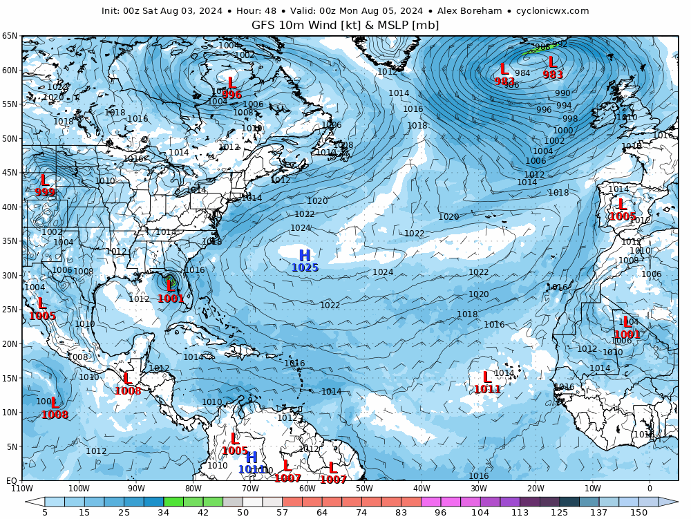
Tropical Depression 4 has formed near Cuba & is expected to head NW then N over Gulf of Mexico as a tropical storms towards NW Florida by end of weekend, perhaps strengthening into a hurricane briefly. This system tracking slowly northeast over eastern seaboard and eventually NW Atlantic, where it may strengthen jet stream towards the UK.
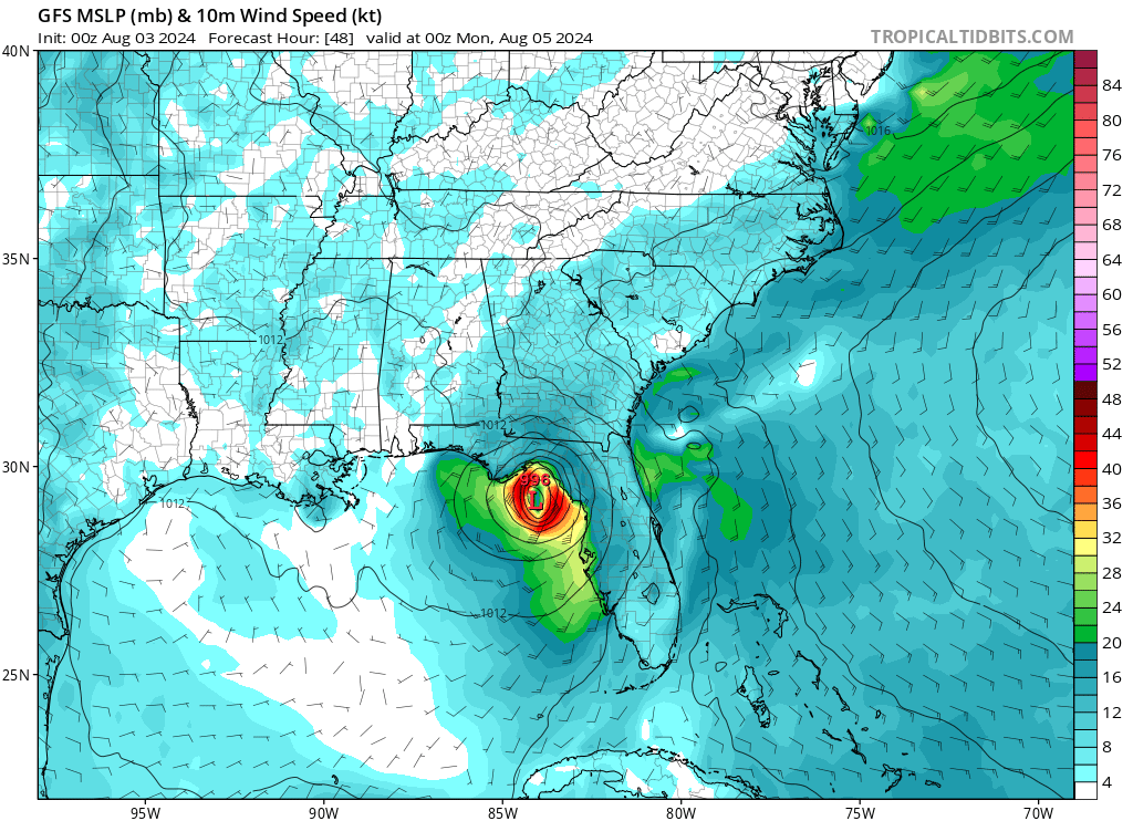
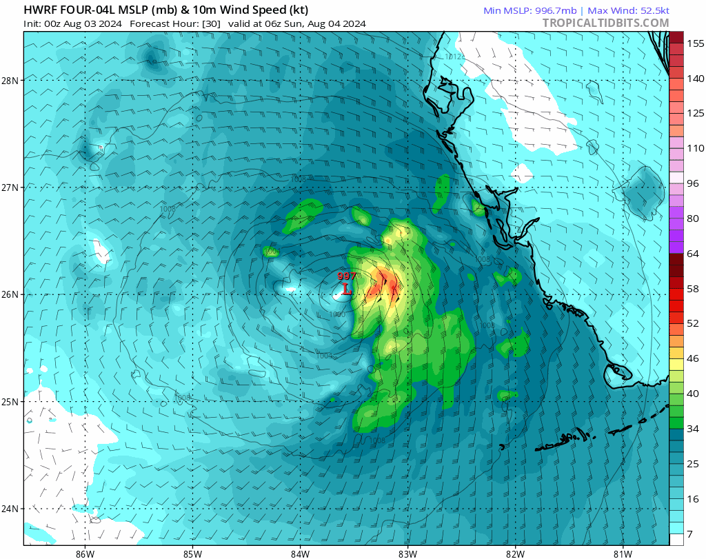
A tropical disturbance off the south of Cuba has developed a closed circulation and overnight was designated Tropical Depression 4. The storm is expected to turn northwest over today and head towards Florida, becoming Tropical Storm Debby tonight over the warm waters of the Gulf of Mexico. Because the depression looks to turn northwest later than previously modelled, there has been a westward shift in the track of the system this morning, meaning it will stay over warm waters of the Gulf of Mexico for longer, allowing it extra time to strengthen. So there is potential for the system to reach hurricane strength before landfall over the northwest of Florida early next week.
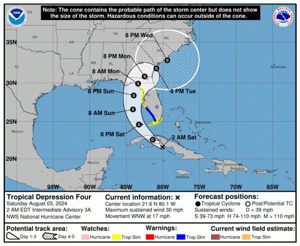
An upper trough over eastern USA is creating a weakness in the western side of the North Atlantic sub-tropical high, thus allowing the tropical depression to turn north over the weekend and strengthen. However, with more of a delay in the turn northwest and north, the trough will have moved on east by the time the system makes landlfall over NW Florida. So the tropical storm by the time its made landfall could become slower in motion over Georgia and eventually the Carolinas, with little impetus for it be pushed on by a weak upper flow. So there will be the increased threat from the slow motion for the tropical storm to dump a lot of rain over parts of SE USA.
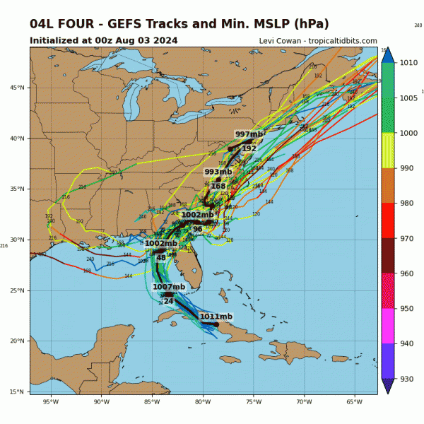
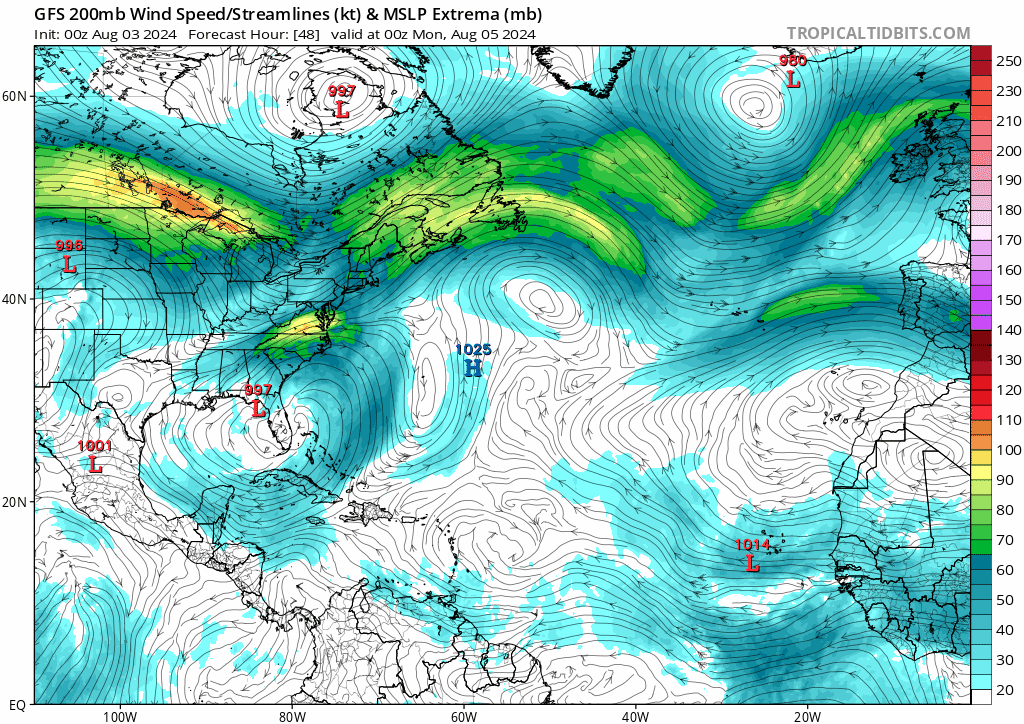
Eventually the tropical system is forecast by most model runs this morning to track northeast along, just offshore or inland of the eastern Seaboard of North America later next week. GFS shows the system being picked up by the jet stream over NE USA before moving out over the NW Atlantic next weekend or early the start of the following week. 00z GFS takes the ex-tropical storm out over the Atlantic off New Foundland early next Sunday, ECMWF the next day.
GFS strengthens the jet stream as the ex-tropical system gets picked up, perhaps due to both an injection of tropical moisture from the system and also strengthening of the upper flow ahead of an upper trough dropping southeast across Canada and pushing towards the NW Atlantic. A strong 160mph jet streak looks to then move across the North Atlantic next weekend, according to GFS, diving into northern Iberia next Sunday. Even if the jet stream doesn't strengthen as much as GFS suggests, the remnants of tropical storm Debby may still inject a surge of warmth and moisture into the westerly flow over the North Atlantic which will help strengthen the baroclinic boundary, bringing waves along it which may develop into lows that bring quite a bit of rain to parts of the UK, but that's a long way off.
Beyond a week, models become increasingly reliable, but 00z GFS and ECMWF runs this morning do show a similar picture of a strong zonal jet stream by next weekend eventually moving south of the UK into the following week. This would mean areas of low pressure just the north of the jet stream tracking further south than usual for August, across southern Britain.
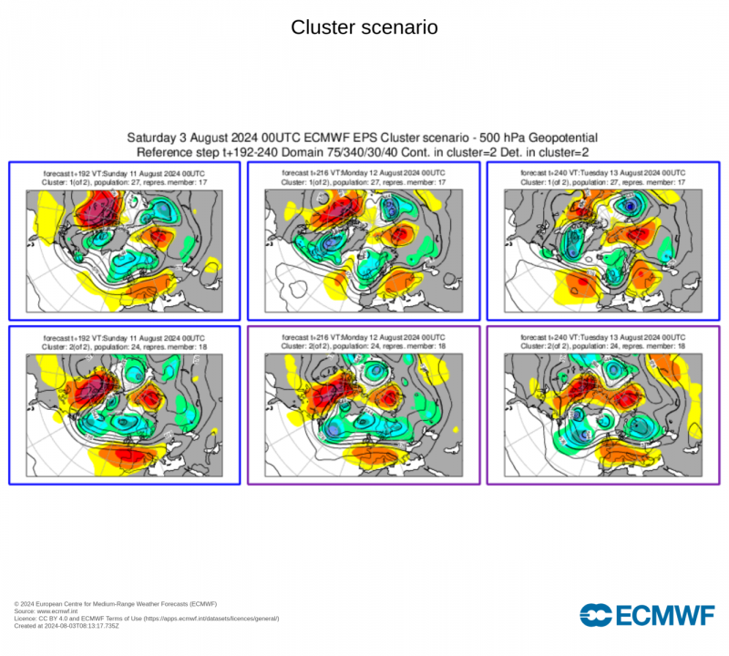
Forecasters tend to treat operational runs with caution beyond a week and revert to using the ensembles. A look at the ECMWF ensemble clusters indicate an almost half and half split between upper trough dug south over the UK Sunday 11th to Tuesday 13th (27 members) or more ridging influence over southern UK and upper trough placed further north (24 members). The 1st scenario would mean cool and unsettled with equal risk of rain or showers for all from next weekend into early the following week. The second scenario suggests warm and drier in the south, but not completely dry, the north and west cooler and wetter. But either way, no sign of any heatwave returning before mid-month, given the strengthening zonal jet stream aimed somewhere at western Europe as head towards mid-month.
Next week does look fairly dry and settled towards SE England, but more changeable conditions are likely towards the north and west of the UK, as depressions move past the north of Britain and associated frontal systems move east over northern, central and western Britain. But next weekend it may turn unsettled across all parts, as the jet stream strengthens but also starts to shift south, taking areas of low pressure further south as they track east towards and over the UK.
Loading recent activity...