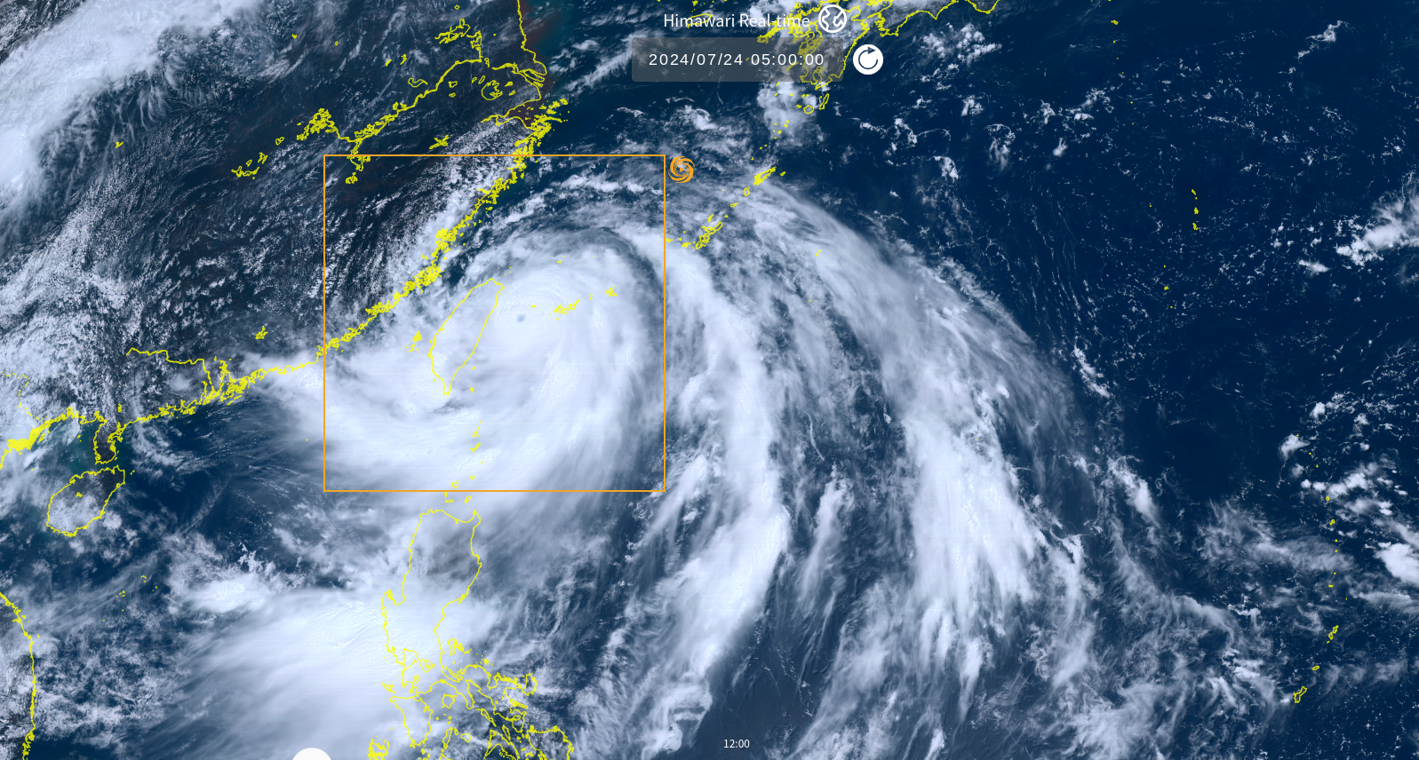
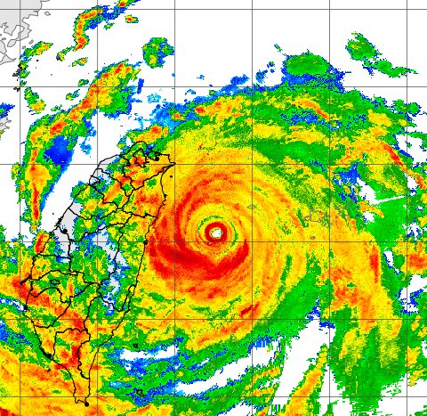
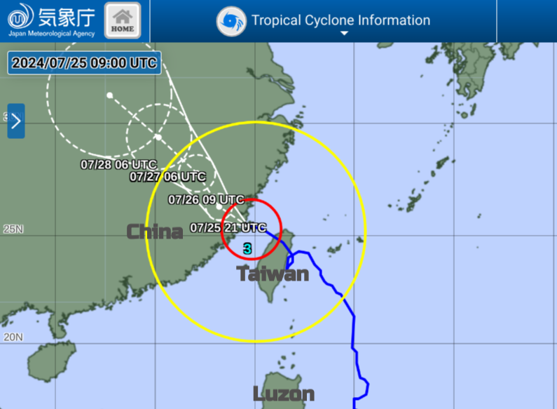
Typhoon Gaemi reached the equivalent of a Category 4 hurricane as it neared northeastern Taiwan on July 24th. This intense cyclone passed over the island and moved over the Taiwan Strait reaching southeast China on the 25th July. There has been intense rainfall with widespread flooding and landslides in the mountainous regions of Taiwan and also disruption and damage from the high winds.
 Taiwan CWA radar
The Philippines were also affected as the cyclone intensified the seasonal monsoon rains. Massive floods hit Manila, northern and central Luzon. Gaemi is known as Carina in the Philippines where there is a different naming convention. PAGASA (Philippine Atmospheric, Geophysical and Astronomical Services Administration) named CarinaPH but also use Super Typhoon (which the JMA regional Typhoon Centre in Tokyo does not). Gaemi/Carina did qualify as a Super Typhoon on the Philippine scale. The flooding was widespread and disruptive. Even as the typhoon pulls away there is the risk of disease with soil, dirty water and sewage coating many areas and homes.
Typhoon Gaemi had been forecast to move westwards across Taiwan but there are many mountains in this region that impact the incoming storm. The high ground is always a region at risk of flash flooding from torrential rains but the cyclone looped offshore, circling off the east coast before making landfall near Nanoa, Yilan County.
Schools and Government departments were closed for two days with train services and flights cancelled. People were evacuated in New Taipei City with buildings damaged and nearly 500 trees falling. There were power outages in Taiwan. A Freighter, Fu Shan, sank and its nine crew members are missing as rough seas hampered the search and rescue with concerns about an oil spillage.
Even as Gaemi moved away from Taiwan the torrential rain continued. Over 1000mm of rain was recorded in 24 hours in some places with ongoing thunderstorm warnings. Slowly train services resumed on the 25th although there was damage to bridges, flooding and debris to assess. Gaemi was downgraded to Tropical Storm strength as it arrived in China but there were still concerns about the heavy rainfall and flood risk along with high winds.
‘The China Meteorological Administration (CMA) upgraded level three emergency responses to level two emergency responses at 11:50 a.m. on July 24. addressing the impacts of Super Typhoon Gaemi. Under this emergency state relevant meteorological departments put timely and precise forecasts and refined services for the government and the public in place.’
Whilst Taiwan had been on the highest alert for the most intense part of the Typhoon, the enhancement of the southwest monsoon for the Philippines also brought terrible impacts through flooding and landslides. The Typhoon will move from coastal SE China later on 25th, passing through Fujian and then turn to move in a more northerly direction, gradually weakening in intensity.
Loading recent activity...