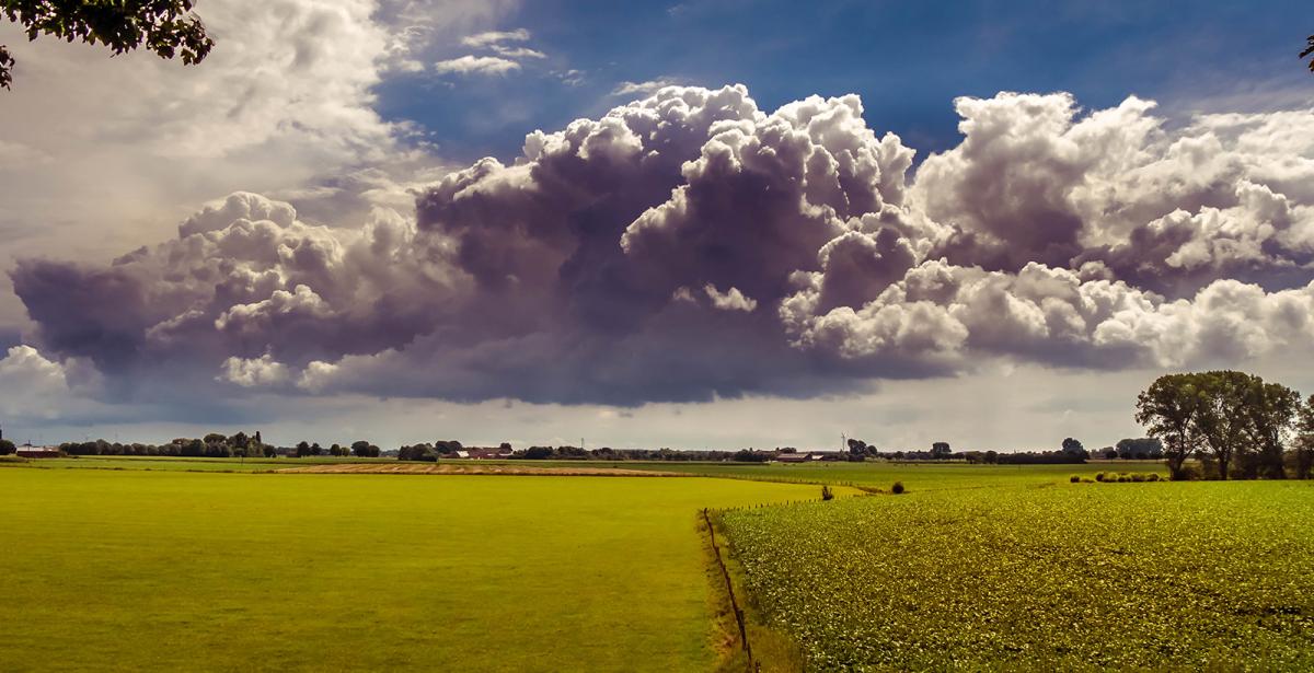
The weather looks to remain changeable for the rest of this week, with occasional showers or longer spells of rain moving through but also some dry and warm sunny spells for many too and not everywhere will see rain.
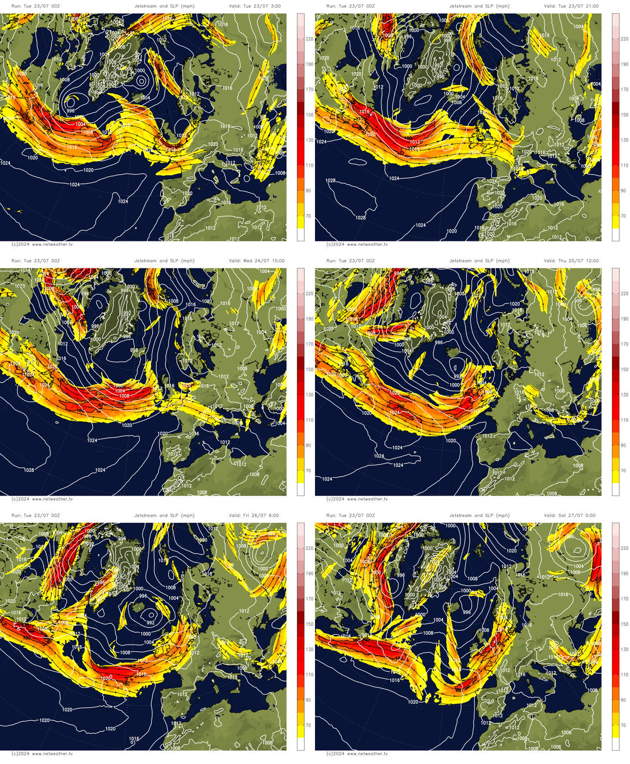
The jet stream will be running west to east across the UK throughout this week, keeping the weather in a changeable mood. The jet stream winds will ease off at times, allowing brief ridges of higher pressure to move through, which will ensure drier and warmer conditions this afternoon, tomorrow and Friday, but bouts of strong jet winds on Thursday and Saturday will encourage frontal systems to move through off the Atlantic, bringing a risk of showers or longer spells of rain in places those days. But, as mentioned, some places could stay dry.
Jet stream over the UK keeping the weather changeable this week
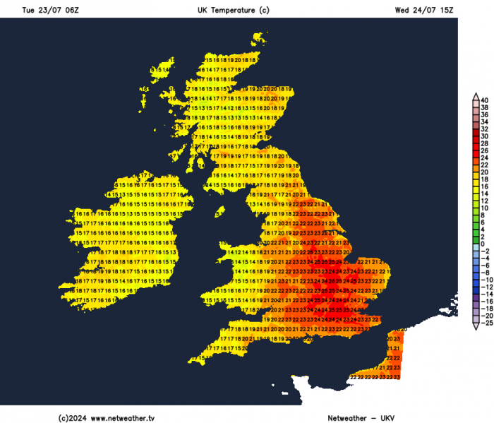
But in the drier and sunnier spells this week, it will feel warm in the sunshine. We should see temperatures reach 24C this afternoon. Tomorrow, which will likely be the warmest day of the week, we should see temperatures reach 25-26C across southern and eastern England. Friday could see temperatures approaching the mid-twenties towards eastern England too.
For now, cloudier skies with some showers across central and southern areas of England will gradually clear southeast through the morning, then joining the rest of Britain to a mostly fine day with sunny spells, as ridge of high pressure builds in from the west. A few showers will develop in places though, mostly light and over chiefly higher ground of northern England, Wales and Scotland. Temperatures reaching 22C in Glasgow, Birmingham and Cardiff, 24C in London.
A frontal system moving in off the Atlantic will bring thicker cloud and outbreaks of rain east across Ireland and N. Ireland on Wednesday morning, then across the Irish Sea into western areas of mainland UK through the afternoon. Further east, a mostly fine Wednesday with sunny spells, though cloud will build to bring perhaps produce a few showers across eastern England. Becoming very warm across central, southern and eastern England – temperatures reaching 23-26C, eastern Scotland reaching 18-20C, cooler across the west.
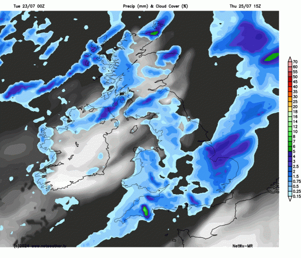
Generally cooler, breezier and cloudier on Thursday, there will be sunny spells, but also some showers across the north and west, which will be heavy in places. A frontal wave running east along the south could bring a spell of heavier showery rain across southern England through the afternoon, though much of eastern England could stay dry and sunny until the evening.
Friday’s looking more settled again for most, dry with sunny spells for much of England and Wales, Scotland and N. Ireland seeing sunny spells but also some scattered showers developing, mostly light but perhaps heavy over N. Ireland. Temperatures reaching the low to mid-twenties towards eastern England, high teens elsewhere.
After a dry and bright start, sunshine and showers is looking the general theme for Saturday, some of which could be heavy and thundery in the south and east of England, perhaps some more organised heavy rain clipping the far southeast. The far west may escape with a dry and sunny day, as high pressure builds in from the west.
Sunday is looking drier and more settled, as a ridge of high pressure moves east across the UK, sunny spells for most with just the odd isolated shower.
Model operational runs and their ensembles this morning have backed away from a hot end to July next week. Can see on EPS trend gif below the culprit is an upper low over the N Atlantic closer to the UK next week on this morning's 00z than previous runs, with a more zonal flow into NW Europe keeping heat suppressed over SW Europe, rather than more amplified upper pattern with a ridge building north over Europe.
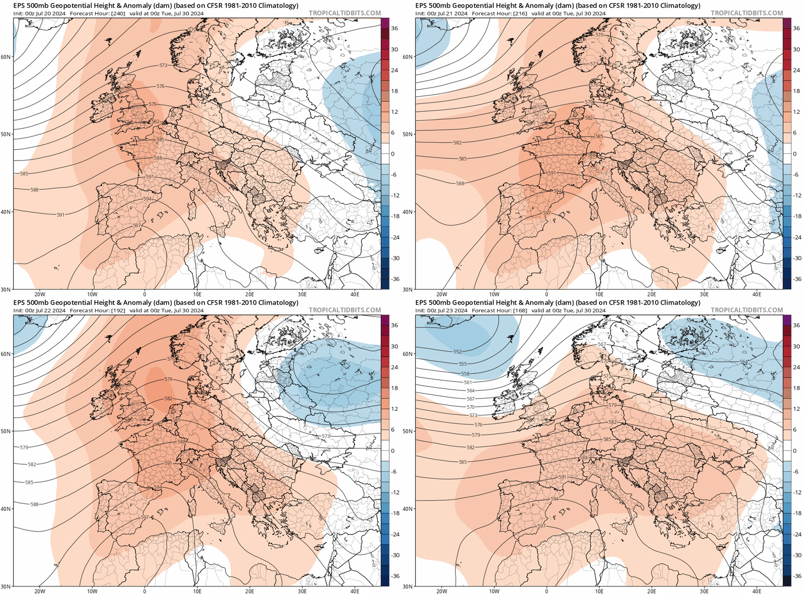
Still looks like southern UK could stay mostly dry and warm next week to end the month. More unsettled towards the N and NW.
Loading recent activity...