
There will be a change in wind direction on Thursday but it's an incoming Atlantic low that makes the shift. That means rain and wind.
The cool northerly flow is going to get interrupted this week. Don’t get too excited the interruption is from an Atlantic low pressure bringing more persistent rain rather than showers. There will be a change in the wind direction, as it backs to a blustery southerly on Thursday with milder air. Then the winds veer to a westerly as the low centre stays nearby on Friday and Saturday, gradually filling, which means lighter winds. There are signs that later next week the cooler northerly flow could return. June- could do better!
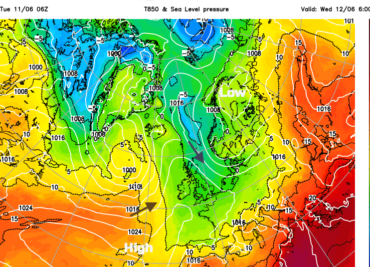
One low pressure has been to the north or northeast of the UK for over a week. The Azores High has stretched closer to western and southwest parts of the UK and Ireland subduing some of the shower activity. Eastern Britain is seeing the main share of heavy downpours, with some thundery ones on Monday. There will be a quiet transition midweek. A few more days of bright or sunny spells with light winds. There will still be a scattering of showers, some sharp ones and a chilly night to come. Inland parts of Northern Ireland, Wales and Scotland could see frost on the grass even a touch of air frost is possible. This is cold air.
Eastern England will hold onto more cloud and see ongoing showers into Wednesday morning.
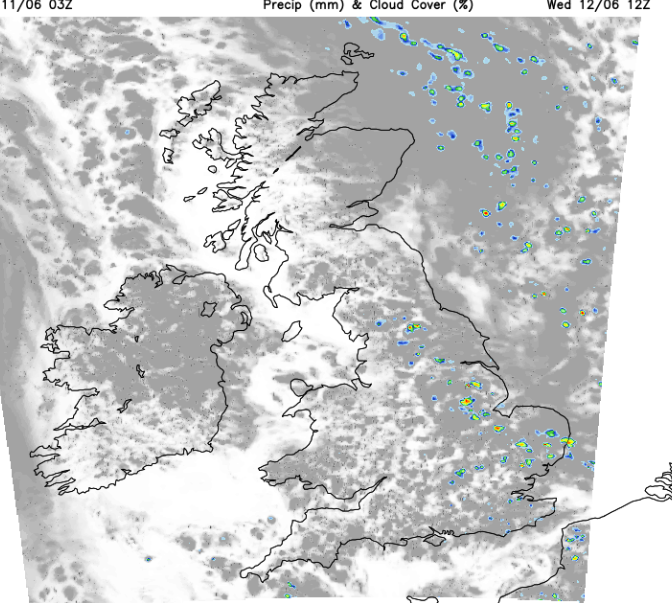
The shower risk continues from the Pennines down to The Thames and over eastern England on Wednesday, again with some heavy downpours. Elsewhere looks fine with plenty of sunshine for western Britain, just a bit more cloud over Northern Ireland.
Temperatures will be between 13 and 18C. In sheltered sunny spells, it will feel pleasantly warm but as it has done for a while, in the shade or breeze, it will feel cool.
Wednesday evening will be quiet and clear before high cloud appears over Northern Ireland from the west. Under the clear skies, it will be a nippy night with hardly any breeze.
Out west, in a southerly breeze, it will be milder.
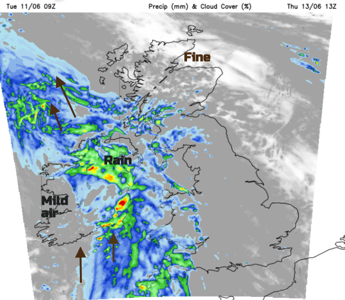
That milder air will spread over the UK as the southerly winds pick up. By lunchtime on Thursday the frontal rain will have set in for Northern Ireland, Pembrokeshire, Devon and Cornwall. There is the risk of southerly gales around southwestern Britain by Thursday afternoon, so a real change from the northerly breeze.
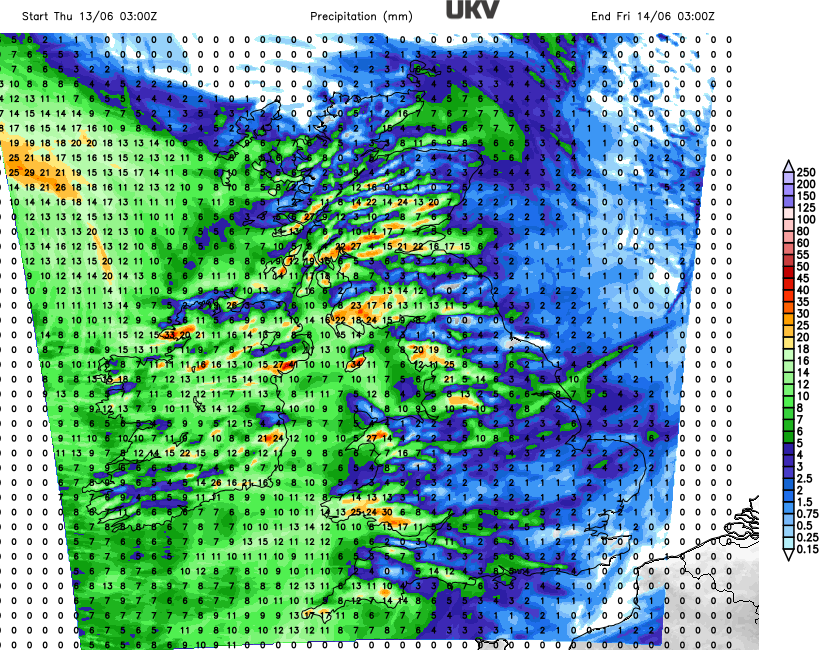
The rain band pivots over Britain later on Thursday and overnight into Friday. The NW Highlands will see some heavy rain followed by hefty showers and clear spells. By Friday morning the rain band will be over Orkney with a fresh easterly. Following that will be bright or sunny spells and a scattering of heavy showers for much of the UK with a light westerly wind.
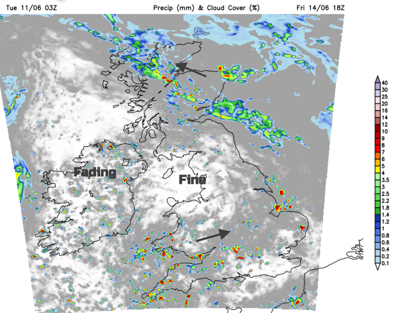
A band of showery rain will develop over northeastern Britain as more showers feed in from SW England and southern Wales across southern Britain, If you catch one of these downpours you will know about it. They could include thunder and lightning, even hail.
Loading recent activity...