
No June heat, even into next week. The airflow from the north is cool so you will need to be out of the breeze and in the sunshine this weekend. Scattered showers continue
The cool flow over the UK will continue through the weekend. Since the colder air arrived the top temperatures in the UK have only been in the high teens. At the weekend a few sunny spots in southern Britain might see 21C but there isn’t any June heat even if there is strong June sunshine. This freshness looks set to last into the middle of next week.
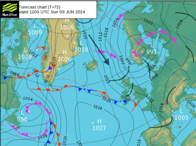
The cool airflow stays with us due to a stationary setup, anchored by the Azores high and a low pressure to the north, which will drift eastwards.
There is a change for Sunday’s forecast. Overall the weekend had included bright or sunny spells with showers mainly in the far northwest. Saturday looked blustery with a few showers elsewhere and Sunday saw lighter winds and more sunshine for Wales and England.
Low pressure has lurked north of Scotland all week feeding showers in from the northwest. This will slide towards southern Scandinavia with the high pressure remaining out in the Atlantic. On Sunday a waving front will slide around the top of the high and reach the UK from the west. This will bring a band of showery rain and thicker cloud but there is some uncertainty about where it will affect during the day.
The ECM model has the rain heading for Northern Ireland on Sunday afternoon and reaching Wales during Sunday night. The UKV 03Z run had the rain over Northern Ireland on Sunday morning, clipping SW Scotland and then over Cumbria and more of southern Scotland by lunchtime and across Northern England in the afternoon with a wider band of cloud. This will be something to keep an eye on as the forecast could shift again before Sunday.
If you are in a sheltered sunny area it will feel pleasantly warm but in the shade, as a shower passes by, in the breeze and certainly after dark, it will feel cool. The weekend temperatures will be 13 to 18C.
Northwestern Scotland will bear the brunt of cold winds and see a rash of showers through the weekend.
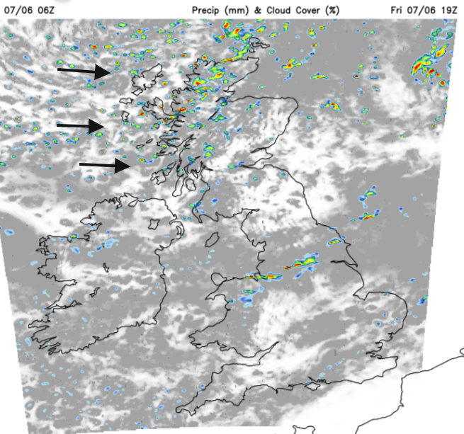
There will be a fading weak front bringing more cloud and a few showery outbreaks over Wales on Saturday morning. This band slowly drifts southwards allowing sunshine to appear from the north. Along the M4 corridor into Essex, there could be the odd shower in the middle of the day with a few bright spells. As it continues to edge southwards the cloud will thin and break allowing more sunshine for Saturday evening. Northern Ireland will have a fine day with sunny spells. Belfast could reach 16C in the sunshine and sheltered from the cool NW wind. Liverpool might reach 14C but will feel chilly in the breeze.
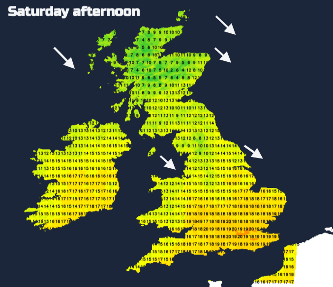
Northern Britain will see a few showers with bright or sunny spells. These fade away into the North Sea during the afternoon. For Scotland, there will be a scattering of heavy showers from the west in the morning. The focus for the showers will shift to more northern areas in the afternoon. By Saturday evening most of the UK, away from showery northern Scotland, will be dry and sunny as the reach of the Atlantic high extends. It looks fine but nippy in Edinburgh for Taylor Swift fans at Murrayfield.
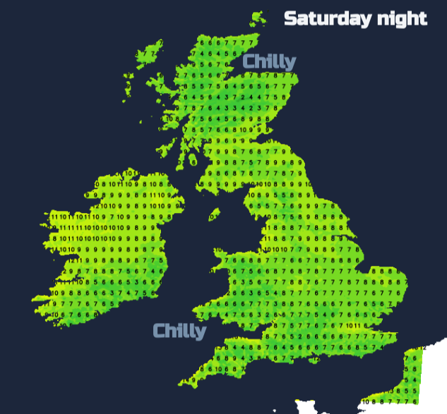
This means that Saturday night will be clear and chilly in rural areas. Temperatures will fall well down into single figures with a light westerly breeze.
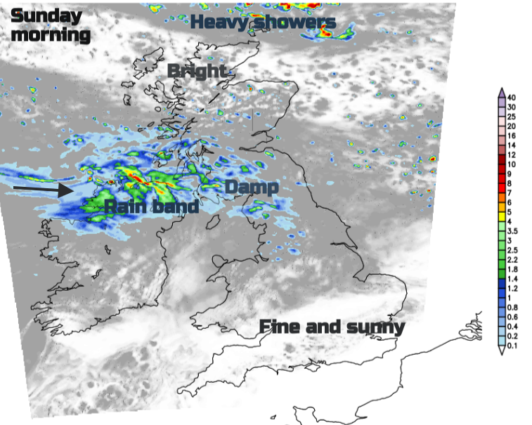
As discussed there is some uncertainty around the incoming frontal band from the Atlantic. Southern Britain will start fine, dry and sunny. Cloud and outbreaks of rain will appear over a central swathe of the UK from this band with a cool westerly breeze. This band will slowly sink southwards over the Irish Sea and northern England into north Wales and the Midlands by Sunday evening. The Sunday weather will be in bands, sunny south, this cloudy rainy band, then bright spells, and showry in the far north with everything edging southwards during the day. Hefty showers will appear for Shetland and Orkney on a fresh NW wind and reach mainland Scotland on Sunday afternoon with a bit of snow likely over the Cairngorms after dark. This showery section accompanies the return of colder air coming straight down from the Arctic and signals more chilly nights.
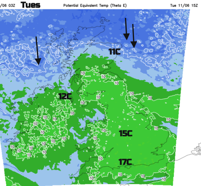
The high pressure remains out west and the low pressure sets up camp over Scandinavia and in between is the cool flow down from the north, well into next week.
Loading recent activity...