After the warmest day of the year so far, prepare for a stark change. Cooler air is sweeping in, bringing blustery showers across the UK.
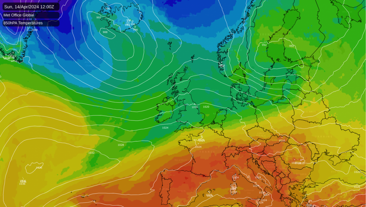
The coming week brings the first bout of 'spring northerlies', so expect a drop in temperature for a while. This process has already begun, with cooler air from the northwest finally spreading to all parts overnight.
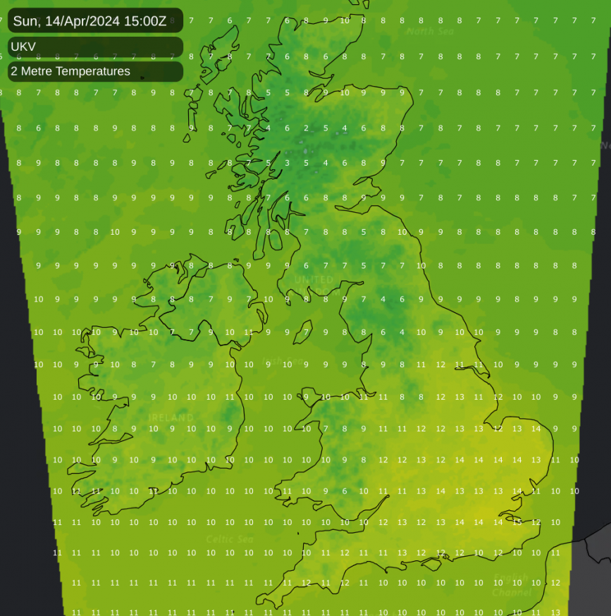
So you'll notice it chillier today, especially towards the southeast, where the warmest day of the year so far, 21.8°C, was reached at Writtle yesterday. Today's values are much closer to the average for mid-April. But after a couple of welcome drier days over England and Wales, the new working week brings the return of blustery showers.
For most, it's a fine but noticeably cooler start, with many central and southern parts staying dry. The best of the sunshine will be in the east and south, but the cloud will 'bubble up' with showers mainly developing in the north and west. Across Scotland and Northern Ireland the showers become heavier and more widespread from the west, giving local hail and perhaps thunder. Wales and the north of England will see some developing later, but the showers will be more scattered elsewhere.
A west or south-westerly wind will become very blustery across the north and west, with gusts in excess of gale force likely in the heavier, more squally showers. It'll feel noticeably cooler, especially in the south, where top temperatures of 13 to 15°C will be some 6 or 7°C down on yesterday's values. It'll be cooler still further north, with 8 to 12°C more likely here.
The evening brings further showers to the north and west, with bursts of rain, some heavy, spreading to all but probably the southeast overnight on a blustery southwest wind that'll continue to give fresh or strong gusts. The showers could even turn wintry on some Scottish hills as winds in the north become west or north-westerly. Lowest temperatures 5 to 8°C in the south and 2 to 4°C in the north, with perhaps a touch of frost in some sheltered Scottish glens by morning.
After some rain across East Anglia and the south, the new working week begins on an unsettled, chilly note. There'll be sunny intervals but also blustery showers, especially over Scotland and in the north, where some will be heavy and wintry on northern hills, giving hail and maybe a crack of thunder, with the best of the sunny intervals on offer in the south.
You'll certainly feel the chill in a west-to-north-westerly wind bringing a 'shock to the system', with further strong, even gale-force, gusts expected in the heavier showers. Needless to say, top temperatures from north to south of only 8 to 12°C will be disappointing for mid-April.
It remains blustery and showery into the evening and overnight, with the south seeing the best of the clearer intervals. But in the north and later the east, the showers may remain quite frequent, with some snow likely on higher Scottish hills as winds of Arctic origin turn into the north. Some sheltered glens could see a touch of frost again, with the lowest temperatures probably between about 2 and 6°C.