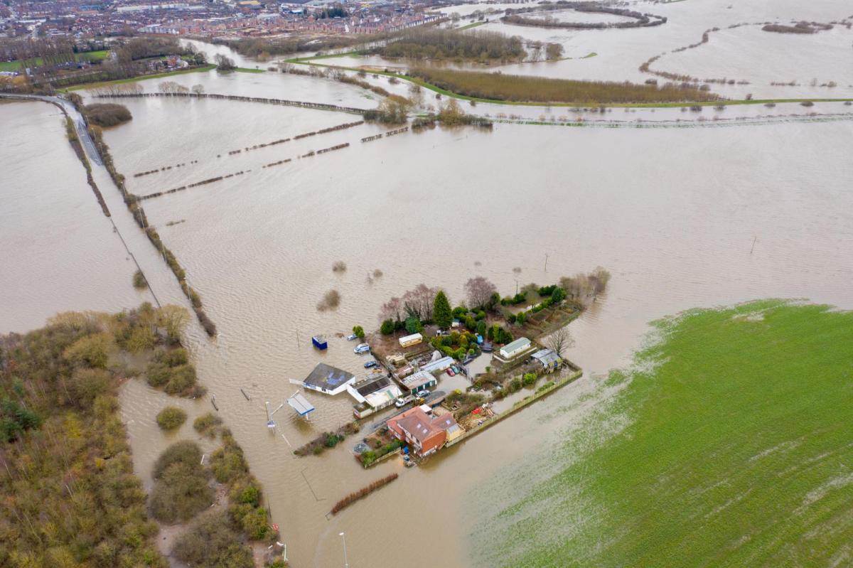
With the ground already saturated, the UK faces an increased risk of surface water flooding this week as further rain is forecast.
Although wet, it's also been a particularly dull March so far, so it was nice to see a sunny start for a change yesterday across much of Scotland and the North and East of England. But typical of the current situation, it didn't last, with our brief taste of early spring soon replaced from the South West by cloud and more rain.
And that remains the picture for the bulk of the coming week, in yet another unsettled period. Already saturated ground will lead to further surface water flooding, with this morning's heavy rain across central and eastern areas a case in point, before the rain eventually clears into the North Sea.
Forecast rainfall totals (from the UKV model) over the next 5 days: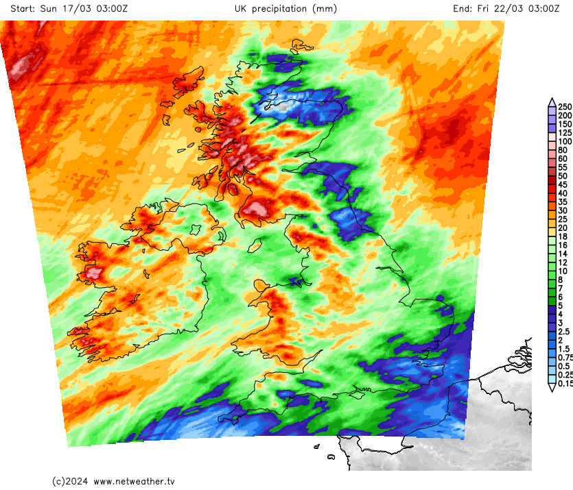
It's a wet start across central and eastern areas with heavy rain in places, accompanied by some hill and coastal fog. This'll move away, but it could be early afternoon before skies finally brighten along parts of the East coast. Once it does so, it'll leave much of the country 'in the same boat' in a day of sunny intervals and scattered showers. They'll soon develop in the West, some becoming heavy and lengthy over Northern Ireland and West Scotland later. Elsewhere, there'll be fewer showers, with the best sunny intervals in the East once the rain has cleared.
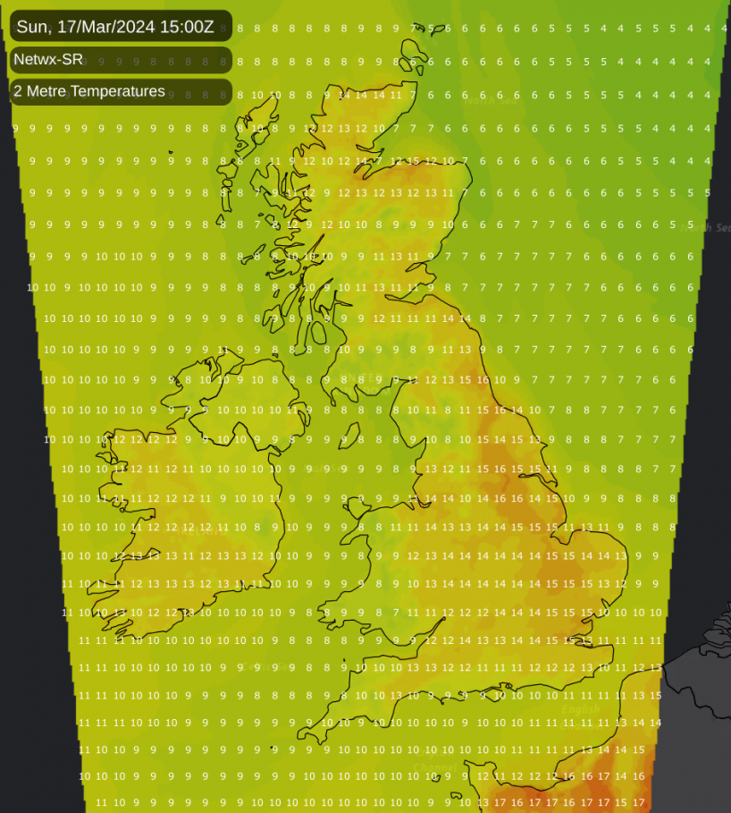
A moderate or fresh southerly wind will be gusty in and around showers, but despite the unsettled conditions, it'll be very mild. Temperatures reach 11 to 14°C fairly generally and 16 or 17°C in some localities towards the Southeast, but the far North will be colder, with 8 or 9°C more likely here.
A weakening trough will enhance shower activity for a while in the North and West, where a South or South Westerly wind will sometimes be fresh and gusty. Some could be heavy before the showers move on, with a few 'cropping up' in more eastern areas later in the night. Here, though, you'll have the best chance of skies breaking sufficiently at times to give a few clear intervals. But on another fairly mild night, temperatures 'across the board' fall no lower than 6 to 9°C.
There'll be a few showers, mainly in the North and perhaps the East at first, but for most, it'll be a drier, brighter day with sunny spells. Some central and eastern areas could become quite 'spring-like', before cloud increases yet again the far West bringing wet and windy weather to Northern Ireland before the day is out. A southerly wind will freshen in the West, becoming strong over Northern Ireland, where gales are likely later. But on another very mild day nationwide, temperatures reach 12 to 17°C quite widely.
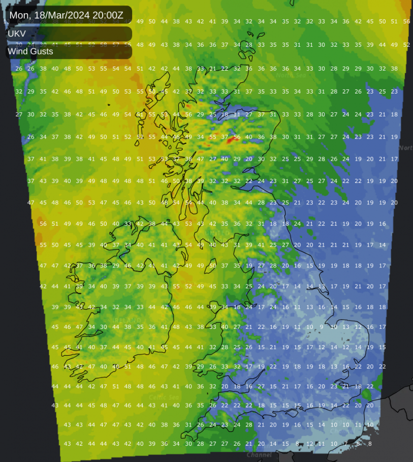
Wet and windy weather spreads to Scotland and the West, where gales could be severe over exposed coasts and hills, before the rain clears to blustery showers across Northern Ireland, Wales and the South West. Further East, it should stay dry in a fresher southerly wind but on another mild night. The temperatures shouldn't fall below 8 to 11°C.