An unsettled few days although with a drier lull for parts of Britain. Atlantic low pressures rattle by with gusty winds and bands of rain but brightness in between.
As a cold front stumbles southeastwards today over England and fades into the night, another Altatic low pressure arrives for the middle of the week. The centre of this one heads north of Scotland, over the Faeroe Islands by Thursday lunchtime. Its frontal bands will bring more February rain to the western shores of Britain and also Ireland. And there will be strong winds, even gales for exposed areas. It turns cold with frost and ice overnight, leading to a mix of rain and hill snow on Friday as a secondary low develops from this one. That new low sits over the UK for the weekend with a good deal of cloud, and rain at times but with lighter winds,
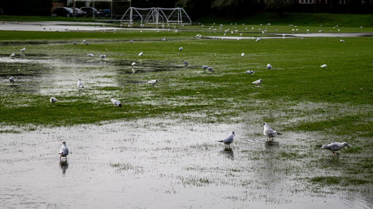
February has been very wet, the winter has been mild. February 2024 will include an extra day, with extra rain but it was already soggy. Just as February 2020 (another leap year) was too, “the wettest February on record for UK, England, Wales and Northern Ireland, and the second wettest (behind February 1990) for Scotland.” Met Office. This year’s figures should be out on Friday or early next week.
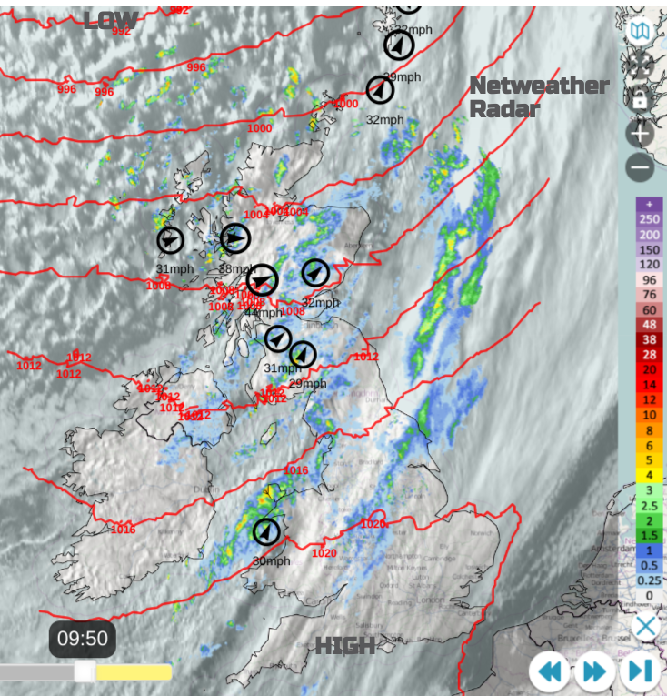
Today’s low centre is east of Iceland and the occulding front is dangling down over the UK. There are fresh, gusty SW winds over Scotland this morning with a veer to a showery Westerly flow behind the front. Southeastern Britain is calmer with bright spells but increasing cloud. Here it should stay dry with temperatures of 6 to 9C. The frontal rain will be heavy over Cumbria, Lancashire and Gwynedd this morning, clearing from Northern Ireland and southern Scotland by lunchtime. This leaves behind brighter skies and a feed of showers from the northwest. The sunshine should lift the temperatures, around 7 to 10C but it will feel colder in the breeze. The frontal rain will continue southeastwards over Wales, the Midlands into southwest England late afternoon.
Tonight
The tail end of the frontal band will move away from southeastern England leaving a dry time for all of the UK except the showery, blustery Northern Isles. There will be some low cloud and fog about again for inland England, with frost in places as temperatures dip to around zero. High cloud will arrive from the Atlantic heralding the next low pressure.
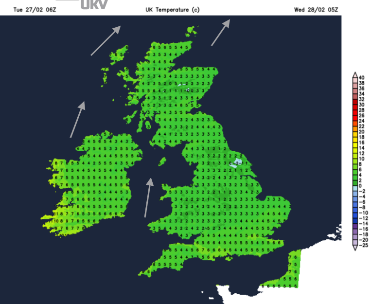
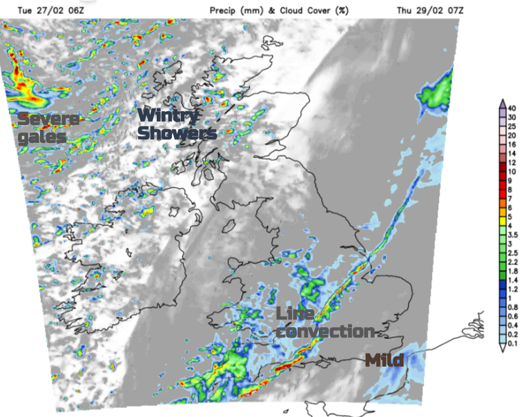
By daybreak, there will be a fine start for much of Britain, but western shores and Northern Ireland will see rain with a brisk southerly wind. One rain band looks to reach right across Scotland in the morning but overall it is the westerly flow bringing cloud and rain in. Northern Ireland could see temperatures of 12 to 14C within the warm sector. Later in the afternoon and evening, heavier bursts of rain should work their way across England with a mild, moderate SW breeze. The active cold front will arrive overnight with line convection showing on the UKV model for Northern Ireland before midnight. In the small hours of Thursday, the sudden gusts and hefty downpours are also highlighted across the Irish Sea into Wales, Devon and Cornwall. It will be worth a glance at the radar on Thursday morning before heading out to look for this active band because some people will get soaked.
By lunchtime, northern Scotland will become very windy with high gusts as the low centre passes to the north. It also looks windy for England and Wales during Thursday night into Friday.
Spring (meteorologically is coming. Weather data defines winter as the the three months of Dec/Jan/Feb. Already the days are getting longer, the daylight changes are very noticeable at this time of year. Crocuses and daffodils even tulip leaves are popping up. It may still be very soggy underfoot but the birds are singing and when the sun does appear, we know that spring is not far away.