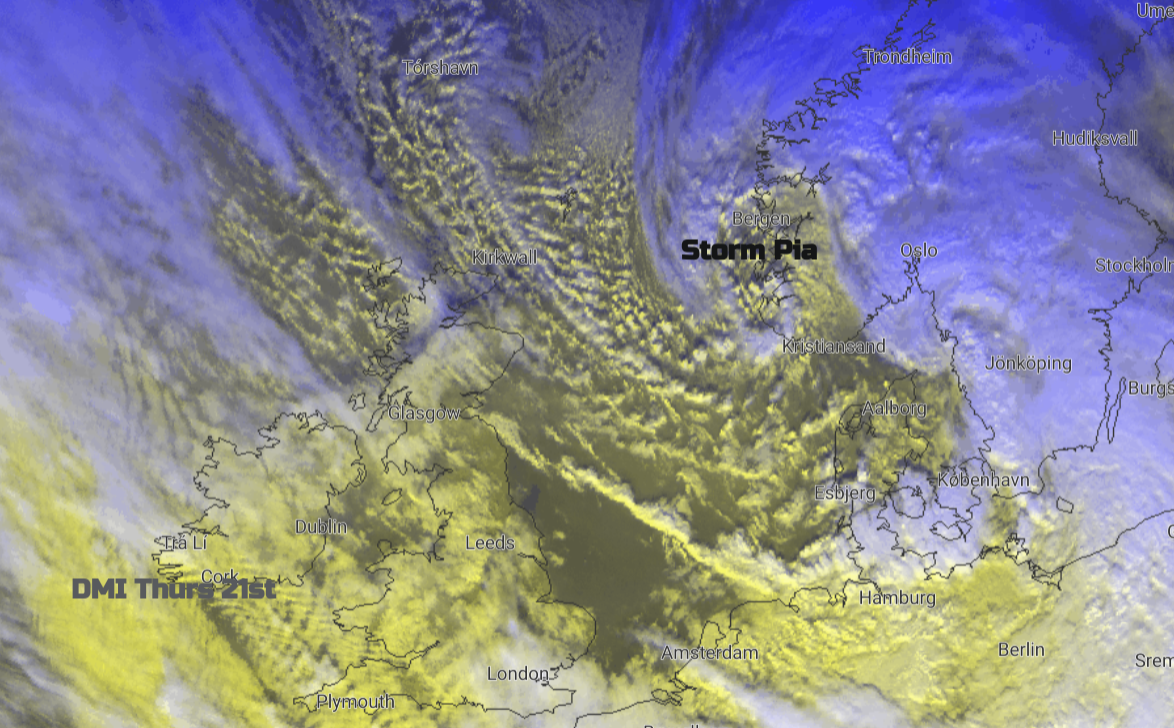
It has been a windy start for Thursday as Storm Pia passed by. The main impacts from this significant low pressure were for Denmark with high wind and coastal surge warnings, and also Norway and the Netherlands. Schools were closed today in Shetland in the severe gales as ferry services to many Scottish islands were cancelled. Rail services in Scotland and northern England were affected by the strong winds with concerns of debris on the lines and speed restrictions were implemented. Some services to northern Scotland had already been cancelled and Scottish & Southern Electricity Networks are reporting numerous new outages.
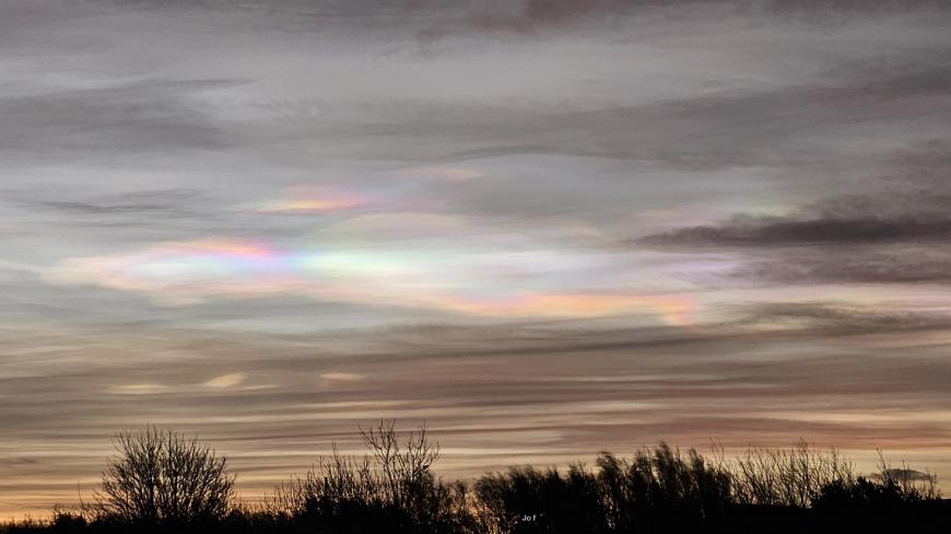
However, the Nacreous clouds were out again, with the most stunning display of this week as the sun rose.
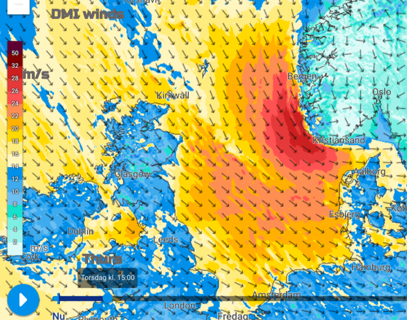
The worst of the gales and high gusts are easing over Britain this morning as the storm arrives in earnest for southern Norway and Denmark later on Thursday with hurricane-force gusts forecast and around 1.5m higher water level than the usual tides.
There are low-level concerns for the coast of East Anglia, luckily it is not spring tide time. “Local coastal/tidal and river flooding is probable in parts of the East of England from later Thursday until Saturday.” On Thursday -” Tides are expected to be higher than usual, due to the forecast weather conditions, for the next couple of tides “ There are high river levels and this extra surge of water pushed ahead of the low pressure down the shallowing North Sea basin. Tidal locking is when tidal waters moving up the rivers restrict the normal drainage out to sea by low tide. With so much water around, it can lead to flooding or overtopping.
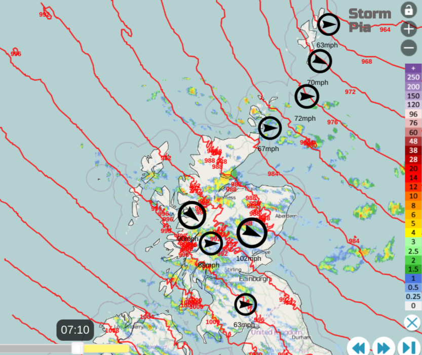
There have been gusts today for the Scottish Islands of 70 to 81 mph. There have been very windy conditions to the lee of the Pennines and Peak District to start the day. Leeds Bradford airport saw a gust of 68mph. Also for exposed western areas, there were many go-arounds or diversions from Manchester airport in the high gusts.
So Pia was named by the Danish Met Institute which are part of a different storm naming group, the Northern one. We are in the Western naming group with Met Eireann and Dutch KNMI. Our next name is G for Gerrit. For those in SW England, Pia is of little interest but for Scotland, certainly the Northern Isles and northern England, another passing named storm is worth highlighting. We will hear about the various storms that affect Ireland with their quantitative way of issuing warnings, (set wind speeds, or rainfall totals) and yet a storm impacting the North Sea, northern Britain but focused on Denmark, that information was subdued by the Met Office?
On one hand, we are to be given information to make good decisions, such as for flood events, but for Storm Pia it wasn’t highlighted, in case we got too excitable. What if it had been the Netherlands who had named it? Whilst we wait to see if there will be a named storm, or there will be an upgrade to warnings (and outwardly this is hard to gauge either) if another country does name it, then we know that the UK Met Office won’t. So our National Met Service sharing that information, as Twitter X falls apart, is valuable.
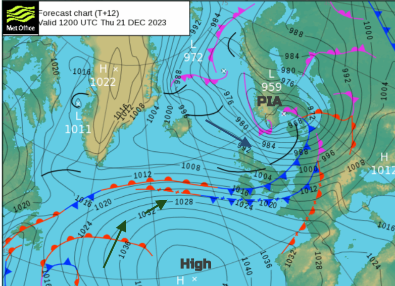
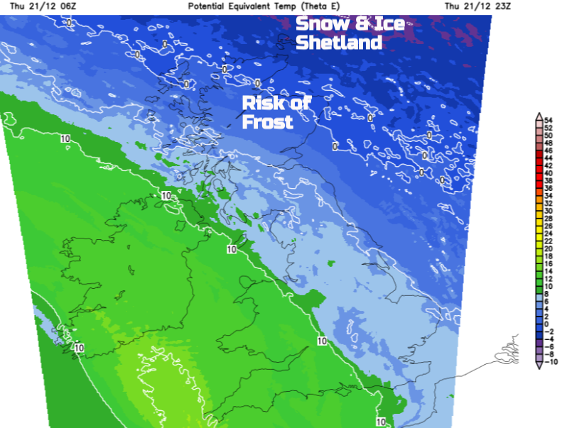
What Storm Pia has done is to introduce colder air from the Arctic as the centre dives off to the Baltic Sea. There have been wintry showers in the mix with the brighter skies. Shetland has a warning for Snow and Ice overnight and all of the UK will stay blustery with brisk winds from the west or northwest. There is a trailing warm front which will edge over Ireland on Thursday night.
There will be a lot of cloud about for Friday with outbreaks of rain from the west. These will turn to sleet and snow over the high ground of northern Scotland during Friday morning with more showery outbreaks by Friday evening. The frontal boundary wavers about over Britain but it looks like the main warm front will be heading northeast during Friday night.
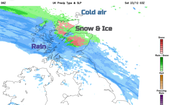
Ahead of this, the winds will fall light over much of Scotland on Friday evening and temperatures will fall with the risk of ice and then snow, as the precipitation hits the cold air for a time. Rain follows and sets in for northern and western Scotland by Saturday morning.
The mild air wins out (for all but the far northeast of Scotland, including the Northern Isles) but the blustery westerly winds remain.
This westerly flow from the Atlantic will bring more heavy rain to western Scotland, to Wales, Cumbria and the Peak District. Other areas already have saturated ground and high river levels, so in the run-up to Christmas it will be the risk of flooding to keep an eye on for most people.
Storm Pia discussion thread
Loading recent activity...