The start of the week has seen a mature low swirling over the UK, almost lumbering its way towards East Anglia on Tuesday night and the centre away over the Netherlands midweek. There are still bands of rain and showers wrapped around this low pressure with heavy rain warnings for Scotland.
“Rain through Tuesday and into early Wednesday may lead to some disruption and flooding in places. ” MO
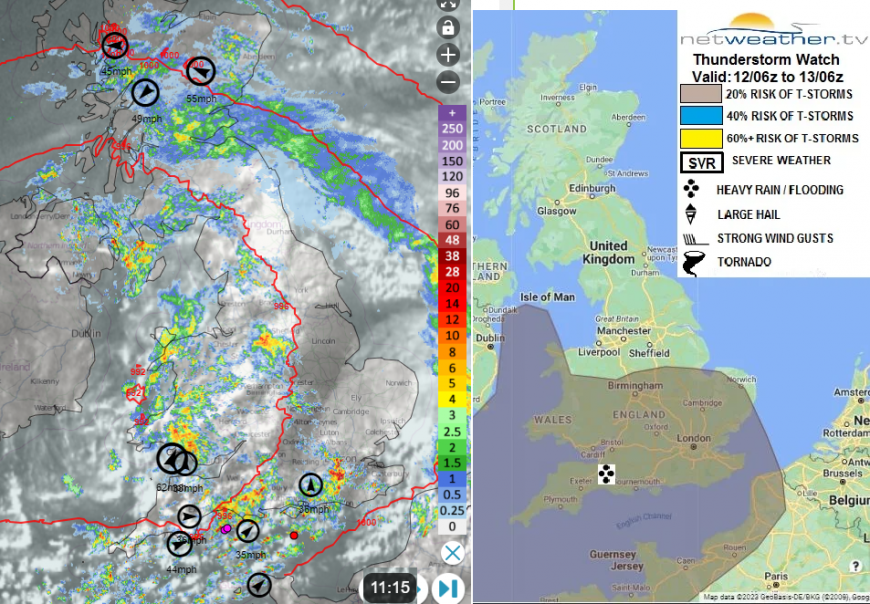
Netweather Radar showing heavy rain for eastern Scotland and sharp showers with sferic dots in English Channel. Top ten gusts on Netweather Extra and Tues 12th Convective forecast map, with thunderstorm risk area.
The same system is causing flooding in the French wine regions, also eastern France into Switzerland and southern Germany today with amber rain warnings that include mention of a thaw. The frontal boundary will push down through Iberia, the Alps into the Balkans early on Wednesday, Behind this, there will be a short-lived tuck of colder air with frost and ice for Scotland on Wednesday evening.
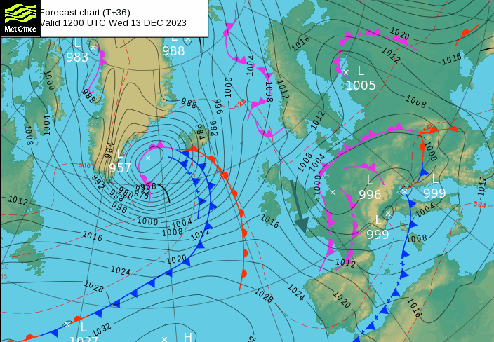
For the rest of the week, high pressure begins to catch the eye on the synoptic pressure patterns. This will bring drier, more settled conditions to some parts of the UK. However, there will be windy weather in the north and even gales possibly early on Saturday. It will be calmer further south, closer to the high pressure.
Bude in north Cornwall reached 13.4C on Monday 11th and again southern England could see 12 or 13C today. The city of Valencia in eastern Spain saw a December record, with 27.3C (AEMET) on the 11th, with observations dating back to 1869.
It’s quite a different picture from the frosty start for December when there was snow and ice. We could do with a break from all the rain though. If you are hoping for something drier there will be a shift this week.
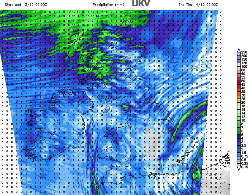
The main frontal band will take its time to clear away to the southeast. High rainfall totals for eastern and southern Scotland and the Central Belt and there are alerts from SEPA (the Scottish Environmental Protection Agency) for localised flooding from rivers and surface water.
This is in the easterly flow around the top of the low pressure but there will be plenty of hefty showers milling about for County Down, the Irish Sea, Wales and over England closer to the centre of the low where winds are light. There is the risk of hail and thunderstorms too.
“Increasing forced ascent of this unstable air mass ahead of the low moving east will support heavy showers and a few brief thunderstorms – which may produce hail, gusty winds and intense rainfall leading to localised flooding”
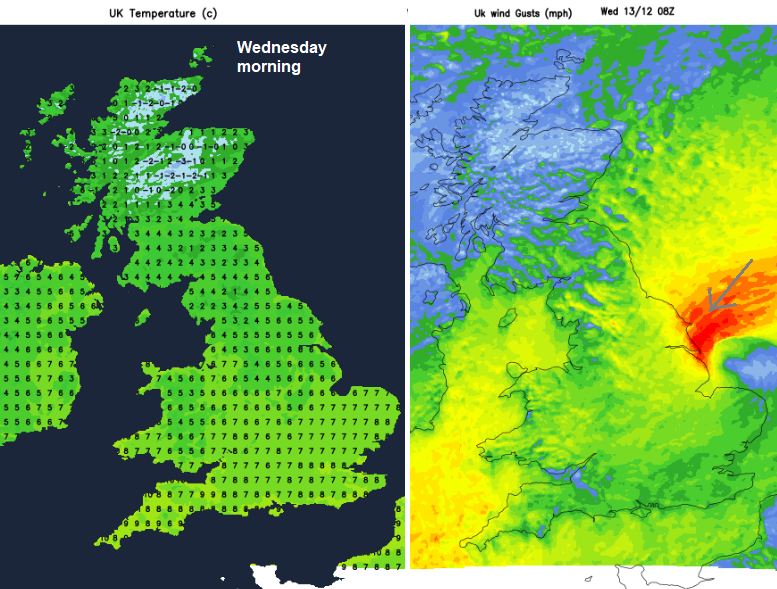
The main band of rain will edge down eastern counties of England with a lot of low cloud and brisk onshore winds from the northeast and then north. Showery weather will continue for SE Scotland and Northern Ireland but there will be clearer and colder conditions further north. This brings the risk of frost and ice early on Wednesday. Coastal North Yorkshire will feel cold in a fresh and gusty northeast wind with outbreaks of rain for Whitby. A brisk northerly wind will be blowing down the Irish Sea and St Ives in Cornwall will see early showers and a keen wind. England will see a cloudier Wednesday with outbreaks of rain from the east, feeling cooler in the north wind. Other parts will feel chilly but see sunny spells.
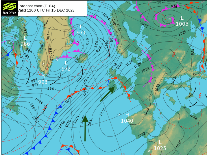
During Wednesday night the winds switch to a southerly as cloud and rain approaches the far northwest. Ahead of this, temperatures will fall away under the early clear skies and again there will be frost with the risk of ice. There could be a touch of frost in the south early on Thursday or Friday morning. The blustery conditions set in for Scotland later this week and could strengthen early Saturday for Highland. Milder air takes hold by Saturday, throughout the UK and the latter part of this week sees drier times than wet ones.
Loading recent activity...