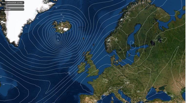
The cold, and in some regions snowy, weather of a week ago was pushed northward last week, ushering in a firmly mild and wet weather regime. However, this mild and wet regime, which doesn't include widespread snow in the forecast for the next 10 days, is only temporary. High pressure from the southwest is expected by next weekend, promising a dry, settled spell of weather and relief for flood-affected areas. Initially, this anticyclonic weather may not be particularly sunny, with plenty of cloud from the west. Eastern Scotland and northeast England, sheltered by high ground, are likely to be sunny and dry.
Long-range GFS model runs hint at the potential for cold northerlies as we approach Christmas, but with considerable uncertainty over whether they will hit Britain directly or head to the North Sea and Scandinavia. This suggests a potential white Christmas or snowy spell shortly before, especially in northern and eastern regions.
Scotland will experience a dull, wet day with rain bands moving northward. Northern Scotland will have showery rain and brighter spells, especially in the northwest. In England and Wales, rain will clear northward, leaving brighter afternoon weather with scattered showers. However, Northern Ireland will see showers and longer spells of rain moving into northwest England by evening. Gale potential is high in Northern Ireland and northwest England, especially near west-facing coasts and hills, with very windy conditions in England, Wales, and eastern Scotland.
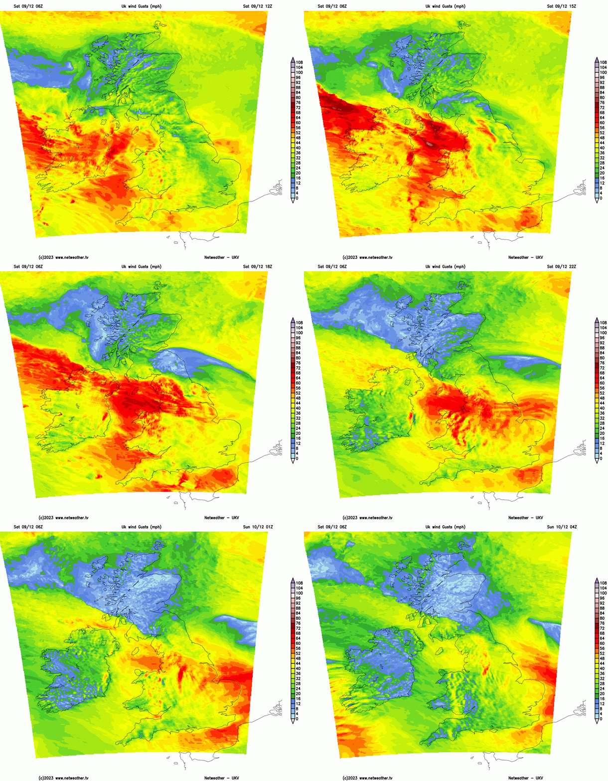
It will be a mild day, with highs around 12°C in southern England in the morning, but cooling as westerlies pick up. Typical highs of 8-10°C are expected across the UK.
Overnight, Scotland's rain will diminish, with clear conditions over England, Wales, and Northern Ireland. Inland areas of Northern Ireland, Wales, and the Midlands may see temperatures drop to 1-3°C, causing slight ground frost, but it will generally be mild, not dropping below 5-7°C.
Sunday starts dry and sunny, but rain from the southwest will cover most areas, except for brighter, showery conditions in northern Scotland. Heavy rain is expected in the west and south. England and Wales will brighten in the afternoon, except in the far north, with brighter intervals also in Scotland. More rain will spread from the west by evening. Northern Ireland will have a brief sunny period in the early afternoon.
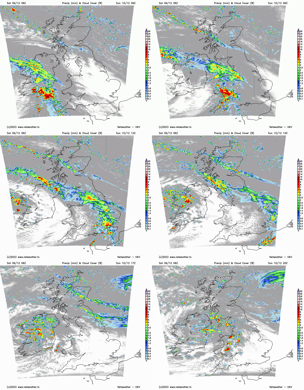
Wales and southern England will remain mild, with highs of 10-12°C, but other areas will be closer to seasonal averages, reaching 6-8°C. High ground in Scotland and northern England may see sleet and snow, while lower levels will have rain.
Next week will alternate between rain or showers on Monday and Tuesday and dry, sunny weather on Wednesday due to high pressure. Northern Scotland will mostly avoid persistent frontal rain, staying bright and showery. Atlantic fronts will bring more rain on Thursday, with eastern and southern England seeing less of it.
From Friday, high pressure from the southwest is expected. The anticyclone, likely centred over southern Britain, will bring westerly winds and moisture but keep frontal systems to the northwest. Some systems may graze northwest Scotland, causing rain, but other areas will be generally dry. Eastern Scotland and northeast England, east of high ground, may see plenty of sunshine, especially near North Sea coasts. However, much of the country, particularly Northern Ireland, western Scotland, and northwest England, could remain predominantly cloudy. The north of Britain is expected to stay mild, while the south turns colder with potential overnight frost and fog patches.
Loading recent activity...