For the last day of November, it wasn't just Scotland seeing the snow showers. Parts of Cornwall had a covering of the white stuff too. More cold air to come.
You might expect snow in parts of Scotland by the end of November but it wasn't just the Cairngorms for St Andrews Day. Cornwall also saw a covering of the white stuff inland.

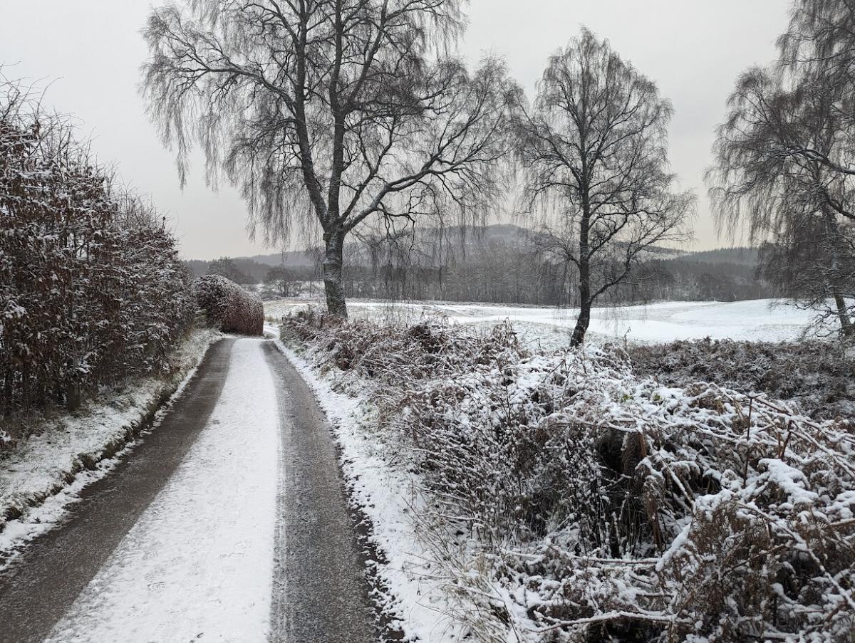
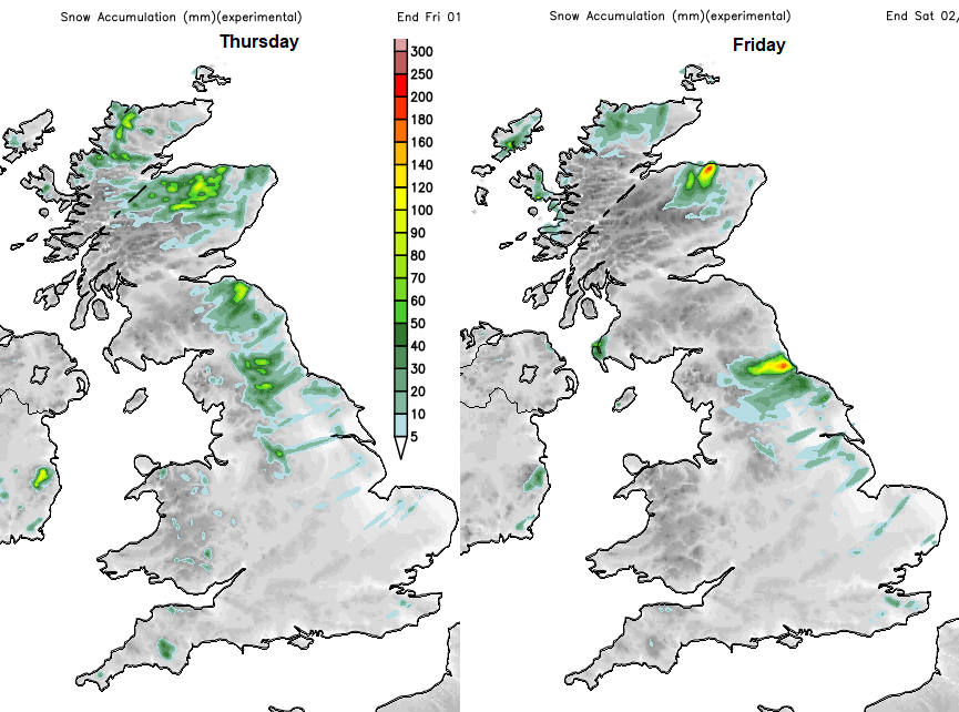
There was a wintry scene for the start of Thursday with snow showers, graupel, frost and ice. Some people awoke to a slight covering of snow, others in eastern Britain had an impactful amount and a real taste of winter closing in. The ongoing feed of wintry showers off the North Sea pushed further inland on a northeasterly wind on Wednesday night and continued on Thursday. Further south the frontal band finally arrived, waving up into the cold air over southern counties of England overnight. This resulted in icy rain, sleet and a bit of snow. Cornwall saw a covering but as in other areas, the roads were soon treacherous with the icy mix.
The low centre in the Western Channel will drift southwards over the Bay of Biscay so the precipitation will fade from the south and English Channel later today.
The warning of snow and ice remains over inland parts of SW England, particularly the Moors during daylight hours. The brisk east wind around the top of the low pressure will make it feel very cold in the damp, icy conditions.
Overnight temperatures fell to -5C in Glasgow, -4C near Birmingham and -6.6C reported at Santon Downham in Suffolk. Thursday night and early Friday will be colder for inland northern Scotland as the snow cover builds and even cold air reaches the UK.
The feed of wintry showers from the northeast continues today with a Met Office dual Snow and Ice warning. There were incidents on Thursday morning including several accidents on the A1 with sub-zero temperatures and a feed of showers from the North Sea.
We need to adjust to winter conditions, with extra time to clear and demist cars, maybe change tyres and remember that gritting roads is a tricky business. It has to be supported, timed right, and hopefully not washed away by a rain shower. However, it’s not magic, so drivers do need to respond to the road and weather conditions.
“Further showers, wintry in places, leading to icy patches developing.” MO
As the low pulls away there will be a tuck of northeasterly winds which will bring showers over East Anglia and possibly some hill snow to Kent. Early on Friday morning. There are signs that there will be a feed of wintry showers moving from the Margate to the Isle of Sheppey side over the Downs to High Weald possibly. However, it is likely that there will be a line of showers but with dry weather on either side. Also, the showers will be a mix of icy rain, sleet and hill snow
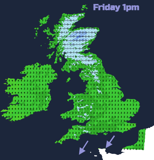
The Met Office warning extends from the Northern Isles across to Lewis, northern and eastern mainland Scotland and right down eastern England. Again there will be areas that see plenty of wintry showers and other areas that escape most of the rain and sleet. The higher ground of northeast England, east coast Yropkshire, SE Scotland and northeast Scotland all look prone again today and early on Friday although the showers fade for the northern half of Britain by lunchtime.
There is an ice warning for parts of Northern Ireland for Thursday night where showers will pass by and any icy deposits or snow could freeze causing a hazard for the Friday morning commute.
The cold Arctic air is here for the rest of the week although with many parts of the UK staying dry with night time frosts.
Loading recent activity...