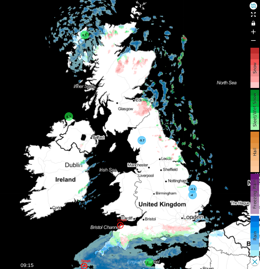
A cold picture today, and as we head into the weekend, with widespread overnight frosts, fog along with some sleet and snow - particularly in the north and east, and for today, parts of southern England.
Parts of eastern England awoke to their first dusting of snow this winter, including my own station near Nottingham, following another very cold night. The Met Office has issued several warnings for snow and ice across eastern England, the north and east of Scotland, parts of the South West, and an additional ice warning for Northern Ireland.
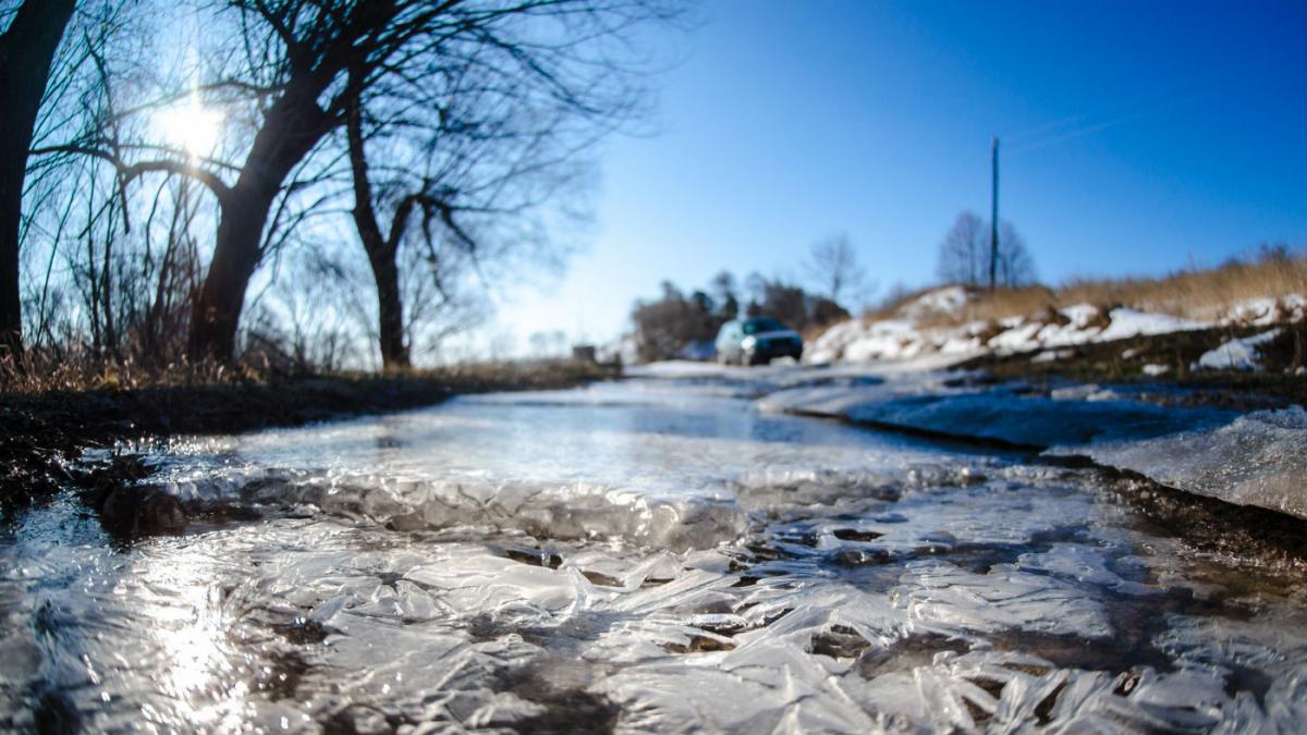
A widespread frost saw temperatures plummet to as low as -6°C around Thetford in Norfolk. East Anglia and some parts of the Midlands experienced freezing fog this morning. However, in Cornwall and Devon, conditions differed with rain, sleet, and snow - the latter mainly over Dartmoor and Exmoor, though not exclusively. The wintry conditions have spread to other parts of southern England, too.
 Keep track of the latest on the live radar.
Elsewhere, showers will be scarce, with most areas remaining dry. Following the dispersal of some freezing fog patches, there will be some sunshine, interspersed with patchy cloud, in a mostly light northerly breeze. In the South West, across the Isles of Scilly and the Channel Islands, a fresh and gusty north-easterly wind will make conditions feel particularly raw. Despite this, temperatures there will reach around 7 or 8°C for a time, but across the majority of the country, 3 to 5°C will be the norm. In areas where fog lingers, temperatures will struggle to rise above freezing.
Little change is expected after dark, with the north of Scotland and eastern counties experiencing a scattering of mostly sleet and snow showers, resulting in another generally light covering in places - but more over the higher ground. The far South West will continue to see patchy rain and snow, expected to clear by morning. The remaining areas will mainly be dry, with clear spells leading to another widespread and quite sharp frost. Patchy freezing fog may also reform, possibly more extensively. A raw north wind, lighter inland, will be most pronounced along exposed coasts, with minimum temperatures mostly ranging from 0 to -5°C.
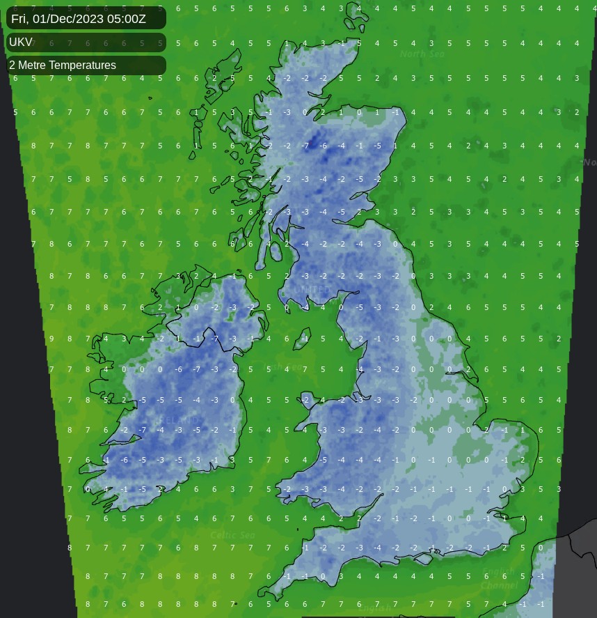
After a sharp frost accompanied by a dusting of snow in parts of the north and east, Friday remains very cold. Most areas will be dry with sunny spells and patchy cloud, which will lead to a few light wintry showers. Any snow at lower levels is unlikely to accumulate significantly. Patches of freezing fog may persist, keeping temperatures close to freezing. Even in sunshine, temperatures will peak at 3 to 5°C, in a mostly light but raw northerly breeze.
Little change is expected after dark, with another sharp frost forecast. Patches of freezing fog will reform in mostly light winds, with mainly coastal areas exposed to the north and west experiencing further wintry showers. Lowest temperatures will generally range from -2 to -6°C.
While conditions are expected to become less cold as the new month begins, the wintry weather will persist into the weekend. There will be some sunshine, but the west is likely to see some rain, sleet, or snow. Patchy freezing fog will continue to pose problems, clearing slowly, and icy conditions underfoot should be noted.