Snow and Ice warnings for northern Scotland and the Northern Isles, eastern Britain from Aberdeenshire down to Yorkshire. Frosty and getting colder across the UK this week.
The Met Office has begun to issue wintry weather warnings with colder air on its way from the Arctic this week. There are snow and ice warnings from Shetland down to Yorkshire over the next few days. Other areas will see frost, and ice is possible but these regions have been identified that wintry weather is Likely to happen but with Low impacts on the warning matrix.
"Some injuries from slips and falls. Some transport routes and travel services affected with some ice on untreated roads, pavements and cycle paths, but road networks generally open. Some road traffic collisions."
“Showers, falling as snow inland, will lead to icy patches and hazardous conditions… These are likely to fall onto frozen surfaces allowing icy patches to form.”MO
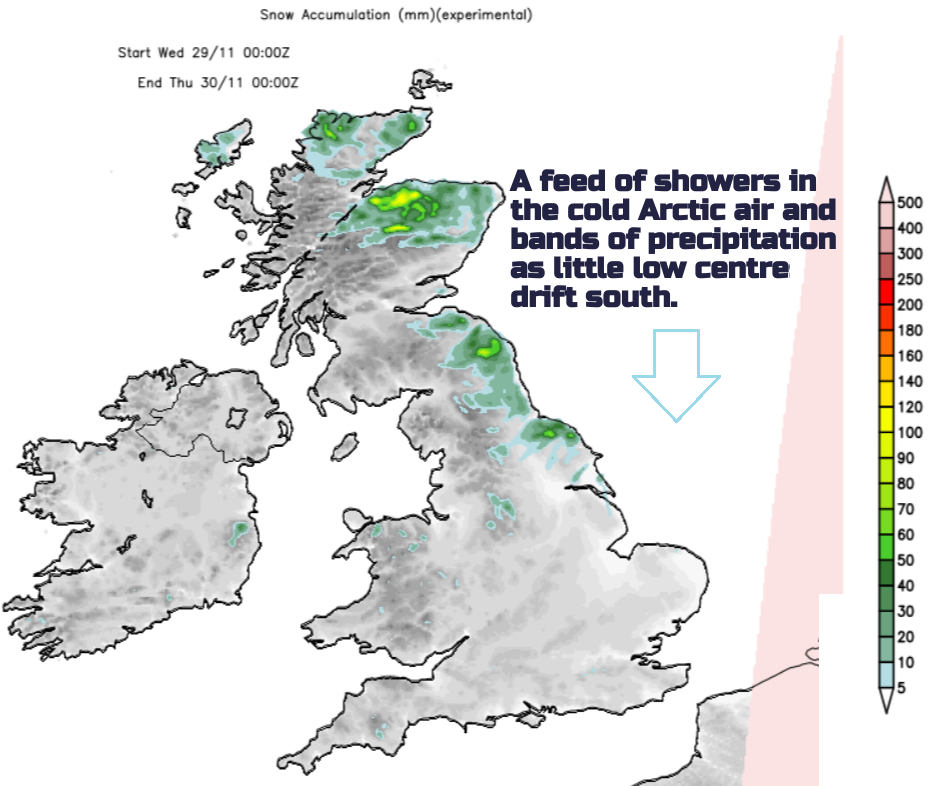
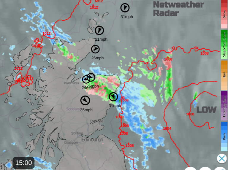
Hence the yellow warnings cover northern Scotland and east coast Scotland down into northeast England and Yorkshire. The main focus is for showers and bands of precipitation from the north reaching northern Scotland, then down North Sea coasts. The deposits then freeze overnight enhancing the risk of ice
The whole southern “snow potential” bit is more restricted now and for many, less likely. It was only ever a low-confidence scenario and one of many. Even so, we have in recent weeks seen precipitation push further north than the models were forecasting, even at short-range. And that occurred when there wasn’t cold air complicating things further as there will be early on Thursday.
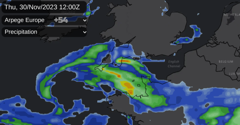
A frontal band in the western Channel will need watching during Wednesday night for Thursday over southwest England, possibly a wider area.
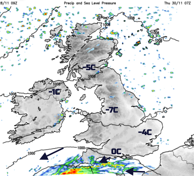
The Surface Pressure charts are quite different today for Thursday into Friday which never instils confidence when there are such significant changes. One Atlantic low almost stumbles across to the Pyrenees with a link back to another low centre. This reaches Portugal on Thursday and central France by Thursday night. Little low pressures are heading southwards in the cold flow, one on Tuesday throwing rain, sleet and hill snow over northern and northeast Scotland.
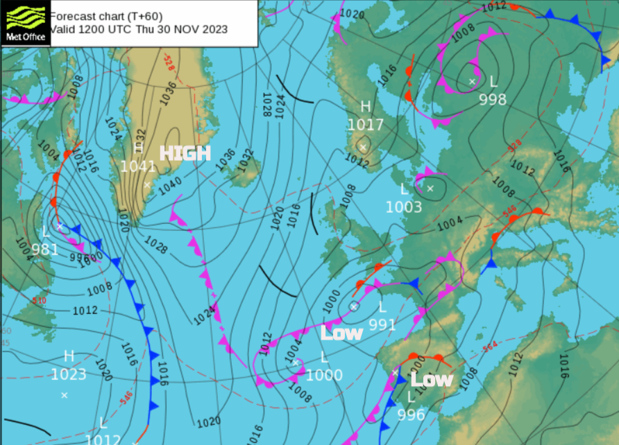 This one almost grinds to a halt over the southern North Sea by Wednesday with trailing weather fronts over England and northern Germany. Germany has yellow weather warnings for ice and snow.
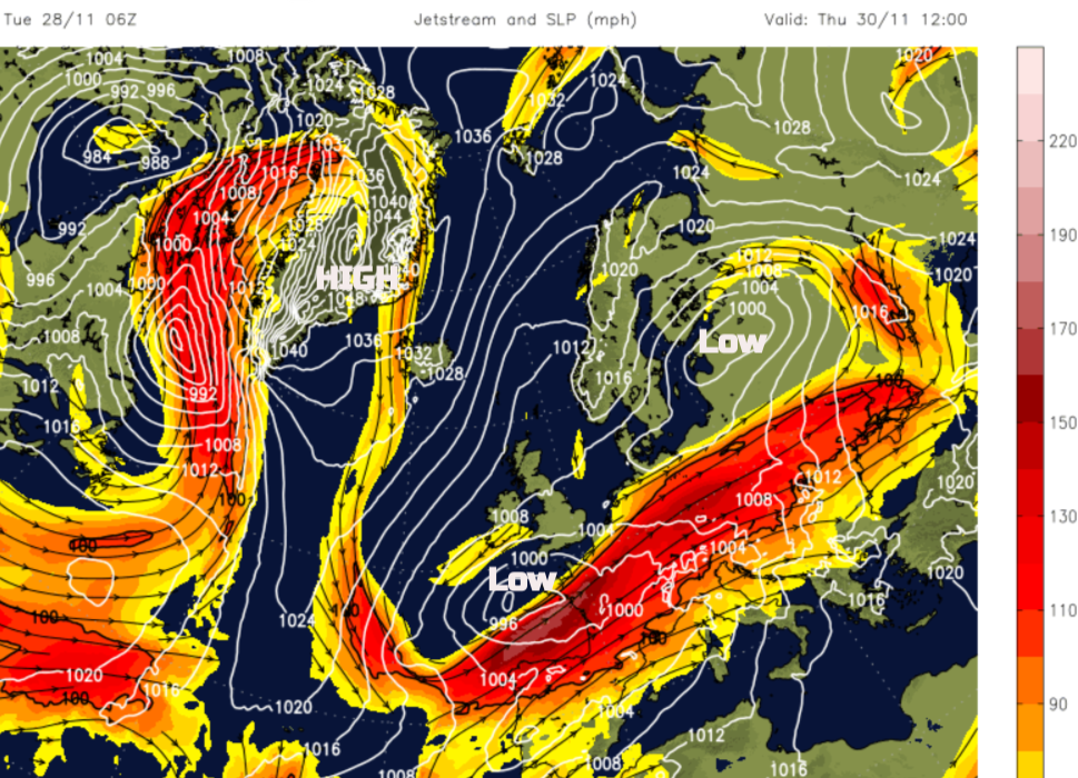 There are great meanders in the jetstream and high pressure over Greenland. This is a large departure from a zonal jet setup where low pressures whizz across the Atlantic and we get the usual wet and windy but mild autumn weather. Another little low pressure is showing, west of Irleanld but moving southwards. It elongates and engages with a jetcore and this will be the bit that southwest England will need to watch but other parts of southern Britain could keep a little glance sideways on. There will be frontal bands over northern France and the English Channel with cold Arctic air to the north. During Wednesday night, there are signs that rain and sleet could edge over Cornwall and Devon with snow over the moors. The UKV keeps the frontal precipitation lurking through the English Channel precariously close to southern England through Thursday.
Tuesday afternoon - the first of many bands bringing heavier outbreaks of rain, sleet and mainly, hill snow.
It will be a day to keep an eye on the radar and not just look at a weather app for symbols. You’ll need to keep in mind the wider picture and that the impacts could switch dramatically if the front shifts 10 miles northwards. The ECM model has the little low twirling about off the Brest peninsula early on Thursday with the frontal precipitation drifting north, potentially over Dorset and the Isle of Wight. The French Arpege model keeps the precipitation over more of southwest England, even brushing the south coast of Wales, for more to Thursday.
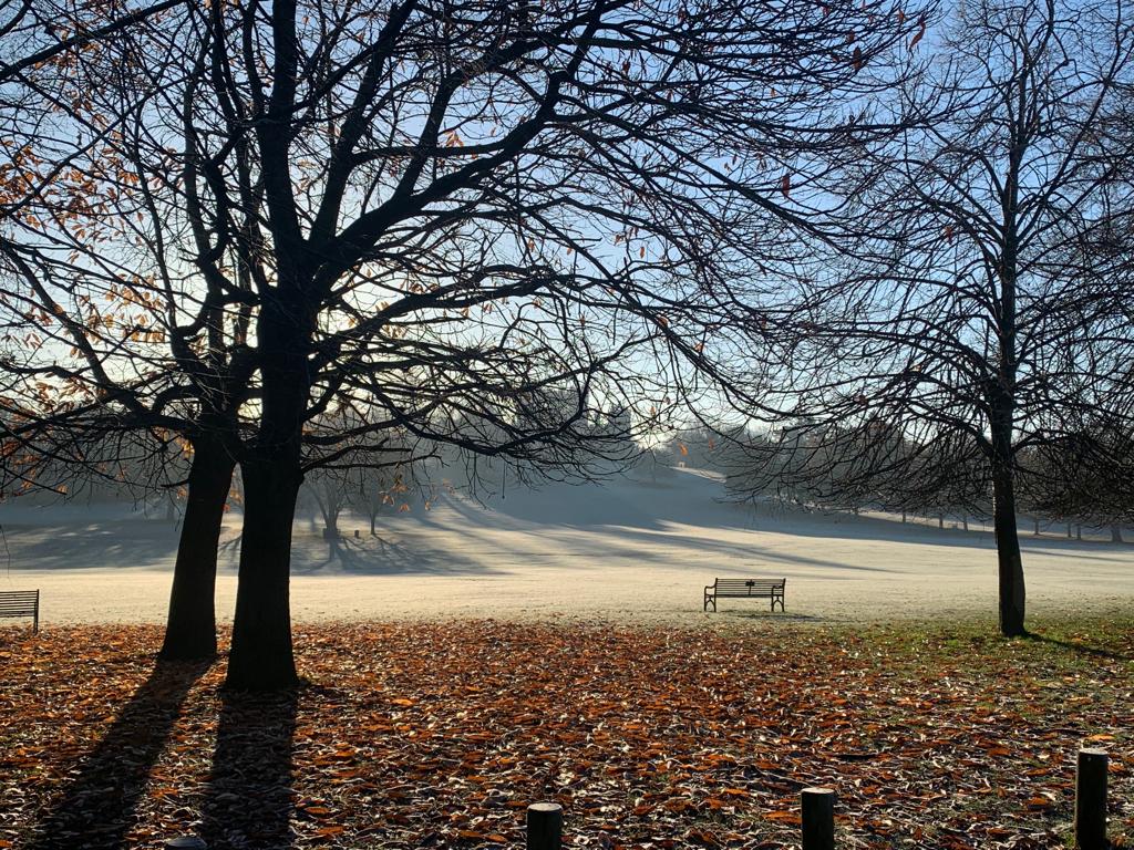
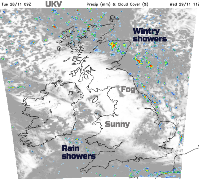
For many the next few days will feel much colder. There will be frost, the risk of ice and lingering fog, even freezing fog. By day there will be bright sunshine but with these wintry showers moving down from the north with more cloud and sudden darkening skies. These will mainly affect the far north and eastern Britain but some will reach down western parts, through the North Channel to Wales.
“Wintry showers will lead to ice forming on untreated surfaces during Tuesday evening and overnight into Wednesday morning. Snow will begin to accumulate, especially away from windward coasts, with 1-3cm possible. Higher routes of northeast Scotland may see up to 5cm of snow accumulate.” MO