A risk of thundery downpours around the English Channel on Tuesday then a mixed few days.
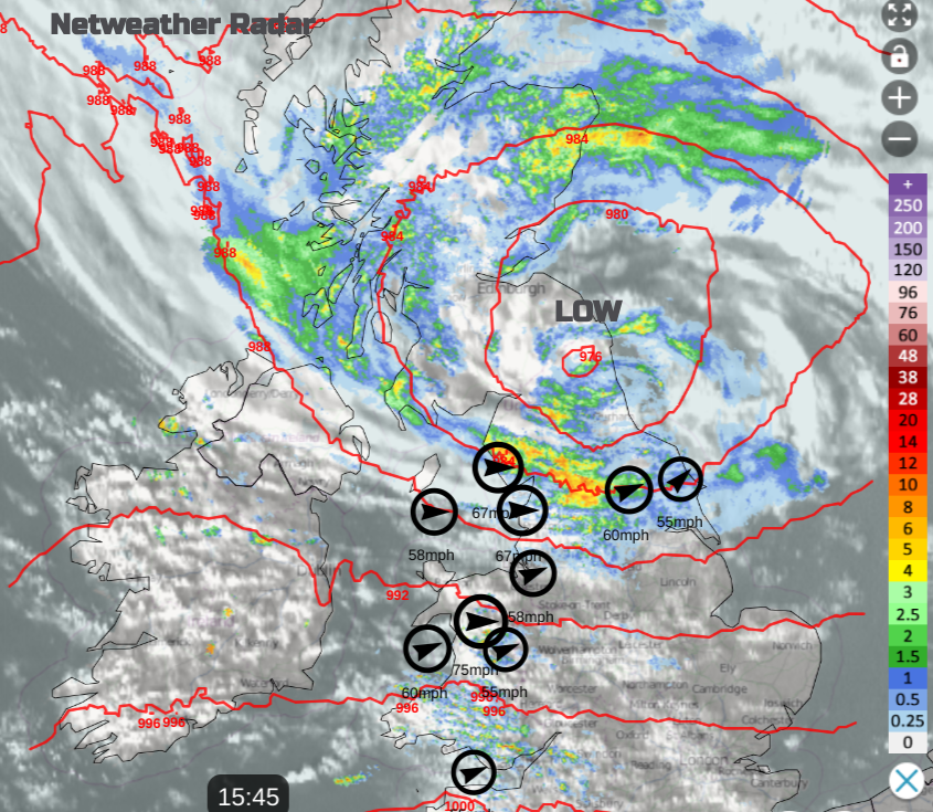
Parts of the UK saw a lively start to the working week as Storm Debi moved by. Met Eireann named the storm with red wind warnings overnight into Monday morning. The low centre moved across the UK with heavy rain for areas that had already saturated ground and the Irish Sea bore the brunt of the wild winds. Blackpool and the Isle of Man recorded gusts around 70mph with severe gale, even storm-force winds onto the coast of Wales and the Isle of Man. Temperatures in the south reached 16C in the short-lived warm sector. By Monday evening, there was still windy weather across a central swathe of Britain with heavy rain to the south of the low centre and an easterly flow once more feeding heavy rain onshore for northeastern Scotland.
Convective forecast 14th Nov "Clusters of heavy showers and thunderstorms look to graze southern coastal counties of England Tuesday morning as they run east across the English Channel and eventually into the far N of France during the afternoon. Hail and intense rainfall leading to localised flooding is possible"
As the wind and rain warnings fade from Storm Debi on Monday there is a thunderstorm warning over southern England for Tuesday from the UK Met Office.
“A band of squally, thundery rain is likely to push quickly east across the warning area through Tuesday morning” Met Office
The earth is saturated here too with high groundwater levels in some counties. Sudden hefty downpours will cause localised surface water flooding.
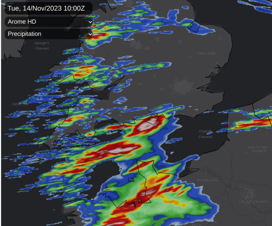
The Arome model showing significant convective activity over northern France and the Channel Islands on Tuesday morning with heavy, potentially thundery showers working their way eastwards along the south coast of England during the day.
This week there will be cooler air, particularly in the northeast for the middle of the week with a touch of frost by night. Nothing particularly cold, and after a milder blip on Thursday, the charts for Saturday are showing signs of much milder air surging our way. This could be accompanied by more wind and rain though.
 Tuesday looks unsettled with heavy showers from the west, sunny or bright spells and the thunderstorm risk in the south. Scotland will be in a light easterly flow and feel cool. Ireland, Wales and much of England will have a light southwesterly then westerly breeze.
Old occluded frontal bands linger over Scotland on Tuesday and for the middle of the week but should pull away from Northern Ireland by Wednesday, leaving sunshine. The showers will also fade over northern England on Wednesday but lines could focus on SW Scotland into Cumbria and up to Mull, edging to Glasgow in the afternoon. Away from this line of western showery rain, there will be a lot of fine weather for Wednesday. The westerly wind will freshen through the Irish Sea and become more noticeable for the Midlands and East Anglia through the day.
 Beyond midweek the confidence falls away. There are signs of another low pressure bringing bands of heavy rain and blustery winds which add again to the sodden ground. There is a signal for a low pressure to pull up from the southwest on Thursday reaching Wales and England on the UKV. A different low pressure away to the northwest could also fling its occlusion into western Scotland with more rain here. The ECM model keeps more rain over Northern Ireland and Scotland into northern England later, with rain further south into western France.
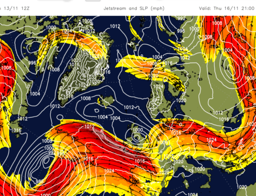 Zonal jetstream through midweek but beginning to buckle at the end of the week, anchoring the weekend low.
Friday could be more settled, drier and brighter. A brief lull before another low pressure with rain and brisk winds moves in. That larger scale low on Saturday seems to have a stronger presence.