While we saw some welcome sunshine into the weekend and in the North and North East yesterday, Sunday also saw patchy rain moving in from the South West. But hot on its heels, we now have a far more potent feature in Storm Debi. This has already brought bouts of heavy rain to all except the northern half of Scotland, where it'll soon turn showery. With the ground already saturated, further flood warnings seem likely, adding to the 9 warnings and 79 current alerts.
Debi will undoubtedly pack a punch today before clearing into the North Sea this evening, prompting several warnings. We have amber Met Office warnings of damaging winds across Armagh and Down and later this morning for North West England, where gusts of 70 to 80mph are likely for a time. There's also a yellow warning of more rain to come for East Scotland, along with a more general yellow warning of strong winds and rain for northern England, the North and West of Wales, and parts of the North and West Midlands.
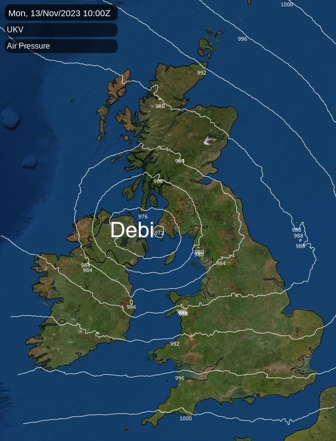
Blustery showers are already replacing the rain across Wales and central and southern parts. Some will be heavy and squally giving local thunder especially in the West, but with sunny spells between. But the showers continue to be quite frequent and lengthy across northern England and southern Scotland closer to Debi's track. Despite a strong West or South West wind across central and southern parts giving gusts up to 50mph, it'll become very mild here. Temperatures could get as high as 14 or 15C in places, but it'll be colder in the North, where 8 to 10C is more likely.
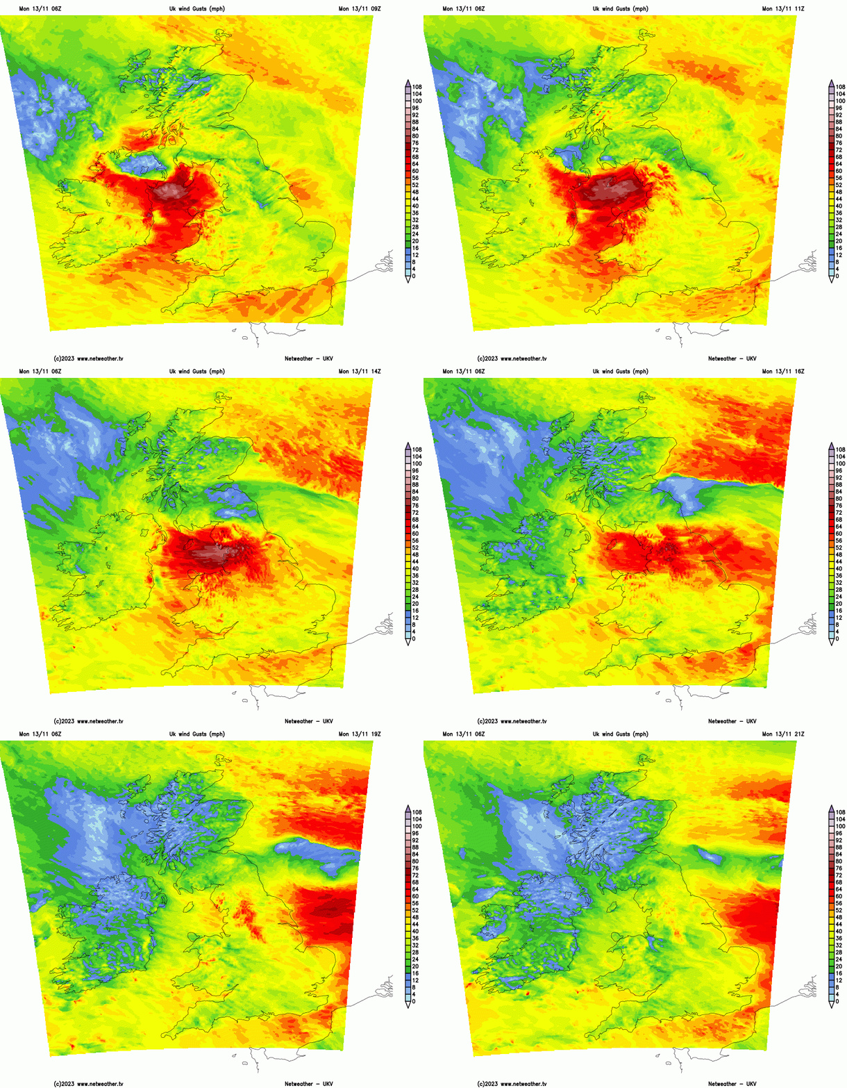
As the storm moves away into the North Sea after dark, winds in most parts will moderate. But a southwest wind in the South may continue to give gale-force gusts towards English Channel coasts. There'll be clear intervals mostly in sheltered eastern areas, but further showers, heavy and blustery in places with the risk of thunder chiefly towards South and West facing coasts. Across the North and East of Scotland a chilly wind off the North Sea will also bring showers, where it could be misty at times Temperatures here will be about 5 or 6C, but elsewhere the thermometer overnight shouldn't fall below a mild 7 to 11C.
There'll be some sunshine tomorrow, but it'll remain unsettled with further showers. These'll be heaviest and most frequent over Northern Ireland and in the West later, where the showers could merge into a more prolonged spell of rain. The far South may also see rain, with eastern areas seeing fewer showers and the best of the sunny intervals. Across North East Scotland an East wind may keep it rather cold, grey and murky. Temperatures here stay close to 7 or 8C, but expect a milder 10 to 13C in most other parts in a South or South Westerly wind that'll be pretty fresh in places.
After dark Scotland, Northern Ireland and much of northern England probably remain rather cloudy and showery, with a cold East or North Easterly wind continuing to plague the far North. Further South across Wales and the remainder of England, it'll be breezier with showers, probably mainly in the West—lowest temperatures about 4 or 5C in the far North, but 7 to 10C more generally.
And it'll remain unsettled for most of the week, although there's a hint with some model disagreement of an improvement in the East and South towards next weekend. But it'll mostly remain on the mild side, except in the far North.
Loading recent activity...