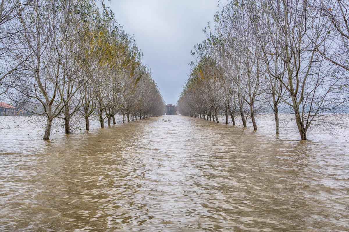
Long after Storm Babet's exit, persistent rain continues to threaten the UK, especially eastern Scotland, heightening flood concerns. While southern England and south-west Wales also face heavy downpours, regions like the Midlands may experience more in the way of drier spells.
Storm Babet has come and gone, but the weather is set to remain very wet for many for the foreseeable future, maintaining problems with flooding. Low pressure systems will keep tracking further south than normal, which traditionally results in the most unusually wet weather being reserved for southern Britain, but this time around, due to the persistent easterly and south-easterly winds on their northern flank combined with slow-moving fronts, eastern Scotland will keep getting the most rain, exacerbating the situation in what is already the most affected region of the UK. Parts of the south coast of England also have the potential to be especially wet, as well as south-west Wales.
Most of the rest of England and Wales look less likely to be unusually wet during this week, although it will still generally be wetter than average. Thus, the areas of the Midlands, East Anglia and northern England that have been seeing flooding recently may see enough drier weather to allow these regions to get and stay on top of the situation.
Most areas have started off overcast, but we have some sunshine in parts of southern England, south-west Scotland and Northern Ireland. During the rest of today, a band of rain, heavy in places with potential for some thunder in the south, will spread northwards through England and Wales, reaching the Midlands by evening, though not reaching the north of England until well into the evening. To the south of this, brighter weather will follow with some sharp showers, which could again be thundery near the south coast of England. Some sharp showers will continue to affect Northern Ireland, though with some sunshine for the west and south of Northern Ireland. For Scotland, it will be another wet day in the north and north-east, but a window of brighter weather will spread northwards through the south, and the Central Lowlands before cloudier weather with some light rain follows into the south.
Temperatures will reach around 10 to 12C in Scotland and Northern Ireland and the far north of England, but it will be warmer to the south of the rain band moving north through England and Wales, with highs of 15 or 16C in East Anglia and south-east England.
Tonight, the rain band over northern England will slowly clear away northwards, with clearer weather developing over England and Wales with some showers near west and south-facing coasts, but it will become wet in most of Scotland and Northern Ireland, particularly in southern and eastern Scotland. It will be quite a mild night everywhere, with minimum temperatures between 7 and 10C.
Sunday will be another wet day in most parts of Scotland, particularly eastern Scotland, which may exacerbate problems with flooding. Elsewhere, it will be bright and showery, and much of northern England and the Midlands will miss the showers altogether and be dry and predominantly sunny, though low cloud may form overnight and be slow to clear in some places. Temperatures will reach between 12 and 14C in most parts of England, but in Scotland, with the cloud and rain, temperatures will widely reach just 8 to 10C.
On Monday, the rain band across Scotland will persist but the rain associated with it will turn lighter and will become mainly confined to north-east Scotland. The far north of Scotland will become dry, sunny and rather cold with Arctic air moving in. Otherwise, it will be a day of sunshine and scattered showers, with the showers heaviest and most frequent in Wales and in the south of England.
After a quieter day on Tuesday, providing relief for areas affected by flooding, rain will spread into south-western Britain late on Tuesday, and the second half of the week will see frequent rain bands pushing northwards through the country, interspersed with brighter showery weather, with potential for some thunder near the south coast of England. The rain bands will be associated with a battle between cold air pushing down from the north-east and warmer air pushing up from the south, so temperatures will tend to be a bit below the seasonal average in Scotland, but often above average in southern Britain, especially by night.
The unsettled, wet theme looks set to continue for the foreseeable future. Some forecast models are suggesting that the weather may start to turn drier and colder beyond next weekend, but this is a long way off and subject to change.