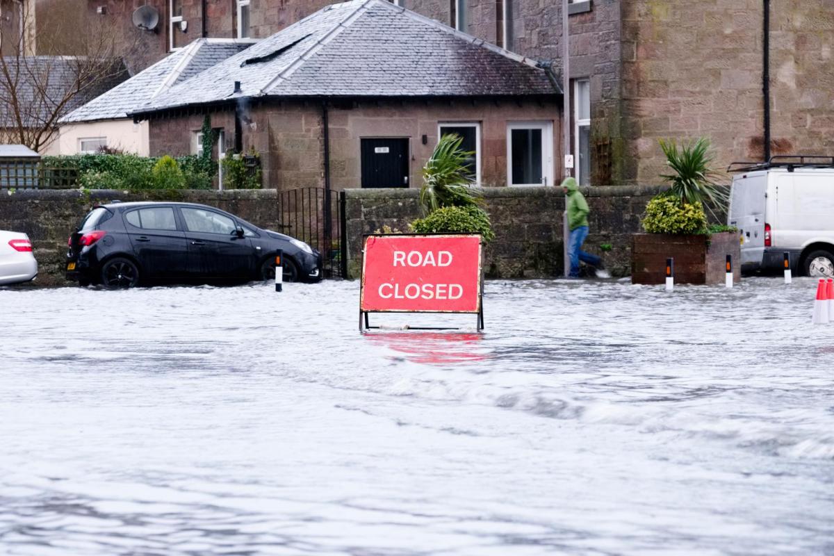
After storm Babet's deluge, the UK was still grappling with 116 flood warnings at dawn this morning. Despite a quieter start to the week, low pressure will persist, heralding more rain and wind during the coming days.
We still had 116 flood warnings and 123 flood alerts at dawn across the Midlands and North after the deluge caused by storm Babet, when more than 100mm of rain fell in three days across parts of East Scotland and the North East. A severe gale and huge waves along the East Coast also resulted in the South Sheilds Lighthouse losing its dome, preventing shipping in the area for over 48 hours.
Record river levels are expected to fall slowly before mopping-up operations can begin. We also had the additional hazard at first this morning of a yellow warning of ice across Scotland and parts of northern England where temperatures fell close to or below freezing overnight.
But after the cold, icy start, much of Scotland and the North of England will have a fine day. There'll be some sunshine, although patchy fog may take a while to clear from the Vale of York, Trent Valley, Midlands and the Welsh marshes. The sun will also be made milky at times by high cloud that'll thicken across the South East, where some rain is likely later. The far South West already has some rain, with the Isles of Scilly recording over an inch during the night, spreading to Northern Ireland later.
Light winds at first will freshen from the East or South East, making it feel a little chilly in the North. But temperatures will rise steadily, to about 10 to 12C across Scotland and Northern Ireland and 14 to 16C across England and Wales, but it'll be colder where murk and fog are slow to clear.
Eastern Scotland and North East England see a few showers after dark, but further West, it should stay dry. Across Northern Ireland and the South West, there'll be further rain at times, with showery rain across the South East moving North into East Anglia and much of the Midlands.
For most, it'll be a milder night, so no frost, with lowest temperatures mostly between 6 and 11C. An Easterly wind will veer South Westerly in the South later in the night.
Tuesday is much more unsettled, bringing rain to those areas that certainly don't need it. Scotland sees showers, particularly in the East, with complex low pressure elsewhere giving occasional rain or showers, some locally heavy. A few brighter intervals are expected, but these'll be at a premium. An Easterly wind across Scotland will be fresh in the North, with lighter breezes across much of England and Wales. Top temperatures 10 to 12C in the North and 13 to 16C, perhaps locally 17C further South.
With much of the country under the influence of complex low pressure, it remains unsettled after dark. There'll be further showers or outbreaks of rain but a few drier intervals also, although these shouldn't be relied upon. Scotland may see winds decreasing slightly, with temperatures generally not falling below 7 to 12C.
Little change is expected into the remainder of the week, with more potent Atlantic systems moving in from the southwest later on Wednesday and Thursday to bring more spells of rain. It'll also become windy at times, with the mildest conditions in the South.