Kent reached 26.1C on Monday 9th on another unusually warm October day. Coventry reached 25.1 and Cardiff 23.9C and the warm air has spread right up through Britain and Ireland although there is some wet and windy weather tempering the feel of the day.
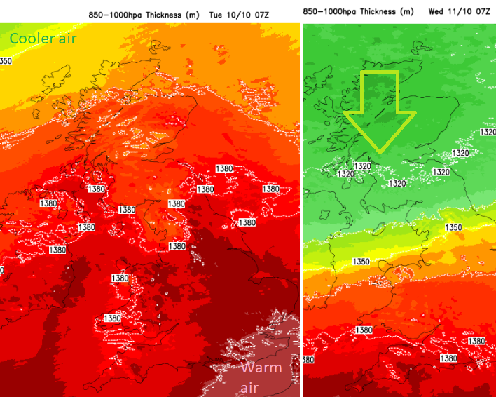
There is a colder trend this week. Cooler air will push southwards across all of the UK, bar the southern counties of England, by Thursday morning. There are signs of a brief surge of warm air reaching up over southern Britain on Friday morning before colder air brings a more seasonal feel to this weekend. This will include frost and wintry showers in the forecast for Scotland. It will feel colder in the north and daytime temperatures will be 9 to 15C, not the 25C of last weekend.
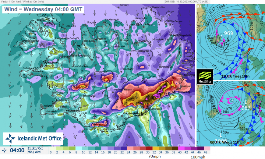
Low pressures battering Iceland will be instrumental in directing the cooler then colder air our way. Although there is high pressure over a good part of mainland Europe the autumnal low pressures away to the north of Scotland will bring more windy weather. They are also throwing weather fronts our way.
This is not what is needed at the moment in the flood-hit regions of Scotland after the weekend's heavy rain. River levels are still high, with water feeding down off the mountains and the clear up continues. Today’s yellow rain warning reflects the ongoing issues.
SEPA “There is extensive flooding due to the River Tay, particularly in Perth, and the River Spey in Aviemore … the situation in these areas easing during Tuesday. On Tuesday, there is the possibility of flooding from heavy rainfall in western areas.”
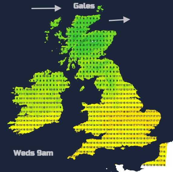
Ahead of the main cold front, there will be fresh to strong, gusty winds from the southwest affecting mainland Scotland and the Irish Sea by lunchtime and Northern Ireland and Cumbria by late afternoon. The wind veers to a westerly in the cold air behind the front with gales, even severe gales for the Northern Isles as one Icelandic low gets closer. There is a complex array of fronts strung across the UK west to east today but they will gradually push southwards by tonight.
On Tuesday we will see one frontal band bring rain from SW Scotland and Co. Down, into Cumbria, the Pennines and down to the Yorkshire Dales this afternoon.
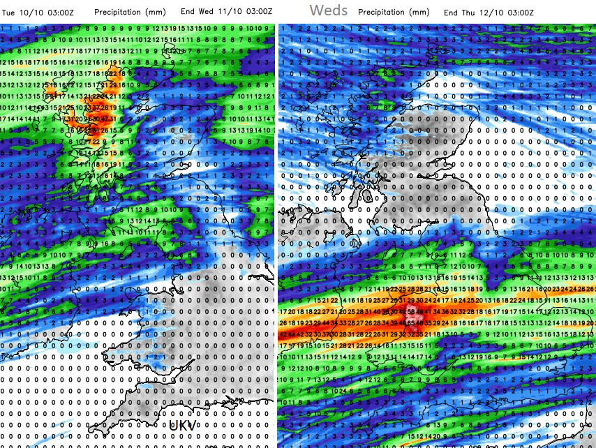
The main cold front takes its time today, which is why there are concerns and a yellow warning for rain from the Met Office and the UKV model is showing line convection along the front this evening. This moves from southern Scotland and Northern Ireland into northern England as a heavier pulse along the frontal boundary surges in from the west. This has been showing in recent days but the location has varied. For Wednesday morning, the heavy rain looks to be over north Wales, Liverpool and Manchester extending across England to the Humber. Scotland and Northern Ireland brighten up on a cooler but drier day. England and Wales have more frontal cloud and this lingering front which turns a bit straggly on Wednesday afternoon yet looks to reinvigorate on Wednesday night.
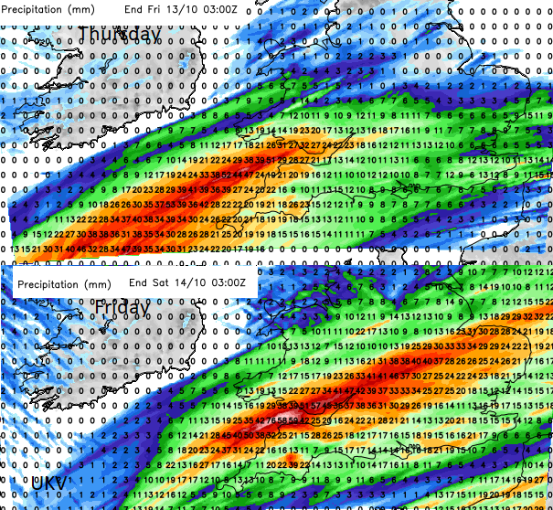
By Friday, an Atlantic low looks to push up from the southwest with more heavy rain as a second Icelandic low passes to the north of Scotland with more strong winds and showery rain for the Highlands and the colder air flows.
Loading recent activity...