


Warmer air will spread up from western Europe as a cool flow comes down the North Sea. In between will be frontal rain and there are weather warnings for parts of Scotland.
Low pressures and weather fronts have continued to wriggle about over the UK with the focus of the rain over Ireland, western Scotland, Cumbria and Gwynedd for Wednesday into Thursday. The earlier concerns about impactful rain and flooding over western Scotland have faded, for now, with a drier lull during Friday.

However, the weekend weather is dominated by two headlines. One, the potential warmth coming up from the south and the other, persistent rain with a risk of flooding for western and central Scotland. Depending on where you will be, one of these will be of little impact. There is a yellow Rain warning later in the week, for Friday night, Saturday and Saturday night. A warm front will bring more heavy and persistent rain to parts of Scotland which have already had a wet week.
“Heavy and persistent rain this weekend may cause flooding and disruption across parts of Scotland”

This frontal band is also the dividing line of colder air from the Arctic moving down through Scandinavia and the North Sea and the unusually warm air set to reach towards the UK at the weekend. Temperatures could reach the mid-20s Celsius but it will remain cool further north and northeast depending on how long the rain and wind takes to pull away.
The UK has had its joint- warmest September on record. Many European countries have seen their warmest September months on record and the WMO’s latest press release states
“September smashes monthly temperature record”
“This continues an extended streak of extraordinary land and sea-surface temperatures and is an ominous signal about the speed with which greenhouse gases are changing our climate. The year 2023 is now on track to be the warmest year on record. Numerous high temperature records have been broken in recent months.”
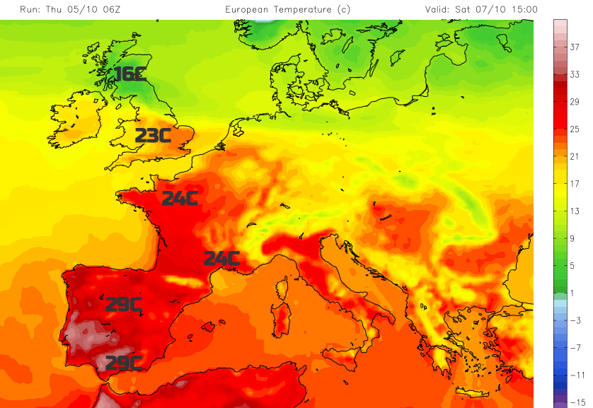
There has been near record-breaking heat for October in the Canary Islands by day and night midweek and that very warm air looks to be directed northwards to the UK this weekend. However, there will be this opposing push and this clash means that some parts of the UK will be wet, windy and not warm at all. The potential exists for southern Britain to see temperatures leap up, where the sunshine breaks through but uncertainty exists.
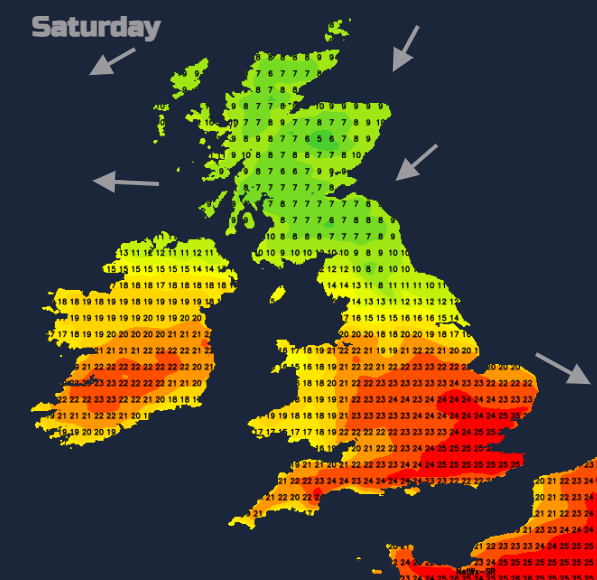
On Saturday there will be a cool north to east wind over Scotland accompanying the steady rain. South of the frontal rain will be a gentle westerly breeze
The very warm air should be over Ireland and the southern half of Britain by Saturday evening and lingers overnight south of a line from The Wash to the North Channel. Shetland will be in much cooler air with single figures by day at the weekend and overnight mins down to 4C

The UKV model has the rain up over the Northern Isles by Sunday lunchtime, so a quicker clearance and a warmer day for more of the UK. There is still a good deal of cloud over northern and eastern parts of Britain. The cool easterly breeze off the North Sea should shift on Sunday morning and veer to a warmer southerly. Monday looks like a fine, warm day but it's not the weekend is it.


.jpg?w=350)


.jpg?w=175)