It's been a record-breaking heatwave, with more to come this weekend with temperatures peaking into the low-mid thirties. But, the breakdown will be getting underway, as showers and thunderstorms begin to break out.
It has been an exceptionally hot, dry and sunny start to September for a large majority of the UK. Provisionally, in Central England (in a series going back to 1659), the mean maximum temperature for the first week of September was running at 8.3C above the 1961-1990 average during the first 7 days of the month.
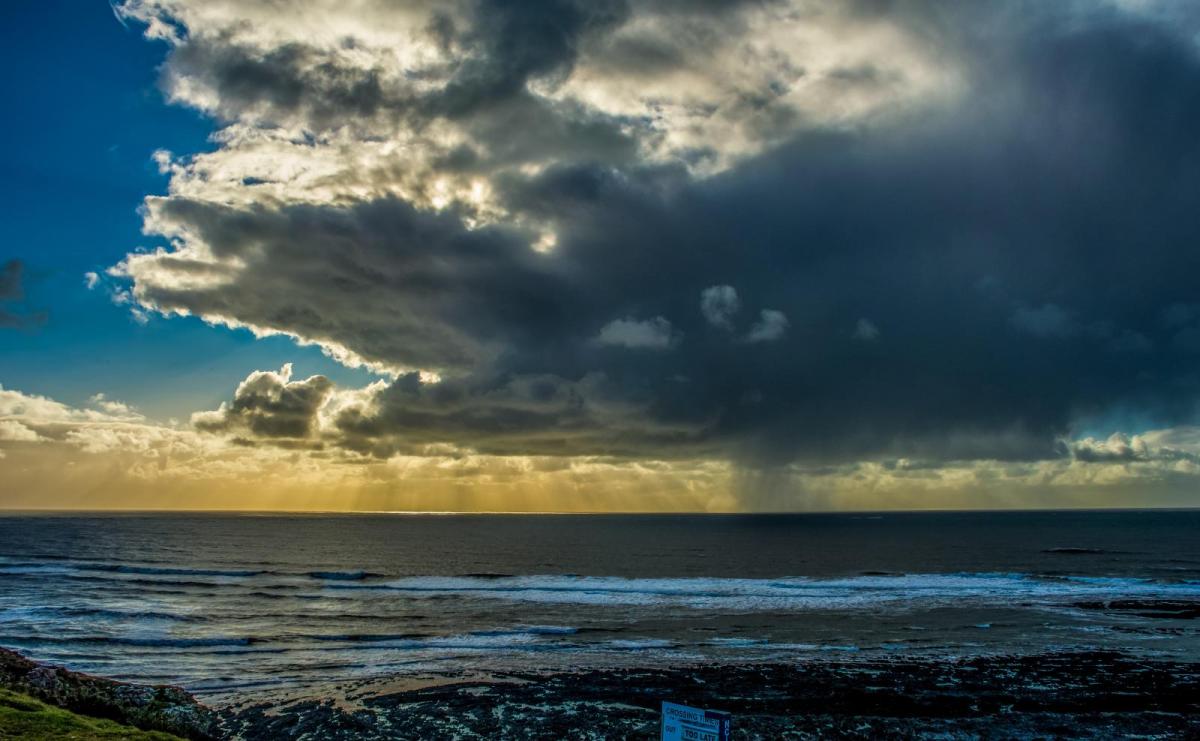
In many areas of the country, the heatwave will peak this weekend, with temperatures widely into the low to mid-30s Celsius in central and eastern parts of England, but it will slowly clear from the north-west during the next three days. On Sunday, the hottest weather will be more exclusively confined to eastern England, and on Monday, it will be mainly confined to the south-east. By Tuesday, temperatures will be much closer to the seasonal average for all of us. In the transition, we can expect a scattering of heavy showers and thunderstorms to break out, starting today and probably peaking on Sunday, although not everywhere will catch them.
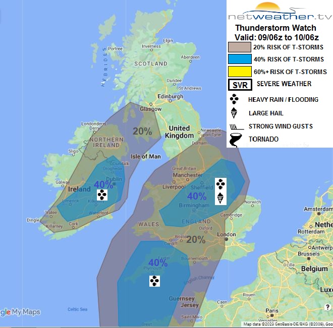
A storm forecast has been issued for Saturday.
Warm nights will be an issue during the weekend, making sleep difficult for many of us, especially in south-east England where minimum temperatures will widely be around 20C.
Today has started off cloudy in large areas of Cumbria and the western half of Scotland, but elsewhere we have plenty of sunshine, and temperatures are already rising into the mid to high 20s Celsius in many areas. The cloudier weather will spread southwards through Northern Ireland during the rest of today, and it will tend to cloud over in the West Country, but it is expected to clear away from Cumbria, and in Scotland, it looks set to brighten up except near the west coast. Otherwise, it will generally be a hot, dry and sunny day. Some well-scattered sharp showers and thunderstorms will break out, particularly in the Midlands and in eastern England from Lincolnshire northwards, but many places will miss them altogether.
Temperatures will remain exceptionally high for early September, and there is a possibility of today being the hottest day of the year in some areas of the UK. Western Scotland and Northern Ireland will be relatively cool with highs in the low 20s Celsius, but for much of central and eastern England, it will be a hot one with highs of between 28 and 32C, and perhaps 33C locally. Eastern coastal areas will be somewhat hotter than on recent days, as we will have a south-westerly breeze today, which will fend off the usual sea breezes. However, south and west-facing coasts in Wales and south-west England will be cooler, and we have been seeing some fog coming onto the coasts of south Wales.
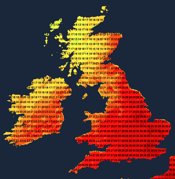
Sunday will generally be cloudier, but with the exception of north-west Scotland, where it will be overcast with persistent rain, there will still be some sunny spells. Overnight on Saturday into Sunday will be warm and humid again, making for difficult conditions for sleeping for many of us, with much of East Anglia and south-east England falling no lower than 20C It will be another hot day in eastern England with temperatures reaching around 33C in the hottest region, most likely around Cambridgeshire and the west of East Anglia, again giving some areas their hottest day of the year. The hottest weather will be more confined to eastern England, with other regions generally seeing highs in the low to mid-20s Celsius.
Heavy showers and thunderstorms will develop more widely on Sunday, especially affecting south-western Britain early in the day, and then transferring north-eastwards to especially affect northern England and south-east Scotland during the afternoon and evening. However, most parts of East Anglia and south-east England will miss them altogether.
Sunday night into Monday will be another warm one in eastern England, but not quite as warm as the previous two nights, with the warmest region, eastern England, generally falling to around 17 or 18C. A weakening frontal system, responsible for the cloud and rain in north-west Scotland on Sunday, will slowly move southwards through Scotland, Northern Ireland and northern England on Monday, introducing much cooler, fresher weather. Some showers and thunderstorms are likely to break out on its southern flank, especially in the East Midlands. Temperatures will still be high in East Anglia and the south-east, but not quite as high as recently, with highs of 27 or 28C in the hottest spots.
By Tuesday, the cooler weather will have spread to all regions - indeed, it will be rather cold for the time of year in northern England, with some persistent rain and a chilly north-east wind. Much brighter weather will spread into Scotland and Northern Ireland through Monday and Tuesday.