True to form, meteorological summer is finishing with unsettled weather, for some, at least. High pressure will build in for the weekend, though.
After wreaking havoc across the northern half of Florida and Georgia yesterday, Hurricane Idalia has now been downgraded to a tropical storm but continues to bring catastrophic flooding and coastal storm surges to the Carolinas before moving on into the Atlantic later today. Across our shores, it's much more benign, if though unsettled for some, as a small depression to the North West of Ireland makes its way slowly across central parts tomorrow before filling and moving into the North Sea.
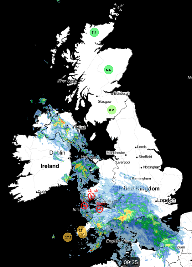
This morning, a front has already brought rain to parts of Northern Ireland, South Wales, the West Country and the South West, where some is heavy. This'll spread to the South and West Midlands and much of central southern England through the day after a bright start in the East with some sunshine.
Much of the rain will be light and patchy before further sharp bursts of rain, perhaps with thunder moving into the South West later. Light winds bringing milder air from the South West become South East or southerly, with temperatures rising slowly to reach 17 to 20C eventually.
Lancashire, Cheshire, Merseyside, Manchester, the North and East Midlands, and perhaps Norfolk may also see cloud and patchy light rain later. Still, it'll remain fine for Cumbria, Scotland and the remainder of northern England. There'll be some sunshine, and apart from just a few showers in the West, it'll be mainly dry, with mostly light breezes from the East or South East. Top temperatures here 14 or 15C in the far North, but closer to 18 or 19C further South, where you see the best of the sunshine.
The front, now a weak feature, brings patchy light rain or drizzle mostly to central parts after dark. Further, South skies may break, allowing mist and patchy fog to form in light winds. There'll be some dry weather, but southern England will see scattered sharp showers, perhaps with thunder. The far North of England and Scotland remain fine in light Easterly breezes. It'll also turn misty in places later, with sea fret perhaps 'hugging' some North Sea coasts, making it grey here by dawn. The South stays mild with temperatures no lower than 13 to 15C, but in the North, 7 to 9C is more likely, with a few Scottish glens falling as low as 3 or 4C, giving a touch of grass frost.
Much of England and Wales may start grey and murky tomorrow, with patchy light rain or drizzle. There'll also be a few sharp showers across the South East and maybe parts of East Anglia, but these will move away. During the day, some places will brighten to give a few sunny intervals, but it'll remain rather cloudy for most. Further North over Scotland and probably Northern Ireland, you'll continue to see some sunshine, particularly in the West. Still, a North East or East breeze will keep eastern parts cooler with patchy cloud—top temperatures from North to South, 15 to 21C.
After dark, central and southern parts may see further patchy drizzle, but skies should slowly break from the North. Elsewhere, it'll be dry with clear spells and light winds, allowing mist and patchy fog to form again in rural areas. Parts of the North could also turn quite chilly again, with lowest temperatures mostly between 6 and 12C.
The weekend sees pressure rising, with a large anticyclone established nationwide by Sunday. This'll bring a welcome return of summery weather to most parts, even though it'll officially be the beginning of meteorological autumn.