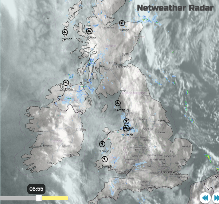
A fair Bank Holiday here in the UK with bright or sunny spells. There will be a scattering of light showers from the west and temperatures just into the low 20s C. Don't go wishing you were elsewhere in Europe.
For those with a day off for the late August Bank Holiday, the weather is looking okay. There will be further bright or sunny spells, but speckled with light showers from the northwest. The air is from a fresh direction, off the north Atlantic so there isn’t any great heat or humidity today. The sunshine is still strong enough at this time of year that if you find a sunny spot, it should be a pleasant day.
Leeds will see a fair, dry morning for those packing away their tents and heading home from the Festival. It should be a fine day for the south coast of England. Brighton will be dry with some sunshine and temperatures around 20C this afternoon. More Butetown Carnival festivities today in Cardiff with a fair day. It will be bright with temperatures of 21C. It's not a Bank Holiday in Scotland today but as the Edinburgh Festival comes to a close the skies should brighten up today with 18C the top temperature.

Note low over southern France, northern Italy
The temperatures across the UK will span from the high teens to the low 20s Celsius. The winds are mostly light, from the northwest across Wales and England but more of a westerly for Northern Ireland and Scotland. There are areas of thicker cloud draped across the UK and there is some patchy rain from these. To start the day over these are over Northern Ireland, Wales, NW & SW England and around the west and north coasts of Scotland. These areas will be the focus of a more mixed day with brighter spells then more cloud and a bit of rain passing by. Some of these showers will work their way right across Britain but overall, there is a lot of fair weather around. It’s just not glorious reliable sunshine.
Later in the day, new Atlantic fronts will arrive and one will bring heavier rain to the Western Isles and then the NW Highlands this evening. With clear skies ahead of this, it could feel cool for inland parts of Scotland but 13 to 15C for southern Britain overnight.

Tuesday will again be a mixed day but with a bit more oomph in the showers. Southeast England will see the best of the sunshine with temperatures again into the low 20s C. Along a more defuse zone linked to the fading cold front, there will be a scattering of sharp showers and a rash reaching northern and western Scotland by the afternoon.

And if you are thinking you should have travelled elsewhere for a holiday, be glad you didn't choose the western or central Mediterranean. Mallorca (Majorca) was hit by an incredible storm. There was lashing rain which affected Menorca and then Sardinia at the weekend. Violent winds with a cruise ship losing its moorings and reportedly shifting, then colliding with an oil tanker. There was also flooding due to the torrential rain reported in Mallorca as holidaymakers hid inside looking out in awe. Not the forecast you would have wanted to see if you were heading out to Spain for this weekend.
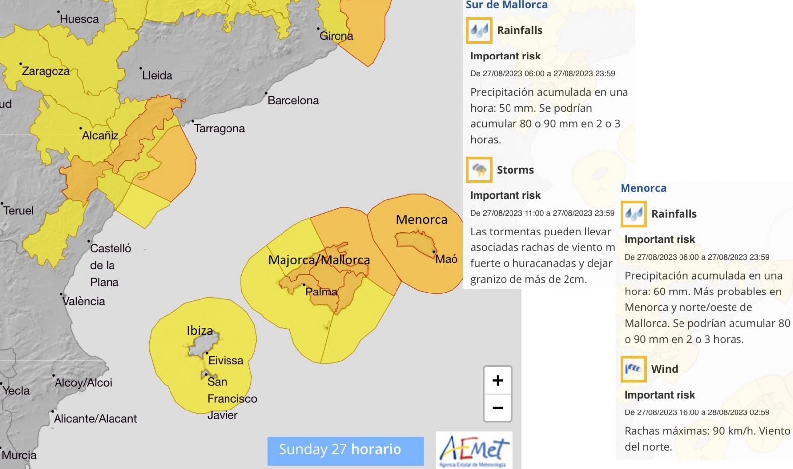
This wild weather progressed eastwards through the Mediterranean as very strong Mistral winds developed for southern France and Italy. The low pressure on the synoptic charts has been named by the Italian Met Service, Storm Rea. Central Europe is littered with severe weather warnings, including red and amber warnings for Wind and Rain.
Western Cuba is readying itself for TS Idalia with a hurricane warning in place and there is heavy rain for the Yucatan peninsula of Mexico. Florida is watching the progress of Idalia as this could strengthen into a significant hurricane.
"Idalia is forecast to become a hurricane by the time it reaches the southeastern Gulf of Mexico, and it could be near or at major hurricane strength when it reaches the Gulf coast of Florida. The risk continues to increase for a life-threatening storm surge and hurricane-force winds along portions of the west coast of Florida and the Florida Panhandle beginning as early as Tuesday." NHC