No heat headlines for this weekend and plenty of showers about on Saturday. Gradually, the long weekend will settle with drier weather and brightness by Monday.
The late August weekend doesn't look hot or humid, nor a complete washout. There will be hefty showers coming and going on Saturday, a band of rain from the west on Sunday but then settling down and not looking too bad. The current very warm and humid air will clear as will today's threat of thunderstorms.
Thursday started with the threat of thunderstorms for SE Britain. Suffolk had a cluster to begin the day as Normandy saw explosive thunderstorm development which brushed by Kent before 9am.
Wisley in Surrey reached 27.9C on Wednesday as France continued with extreme August heat. Many local records fell in the ‘Canicule’ and the heatwave produced the hottest August day on record for France, with two stations beating the previous record (Provisionally) 44.4C at Salindres and 44.2C at Siran. Toulouse-Blagnac airport stayed at 27.4°C overnight, which is way over our 20C threshold of a ‘Tropical Night’.
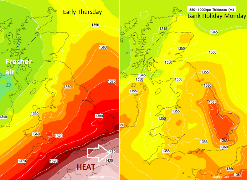
The thunderstorm threat is along the boundary of this hot and humid air, which has been impacting France and Spain this week, and cooler, fresher Atlantic air flowing down from the northwest which will be with us through the weekend.
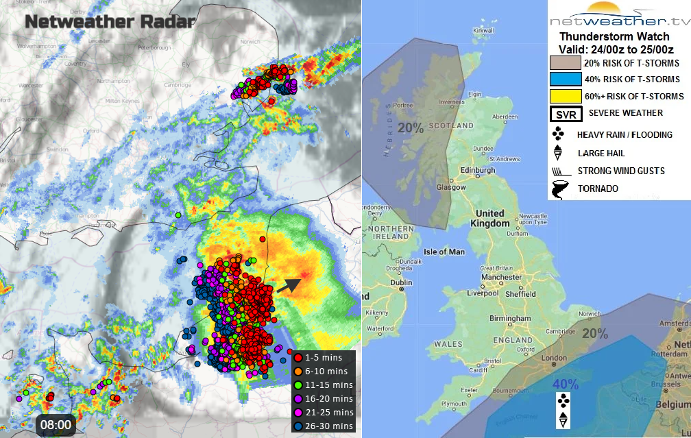
"increased ascent and destabilisation of the warm humid airmass, with a new cold front developing ahead of the weak front moving SE - supporting the development of heavy showers and thunderstorms across southern counties of England during the morning, before clearing by early afternoon." Convective forecast
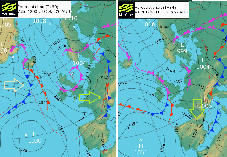
Low pressure over the Western Isles has been throwing some sharp showers into the west coast of Scotland and heavier frontal rain across the northeast and Orkney. This low pressure will hang around through Friday and affect our UK weather on Saturday as it finally edges away over the North Sea.
Around this low pressure there will be a flow of cooler air from the north/NW and plenty of showers. These will reach over the UK later on Friday with heavier downpours mixed in. Many places will miss the showers but there will be some lively ones and more over northern Scotland.
The warmth and more humid air that has been over SE Britain will have cleared by Friday evening. Although it will still be 17 or 18C as most people finish work, it will cool off after dark.
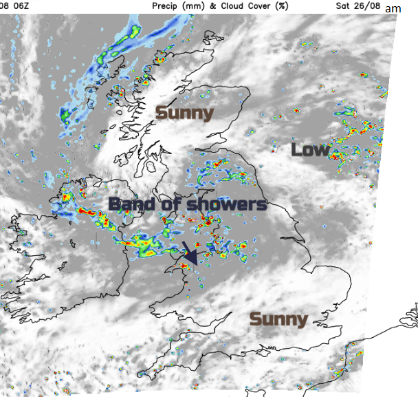
Saturday will see showers. There will be a northerly flow down the west coast of Britain and for Northern Ireland, pushing showers along. Others will reach further inland mixed with bright or sunny spells and lighter winds. Some of the showers will be heavy, even thundery on Saturday.
In the strong sunshine, it will feel warm but into the evening it will feel fresher. Temperatures by day will be in the mid to high teens and tipping into the low 20sC.
A new Atlantic system will be approaching for Sunday so during Saturday night there will be a lull. As pressure rises slightly ahead of the new fronts, the shower activity will diminish and the west/NW winds should fall light. It will be cool overnight.
Fading rain from the west on Sunday. The frontal band of rain currently looks to arrive over Northern Ireland on Sunday morning, This will throw more cloud ahead of it and the breeze will pick up. Ahead of the main rainband, there might be some early brightness but the day will be quite mixed with more cloud and outbreaks of patchy rain. In any birth or sunny spells for central or eastern Britain temperatures will reach 19 to 22C.

The frontal band fizzles as high pressure towards the Azores just tries to settle the UK weather down. Monday will start off still quite mixed with variable amounts of cloud and a few bits of patchy rain. There will be a westerly breeze but inland and eastern areas should feel a bit warmer. It’s not hot or humid but pleasantly warm in any bright or sunny spells. The temperature range will mainly be 18 to 24C, just cooler for west coast Britain and cloudy areas. Not too bad for those on a break for the Bank Holiday, just not stunning.