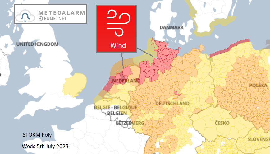
Schipol airport ground to a halt as trees fell in the high winds of Wednesday morning from summer storm Poly. Tuesday's wet weather for parts of the UK was the build-up that we were lucky to miss.
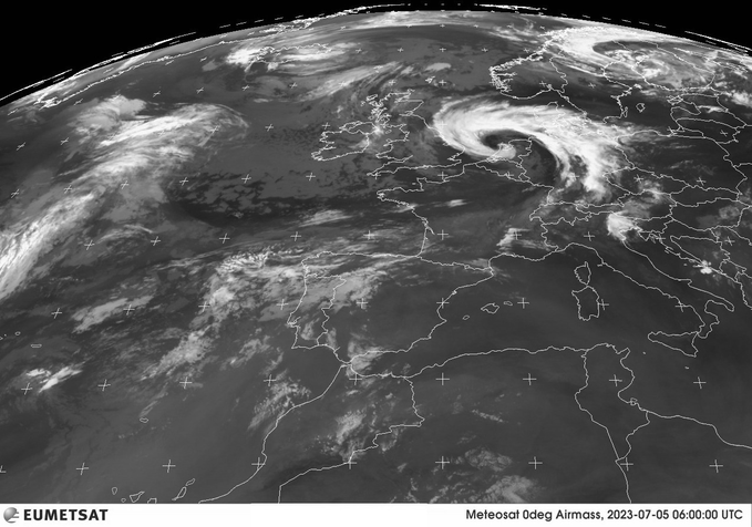
The rain which stopped play at Wimbledon yesterday went on to develop into Storm Poly which hit the Netherlands today. Southern Britain saw rain from a waving front and subsequent developing low on Tuesday. This affected most of the courts at Wimbledon, soaking hardy spectators. In Suffolk, there was over 50mm of rain in 24 hours, so 2" of welcome rain but giving a soggy Tuesday. Today the Netherlands started the day with red and orange wind warnings due to wild summer weather.
"This can cause considerable damage and very dangerous situations as a result of falling trees and flying objects" KNMI
The low pressure had brought heavy, yet welcome, rain overnight to East Anglia and then underwent significant deepening across the North Sea before impacting the Netherlands on Wednesday morning. The vicious winds and high gusts from the unusual summer storm felled trees which blocked roads and damaged vehicles with chaos for those who continued with their morning commute.
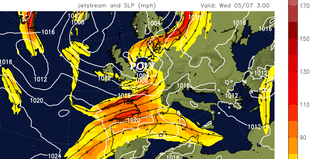
Overnight, the low pressure deepened, being under the left exit of the Jetstream, showing signs of dry air being pulled down from the stratosphere on water vapour imagery. KNMI put out the red wind warnings this morning with a risk of gusts of 75+mph at a busy time of the day.
The key air travel hub of Schipol Airport in Amsterdam had to surrender to the storm.
“Due to strong gusts of wind, rain and poor visibility caused by storm Poly, very limited air traffic is possible between 09:00 and 16:00 on Wednesday, July 5th.”
Further impacted by works at the airport
“With the westerly winds as they are at Schiphol tomorrow (Weds) morning, aircraft can normally start and land on the Oostbaan and Buitenveldert Runway. However, the combination of strong gusts of wind, rain and poor visibility means the Oostbaan is not an option due to safety concerns. The Buitenveldert Runway is under maintenance. Even if the Buitenveldert Runway had been available, the vast majority of take-offs and landings could not have taken place due to the weather. “
Conditions are expected to ease this afternoon for the Netherlands but northern Germany has red warnings for today and gales look to also affect Denmark with storm force gusts mentioned.
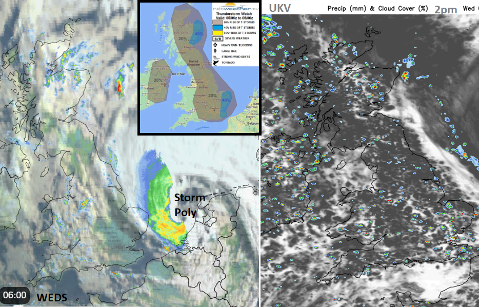
We are left with scattered showers, bright or sunny spells which will lift the temperatures after yesterday’s rain and cloud in the south. The showers won’t linger but there is the risk of thunderstorms today
“Widespread showers will develop and spread eastwards across much of the UK and Ireland during the day, as surface heating beneath cold mid-levels generates increasing instability. Some showers will be heavy, with isolated thunder – especially towards eastern areas – perhaps greatest chance of lightning towards eastern coasts of E Anglia and Kent along with eastern Scotland.” Convective Forecast
There will be a westerly wind, which will be more noticeable for western Britain but very light for NE Britain. Temperatures today will range from mid-teens to 20 or 21C for London and southern England. The winds will ease and back to a south-westerly tonight with temperatures around 10 to 13C.