Western areas have seen 24C this week with brilliant sunshine but parts of Britain have been stuck under grey skies and felt chilly in the breeze. Why is it stuck?
This weather looks set to stay into next week. The high pressure is very comfortable away to the northwest of the UK. It is keeping conditions steady and settled and the overall synoptic pattern does not change. This blocking high pressure is bringing a lot of dry weather but with stark contrasts of western sunshine and warmth against North Sea thick cloud and a chilly breeze.
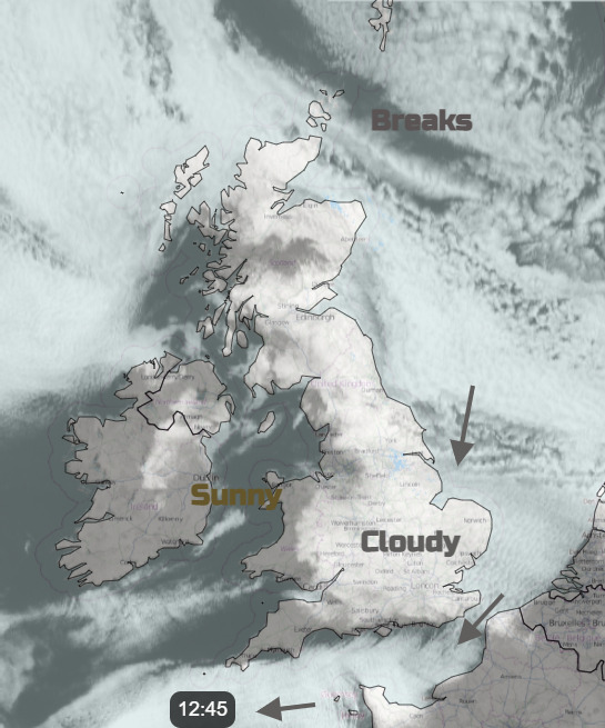 Visible satellite image Thurs 1st June
The Jetstream is weak and split. One arm is being forced away to the north closer to Greenland and then Norway. Another arm is way to the south, over northern Africa and it has been Iberia and the Mediterranean that have seen heavy downpours and showers. Our weather is staying the same as there is nothing really to shift it. The high pressure is large and extends up through the atmosphere.
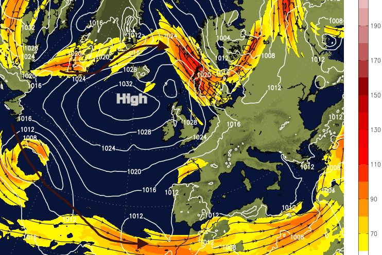 Jetstream and surface pressure
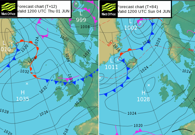
Looking at the various computer models there are all keeping the high nearby.
 A weak weather front on Thursday with thicker cloud and a bit of drizzle for eastern areas. Brighter skies later in the week, with some breaks over the North Sea
Still light winds for northern Britain and Northern Ireland, with a cool breeze for the southeast and along the English Channel. That doesn’t seem to give up. The amounts of cloud, the Stratocumulus cover will vary so for those in England and inland Wales that have been stuck under a blanket of grey skies and seen temperatures of only 12 to 16C, there is hope. Western shores will continue to see more warmth and sunshine but not quite the mid-twenties that have been the maximums this week so far.
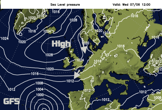
GFS Model showing slow moving large low pressure appearing off Portugal by the middle of next week.
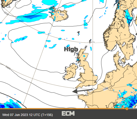
ECMWF Model showing the high still in place but perhaps a few showery bits over inland Scotland. Still mostly dry and settled, breezy in same places
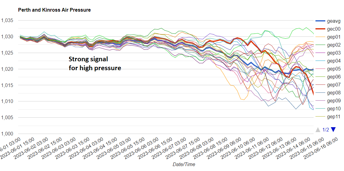
Scotland has been closer to the high centre with lighter winds and looking at the Ensemble graph for Perthshire, you can see high confidence in the next week for the high to remain nearby. After that there is some spread, that gradually the high pressure loses its grip.
For now though its more of the same which might be sunshine and warmth, with high UV. Or morning cloud and waiting for it to thin and break leaving a sunnier end to the day. Or keeping the cloud and the cool breeze and thinking “Where is summer?” It will shift, eventually.