Any strong May sunshine will feel warm in sheltered spots, but the air is from a cooler NW direction. Temperatures then rise later in the week with high pressure nearby.
After a warm weekend with temperatures tipping into the low twenties throughout the UK, there is a cooler start to the week. There are still some showers in the forecast but it's not like last week with that rash of hefty downpours and thunderstorms. For the start of the week, it is Scotland seeing most of the showers, which also reach Northern Ireland and northern/eastern England through Monday and Tuesday. High pressure is nearby, and there will be a lot of fair, settled weather around this week.
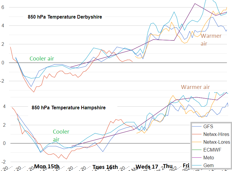
The cool air brings a risk of frost for a few spots, so gardeners and growers beware. We start with a north-to-north-westerly flow from behind a cold front and around the top of an Atlantic high pressure. Cold air will reach the Northern Isles during Tuesday and overnight, but by Thursday there looks to be a warmer shift. Very light winds will give way to a south-westerly flow, lifting the daytime temperatures with another pulse of even warmer air by Saturday.
Even on Monday with temperatures of 14 to 17C, it will still feel pleasantly warm in any shelter sunshine but there is a slight coolness for the early mornings and once it starts to get dark. Later in the week will lose the nip in the air and see the daytime temperatures shift, 16 up to perhaps 22C. The low twenties in mid-May is not overly warm. It's above average but the extremes for the month reach just into the 30s and you may remember occasional May Bank Holidays when it reached 27 or 28C.
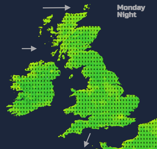
There will be a scattering of showers on Monday with the risk of the odd heavier downpour over Scotland, or NE England later. Tonight, the showers fade, and there will be clear skies and light winds with temperatures down into single figures.
Weather fronts approach the far north of Scotland, with more cloud and showery outbreaks of rain. There will be colder air behind this, with Shetland only reaching 8C on Tuesday and feeling colder in a brisk north wind. Showers will move down through Scotland on Tuesday morning, reaching Northern Ireland and Northern England in the afternoon and then extending to Lincolnshire. Again, there is the cool NW flow but warm sunny spells.
High pressure extends in from the west, subduing the shower activity and giving a quiet night across the UK once more. High cloud will reach over Northern Ireland and Scotland ahead of a warm front caught up around the high and so it won’t be as cool as on previous nights.
On Wednesday, frontal rain could affect the far NW and north of Scotland with wider cloud cover, and it looks like there will be a scattering of showers over SE Britain for midweek. Otherwise, it is another fair, settled day with bright or sunny spells.
Atlantic fronts keep trying to slide into the far NW of the UK, bringing patchy rain and more cloud. Gradually the flow turns to a warmer south-westerly, although depending on where the high centre ends up, East Anglia and SE England could catch a cooler north-easterly flow by the end of the week.
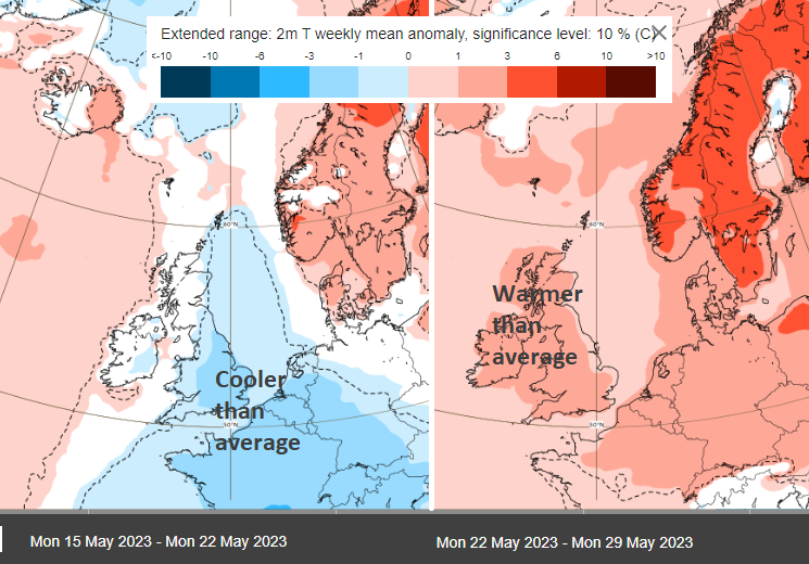
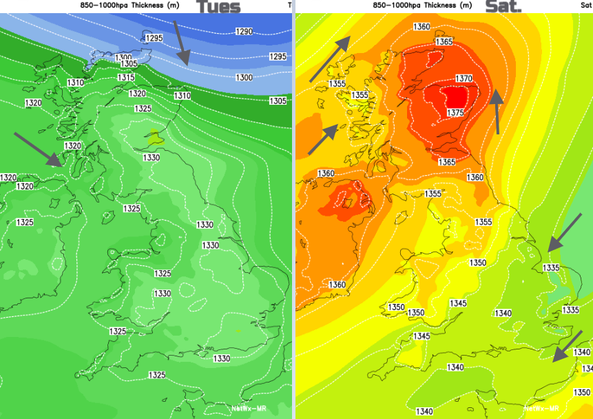
Next week looks warmer than average across the UK on the ECM outlook charts. The UK is often in a col, the area between two high pressures (this time over Scandinavia and the eastern Atlantic) and two low pressures. It’s a slightly frustrating area to forecast for. It doesn’t tend to attract severe weather, but the details of showers or wind direction can remain elusive yet significant.