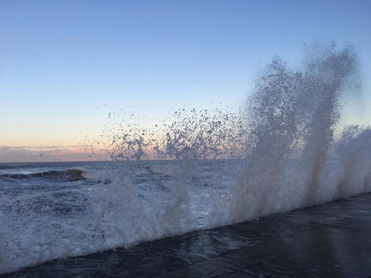
A gale and driving rain to start the day for the Channel Islands and homes without power in Cornwall after a wild night thanks to Storm Mathis. More windy weather through the English Channel today
The Channel Islands have started Friday with a westerly gale and driving rain. It has been wild overnight through the English Channel and for Cornwall where 700 homes are without power this morning. In France, highly exposed Pointe du Raz on the coast of western Brittany saw a gust of 146km/h (91mph). It is the equivalent of the Needles Old Battery location. Jersey saw a gust of 67mph at 5am in a gale force westerly and Guernsey a 60mph gust at 8am. St Mary’s Scilly also saw a gust of 67mph and Plymouth 62mph with over an inch of rain for Dartmoor during the night.
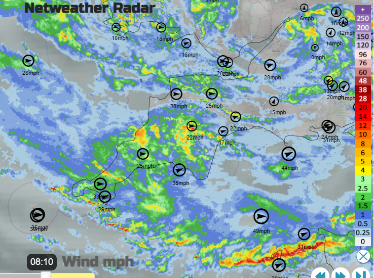
Jersey Met continues with their Orange warning for high winds across the Channel Islands.
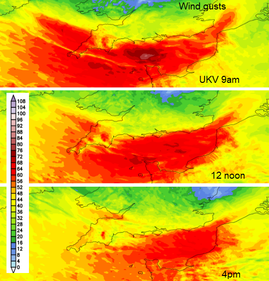
Wind: Southwest to west strong F7 to gale F8, with gusts to 65mph at first, decreasing strong F6 to 7 by dusk.
Much of France is covered in yellow wind warnings with Manche having an orange wind warning and Pas de Calais also having warnings for wind, heavy rain/flooding and high waves. Tempete (storm) Mathis was named by Meteo France on Thursday 30th March. People will be starting out on journeys for Easter holidays and the eastern end of the English Channel will continue to be lively through Friday.
WIND Southwesterly 7 to severe gale 9, veering westerly 6 to gale 8, then northwesterly 4 or 5 later. SEA STATE Moderate or rough, becoming rough or very rough for a time. Met Office inshore waters
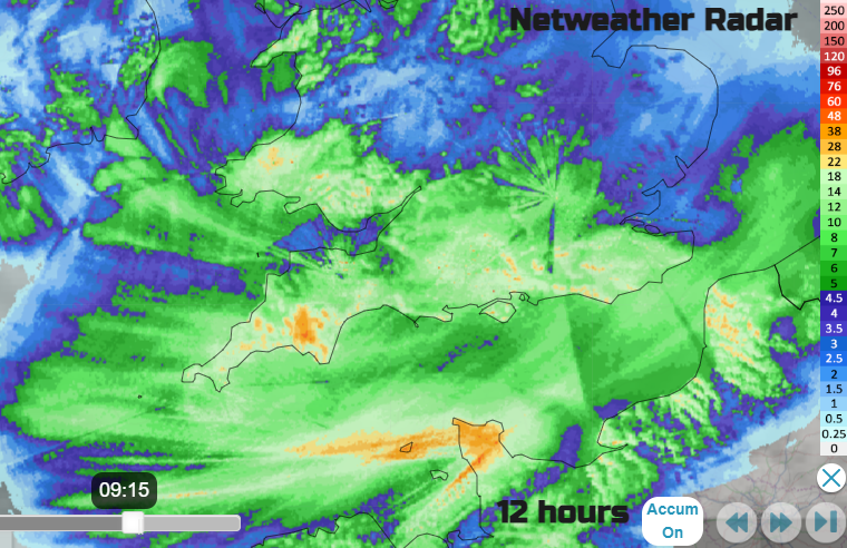
Care will be needed along Channel coasts with strong winds and sudden high gusts. The ongoing showery rain will make visibility poor at times on the roads with surface water and spray.
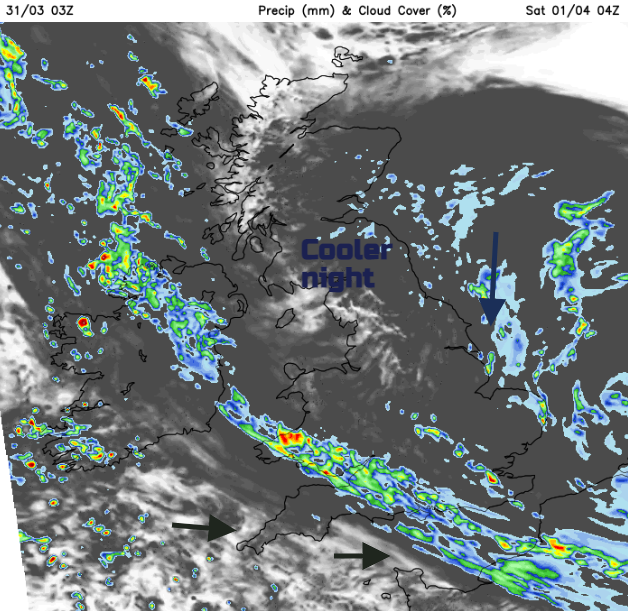
As the centre of maturing Mathis moves across to East Anglia this afternoon, there will be cooler north-easterly winds coming onto the coast of NE Britain and the ongoing strong westerly flow through the English Channel. This will be southwesterly this morning and be felt more as it reaches Hampshire, Sussex and Kent before veering to a westerly later. The strongest winds will fade from the eastern Channel during Friday night.
The rain warning continues through Friday, easing this evening. It covers Cornwall, Devon and north Somerset but Cornwall will see the rain edging away eastwards this afternoon and brighten up. “Heavy rain leading to some travel disruption and a chance of some flooding in a few places.” MO
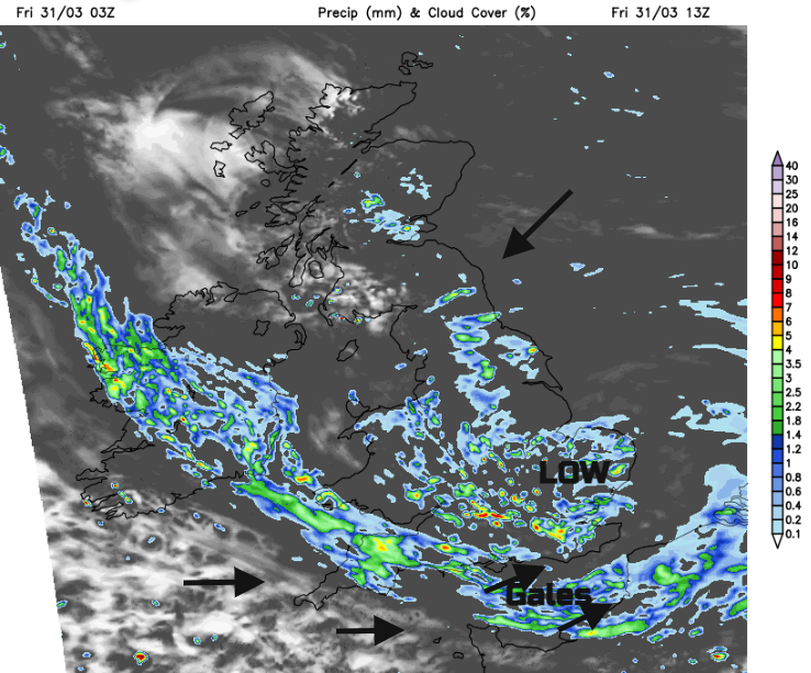
The trailing occluded front will bring rain to Southern Ireland and SW England but then edge into Northern Ireland, still over Devon and SW Wales. Heavy showers continue for England, especially late afternoon for SE Britain. The trailing frontal band lingers into Saturday but a cooler northerly flow will take hold.
More discussion in the Netweather community forum