It's been a wet March for much of the UK, with well above average rainfall, though the Northern & Western Isles have been drier than average. Despite a colder drier respite on Monday, staying generally unsettled to see out the rest of the month. But hints of some drier weather in early April.
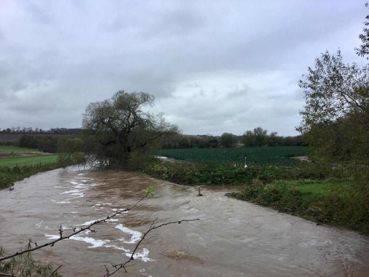
It’s been a wet March so far across many parts, with many places already recording more than the monthly average rainfall by mid-month. The UK average rainfall so far this month is 130mm which is 153% of the March average. For England, an average of 111mm has fallen which is 191% of the March average. However, for the Northern and Western Isles, it has been drier than average. For example, Kirkwall on Orkney has only seen 46% of the March average rainfall for the town, while Stornoway on the Isle of Lewis in the Western Isles has seen 70% of the average.
Despite the cold weather with snow earlier in the month, milder weather over the last few weeks has seen the March average temperature so far recover close to the 1991-2020 average for the month after being near 2C below earlier in the month.
A strong jet stream close to southern Britian continues to bring unsettled weather next few days. Briefly the jet buckles Sunday/Monday to allow a respite and come colder conditions from the north, before the jet resumes its strong west to east flow with more unsettled weather to see out March
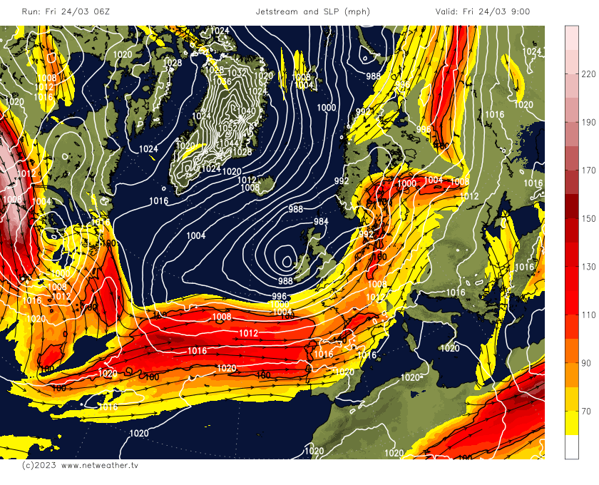
The unsettled conditions look to continue for the rest of the month, thanks to the jet stream close by feeding areas of low pressure across the UK. The jet stream is close to southern Britain over the next few days, with low pressure in charge feeding further showers or longer spells of rain across many areas. Mostly sunshine and showers today and Saturday, but Sunday looks to seen an area of low pressure track across the far south, bringing a spell of rain and a bit of a washout across southern Britain for the morning.
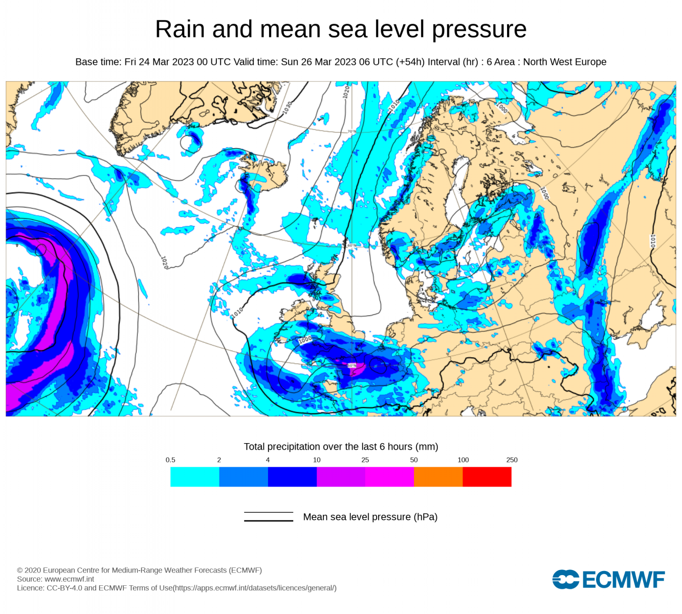
More prolonged rain arrives for Sunday morning across southern Britain
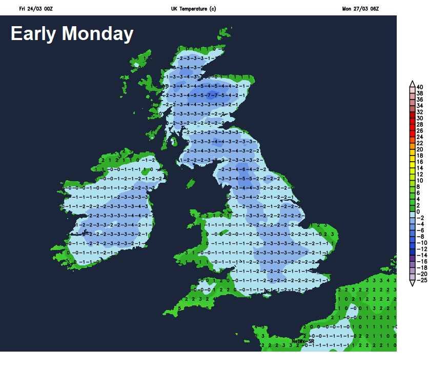
Sunday morning’s rain should clear early afternoon, following winds look to then turn northerly, as the jet stream buckles temporarily to allow high pressure to build close to the west as low pressure clears to the east. The northerly flow will bring increasingly wintry showers across the far north and down along eastern coasts later on Sunday and through Monday morning, falling as snow across Scotland and NE England, perhaps a wintry mix further south along eastern coasts of England. Otherwise, a widespread frost looks likely Sunday night as skies clear. Temperatures may fall as low as -8C in the Highlands.
A chilly but mostly dry day looks in store on Monday, as high pressure builds in from the west and the northerly wind eases with wintry showers in the morning along eastern coasts tending to fade. Then turning unsettled again from Tuesday, as the brief buckle in the jet stream on Sunday and Monday flattens out again – with a strongish jet stream resuming a flat and zonal (west to east) flow close to southern Britain, though waving north at times, for the rest of the week. This will mean low pressure in charge again, with showers or longer spells of rain at times.
Low pressure back in charge from Tuesday next week through into the first few days of April.
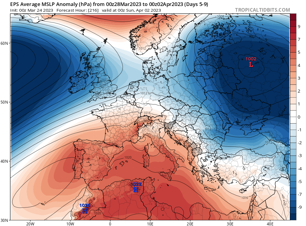
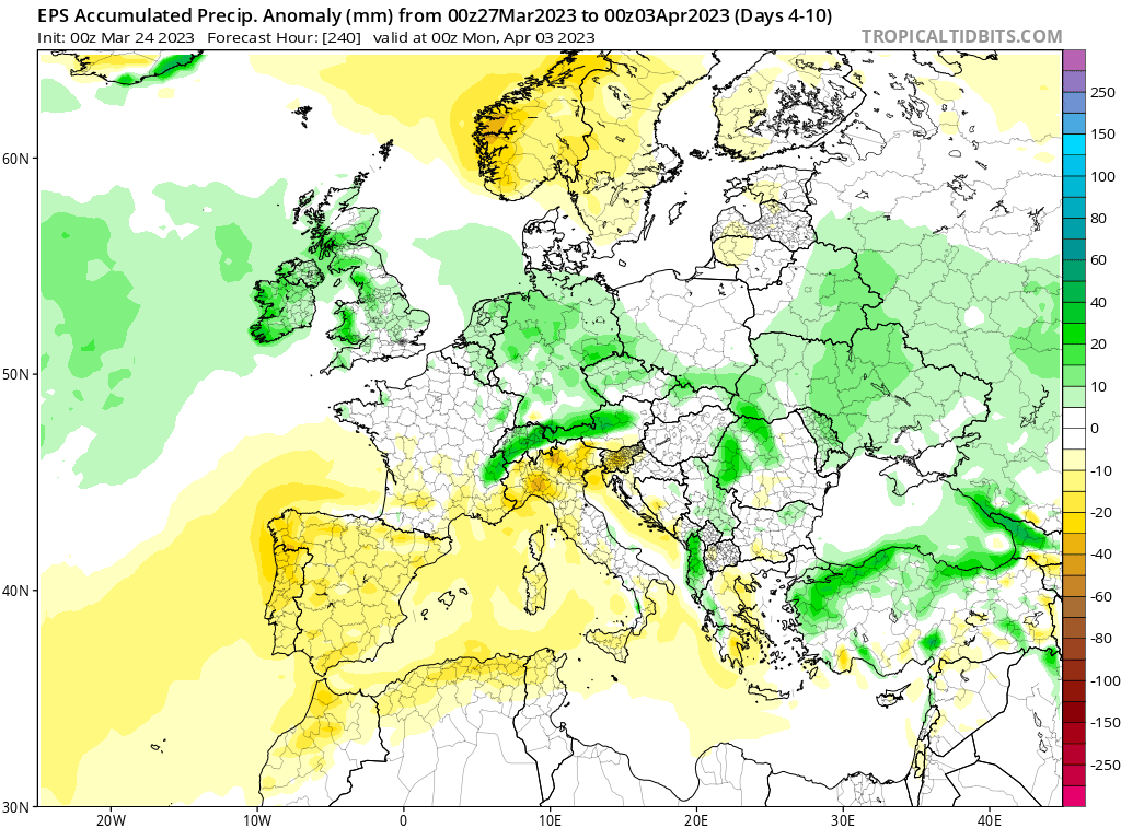
However, as we head into the first 5 days of April, starting next weekend, there are signs now from the models that high pressure could build north across the UK and bring a break from the unsettled conditions, with areas of low pressure diverted away from the U.K. This is backed up by the EC weeklies weather regimes updated yesterday – which point to more of a blocking regime as we head into early April.
Signal for more blocked regime and -NAO (northern blocking) increasing early April
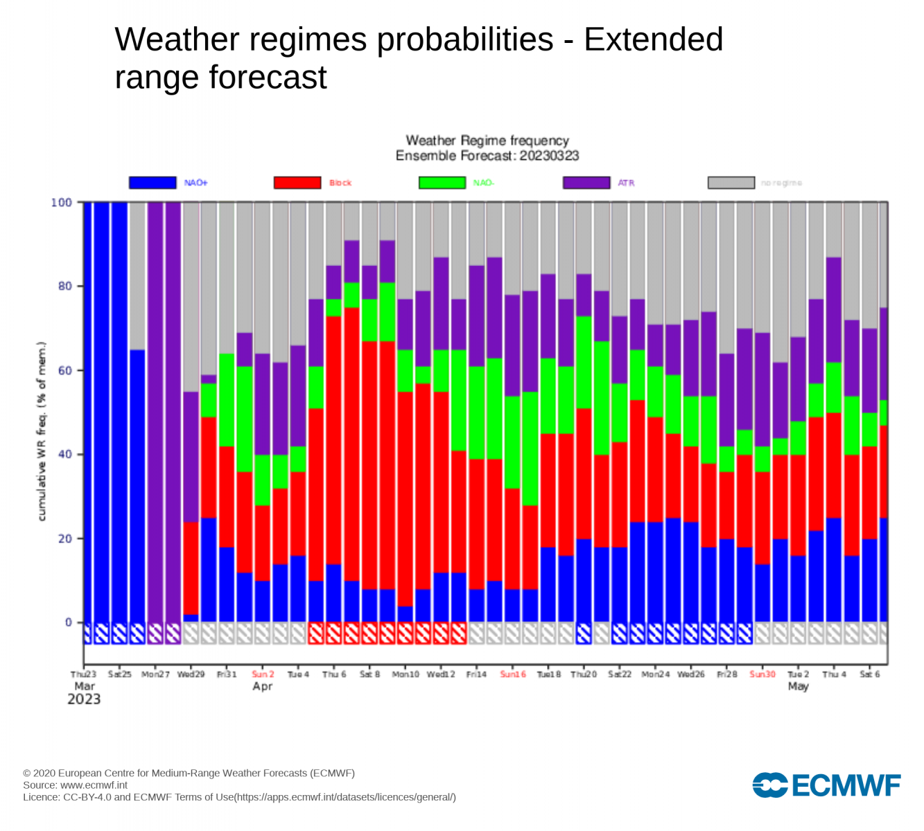
How long the more settled break lasts is far from certain though. 00z EC ensemble clusters indicate a wide spread of possibilities, but with a slightly greater probability for high pressure eventually building to the north of the UK, with a signal for high latitude blocking. High pressure perhaps close enough to bring drier / more settled conditions to northern areas, but with more unsettled and wetter conditions resuming towards the south. But also the potential, if high pressure to the north moves too far north, that it may turn unsettled across all areas again towards the end of the first 7 days of April. So, it could be a mixed picture in early April, perhaps starting off dry but turning unsettled again, at least across the south.