The north wind will be back by Sunday bringing a nip to the air and the risk of frost. There will be wintry showers and hill snow in the cold flow after a mild but windy week.
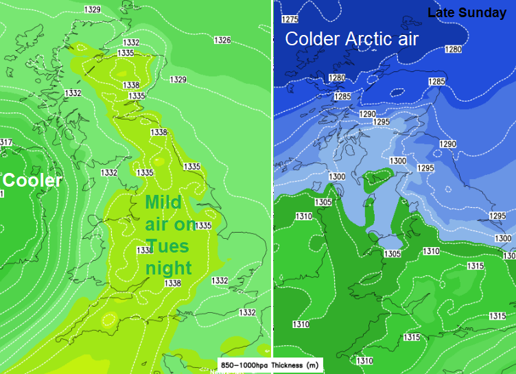
This weekend will see colder air pulling down from the Arctic with snow in the forecast for the new week. Saturday’s brisk westerly winds will give way to the cold, northerly flow on Sunday. Temperatures have reached 16C (61F) this week with warm spring sunshine. The northern half of the UK will stay in single figures on Sunday. The north winds will ease to end the weekend allowing frost through the UK. After the recent mild conditions, it might be worth covering up any tender plants.
Atlantic low pressures continue to run in this week with more on Friday. That means further bouts of blustery winds and bands of rain with sharp showers in-between. The shower risk continues for Friday evening with scattered hefty downpours, hail even a bit of sleet and snow over the Scottish mountains. With a low centre close to Scotland to end the working week the winds will be lighter and the showers will take their time moving by. Across Wales and England, it will be windy and lively bands of showers rattling past. It looks quite wet at times for Wales, NW England and SW England. Northern Ireland will also see peppering of showers as the winds begin to veer. Temperatures on Friday will be around 11 to 14C and overnight 2 to 8C.
Saturday morning will feel cooler in the fresh westerly wind, with strong winds at times for coasts and hills of southern Britain. Sheltered sunny spots will feel warmer and there won’t be as many showers about. It won’t be a wholly dry day although western Britain will see more showers than inland and eastern areas. Later in the day, there will be bands of showers from the north reaching northern mainland Scotland with an icy tinge. There could also be a frontal band waving across the Channel later in the day bringing rain to SW Britain by the evening. There is uncertainty here and that rain could spread over more of southern England during Saturday night.
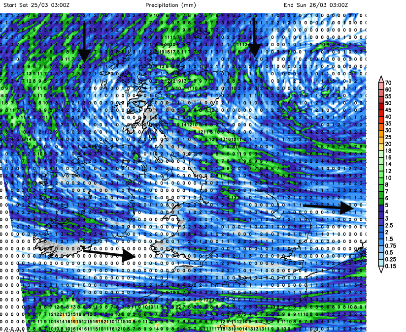
The colder northerly flow will be reaching down through northern Britain on Saturday night. There will be clear skies and the chance of a frost for Northern Ireland, the far north of England and southern Scotland but more cloud and wintry showers reaching Grampian and the Northern Isles. The UKV model has the cloud and precipitation over more of northern Britain on Saturday night.
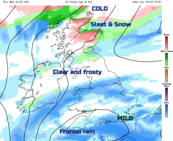
By Sunday the UK is in the colder northerly flow. Snow showers could reach even low levels by late afternoon over northern mainland Scotland and the Northern Isles. There will be a wintry mix for the Southern Uplands, and the northern Pennines with wintry showers reaching northern counties of Northern Ireland and the North York Moors on Sunday night. There could be heavy pulses of rain, sleet and snow managing to work their way southwards at the end of the weekend. That might leave a scant covering ready for Monday morning, mostly over high ground but the ground has begun to warm up this week and the sunshine soon gets to work. The shower focus shifts through Sunday night to the east coast of Britain and still over the far north of Scotland.
It will be a chilly night with frost in places as the winds ease. Quite a change.