It’s been on the chilly side this week, but rather benign, thanks to high pressure centred close to northern Britain pulling in a cold wind from the northeast across many areas. Pleasant enough out the wind and in the sun, but this afternoon many areas under a blanket of cloud so feeling more chilly than yesterday without the sun. However, temperatures have been, on the whole, around average for early March.
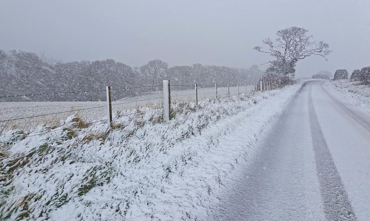
However, the area of high pressure that been close by this week will drift northwest towards Greenland over the weekend and into the start of next week. This will allow a northerly flow to develop down across the UK on Monday into Tuesday, ushering in much colder arctic air down across all parts and with it - increasingly wintry showers, which by Tuesday will fall as snow across northern and eastern areas.
A cold northerly flow direct from the arctic next week will bring much colder conditions with snow and perhaps some disruption
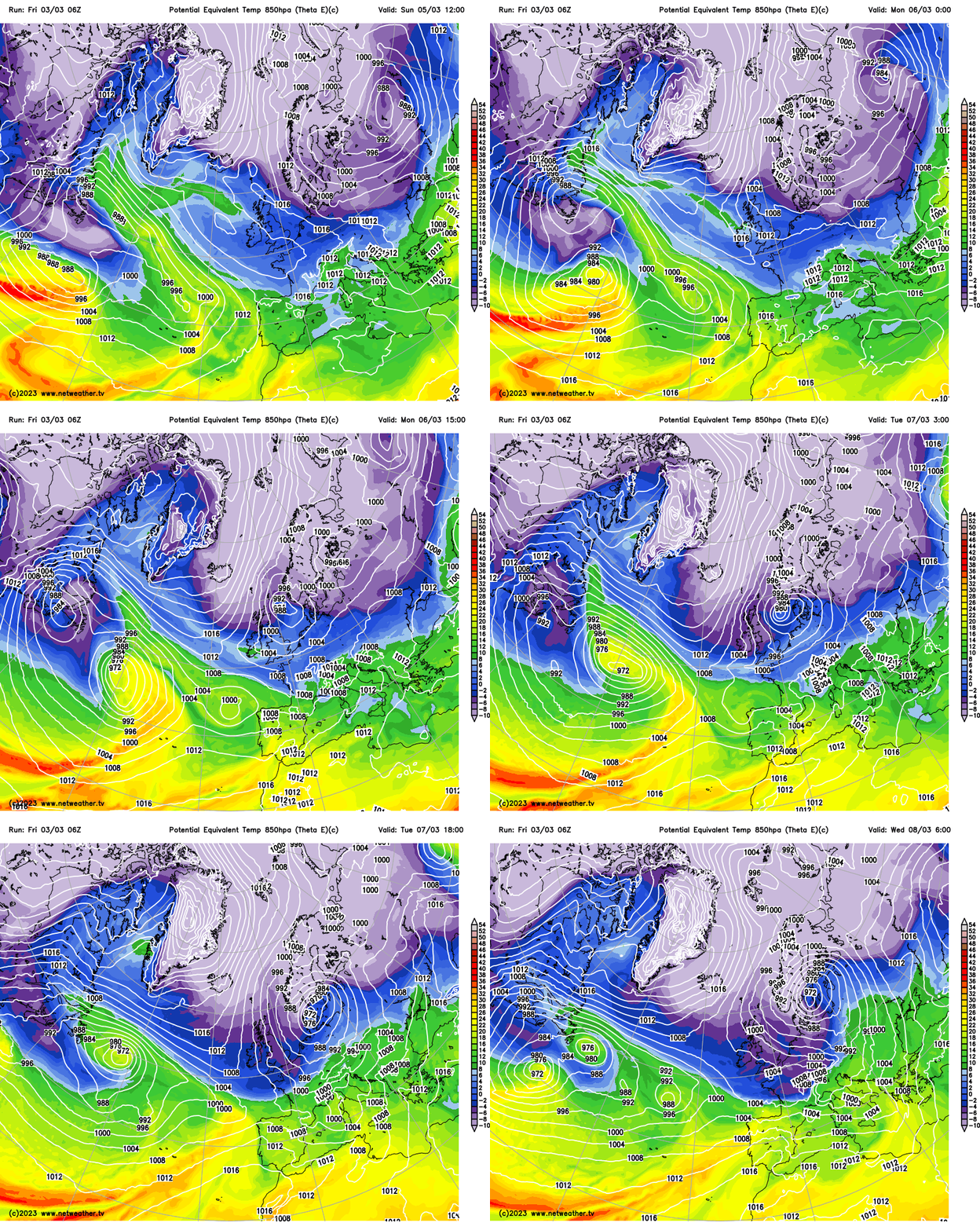
The Met Office have issued warnings for snow and ice for northern and eastern Scotland and NE England for Monday and Tuesday. Snow will initially be most disruptive in these areas, while snow may fall further south too, though unlikely to amount to much and be disruptive. But as the week progresses, we may see a disruptive snow risk develop across central and perhaps southern areas too, particularly Thursday, as the models indicate the potential for an area of low pressure to move east off the Atlantic somewhere across the southern half of Britain.
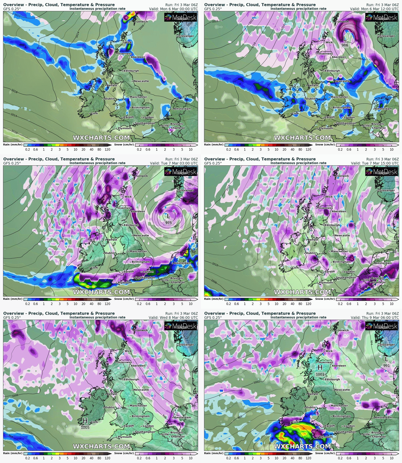
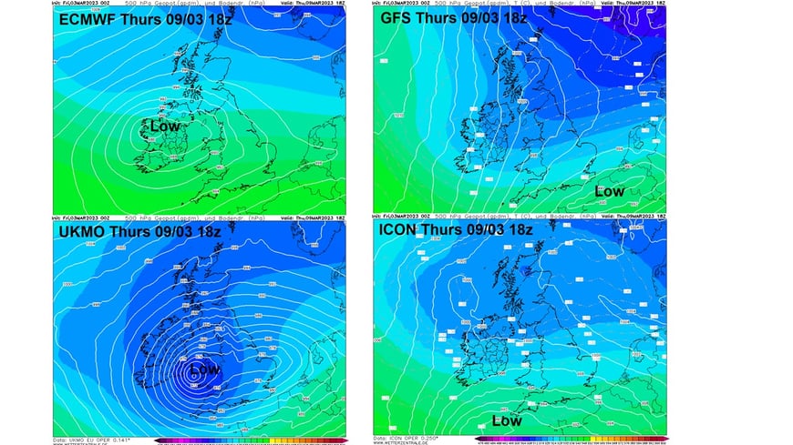
However, there’s a fair bit of divergence between models over the track of this low, as can often be expected at range of 6 days or more away. From the overnight (00z) runs - UKMO model takes the low across Wales, Midlands across to eastern England, with a snow risk for the Midlands / North Wales northwards. ECMWF model takes the low track even further north across northern England, with the snow risk for N. Ireland, southern Scotland and northern England. The American GFS, however, takes the low east across southern England, with snow risk a lot further south. Another low pressure / frontal system may move off the Atlantic to end the week or during next Saturday – which may bring further snow for some as the associated rain turns to snow as it bumps into the cold air. But following may be a transition to milder conditions in the south over that weekend, but a great deal of uncertainty over this transition to milder southwesterlies and far north the milder air reaches if it does occur.
Great deal of uncertainty over potential track of a low moving east off the Atlantic later next week, which could bring disruptive snow on its northern flank. Model comparison from 00z runs for 18z (6pm) on Thursday:
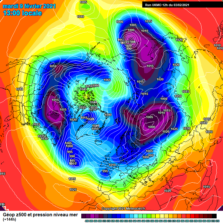
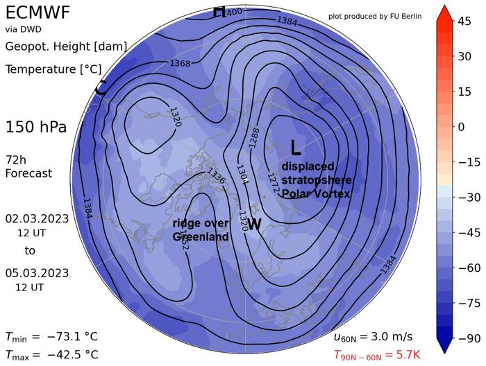
The changes afoot to much colder and wintry weather from the north next week are likely tied to the 'mirroring' of wind patterns in the troposphere (where our weather happens) of a weakened and displaced stratospheric polar vortex caused by the recent Sudden Stratospheric Warming (SSW). The reversal of winds to easterly high up in the stratosphere, following the SSW, look to propagate down and couple with the troposphere at higher latitudes. This tends to lead to areas of high latitude blocking, particularly over the North Atlantic sector, aided by the weakened polar vortex now displaced to Russia allowing heights pressure to rise over the arctic regions to our north and northwest. So, we will see a blocking high develop over Greenland for a time early next week, before it weakens and drifts into northern Canada – perhaps a sign of the SSW imprint and coupling waning.
Area in the white box on the chart below shows the SSW reversal downwelling from the stratosphere coupling with the troposphere towards the bottom
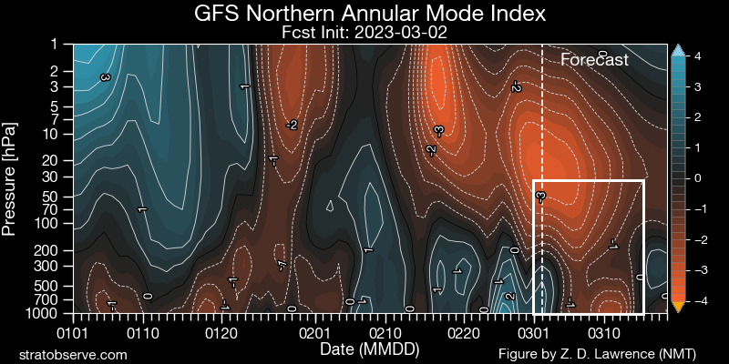
Chart below for the bottom of the stratopshere show, below, shows a ridge forming over Greenland and the displaced polar vortex - this imprinting further down into the troposphere weather patterns.
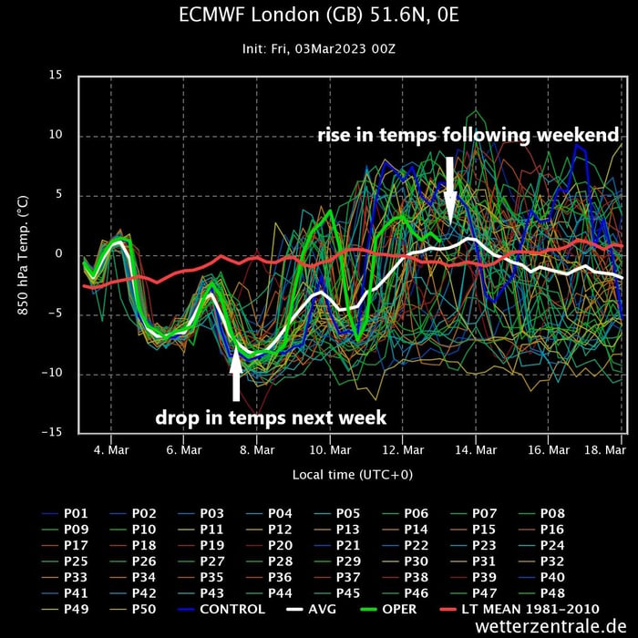
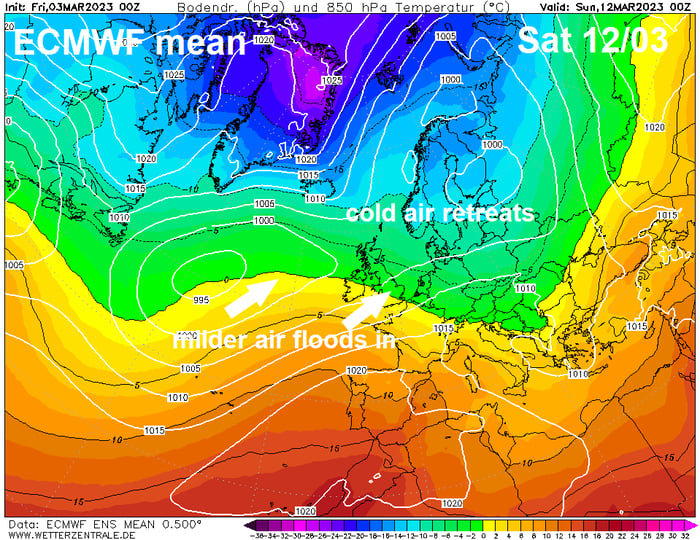
This waning of blocking over Greenland looks to be the catalyst for the cold northerly flow next week relaxing its grip later next week in the south and perhaps further north over the following weekend, as milder air floods in from the south along with wetter conditions. However, it may take all weekend for the milder air to reach northern Scotland. So rather cold and wintry week next week followed by turning milder from the southwest the following weekend seems to be consensus for now from cross-model ensemble guidance. This is shown by the graph of ensemble members for London below, with a drop in 850 hPa temperatures next week, before the mean of the ensembles rises – indicating a greater probability of milder conditions winning out the following weekend.
However, there is a possibility that the cold air arriving next week may take longer to be removed or may not be removed at all from the UK or just removed from southern areas through to mid-month. But this looks a low probability, for now.
Control 12z trying
6 minutes ago, SteveB said: Didn't the models show something like that for the last cold spell, just gone. Turned out to be snow for further north and east, in the end. Models are showing usual nirvana 10 days out. Reality is nothing like that....
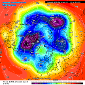
Control is trying its best
You have been promoted to Associate weather man because you live near me and are outdoors quite a lot lol
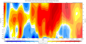
One thing I’ve discovered about the polar cap height chart at https://hebweather.net/stratosphere/?model=gfs&product=gph_atl&view=zoom&run=20261118_12Z is that you can view for just the North Atlantic sector. Comparing GFS 12z (left) with 0z...
58 minutes ago, cheshire snow said: So true I wait for our own @Day 10 superb analysis,there are a few knowledgeable posters in there but trying to find there posts in between all the rubbish is hard going. Yes I find level headed posters such as...