




It was rather cloudy for many over the weekend, I didn’t see the sun at all here in Surrey. However, the skies cleared across the north and far south overnight, so a frosty start earlier across eastern Scotland, northern counties of Northern England and parts of north Wales this morning, Temperatures fell as low as -5C inland across NE England and Aberdeenshire. Most other places getting off to a cloudy and milder start though clear skies (and a frost) to the south of London last night allowed sightings of a meteor along the south coast and north coast of France around 3am.
Monday will be another dry day for most, while sunshine should develop more widely than yesterday after a cloudy and misty start across SW England, south Wales, Midlands and eastern England. However, cloud may linger across eastern England, N. Ireland and western Scotland. Temperatures reaching a mild 10-12C generally, which is above average for early February.
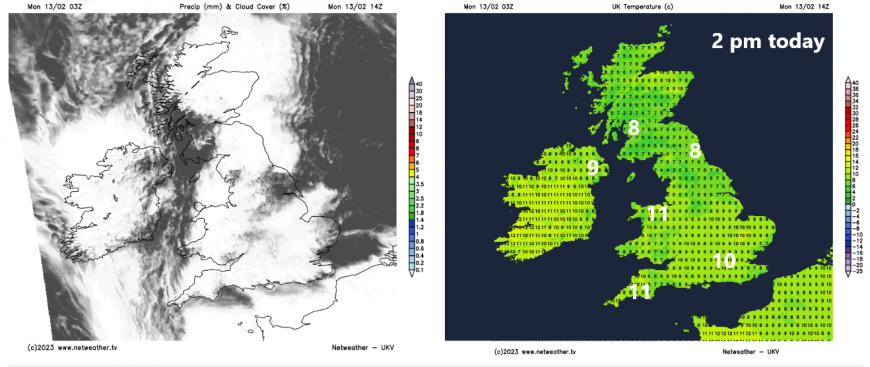
Clear skies for many tonight will allow temperatures to fall close to or just below freezing with some patchy mist and fog forming too. The exception will be across the far west – where it will be cloudier and breezier, with some patchy rain arriving across Ireland and N. Ireland by the end of the night.
Dry with sunshine for most on Tuesday once early mist and fog patches clear. However, a weakening warm front moving in from the west will bring cloudier skies across N. Ireland, north Wales, NW England, northern and western Scotland. The cloud thick enough to bring some patchy rain or drizzle for a time across N. Ireland and western Scotland. There will be a brisk breeze all the way up from Iberia, so it will be very mild, temperatures reaching 12-14C across England and Wales, perhaps 15C in one or two spots. Across Scotland and N. Ireland reaching 11-13C.
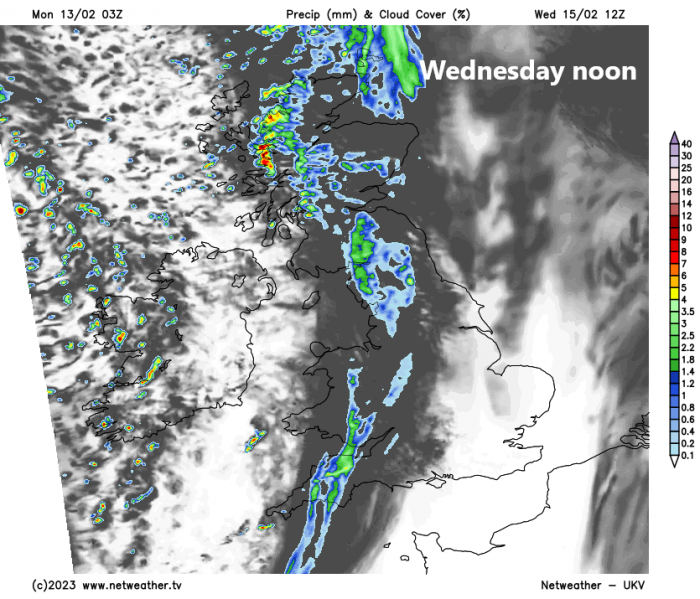
As well bringing unseasonably mild air, the long draw southerly wind will also import Sahara dust aloft all the way from NW Africa. So, you may notice an eerie hue to the sky on Wednesday as the dust arrives in the atmosphere high up. A cold front moving in from the west during day will bring a band of rain too, which could deposit the dust on cars and other surfaces where it falls. The rain heavy in the north and northwest for a time, before it fizzles out as it moves towards eastern England as the front moves into higher pressure. Brighter and windier conditions following the front across west but with blustery showers across N. Ireland and western Scotland. Where skies clear early evening, could be a vivid sunset where dust hasn’t been cleared away. Another rather mild day, temperatures 12-14C ahead of the front across southern and eastern England in the afternoon, 9-11C behind the front elsewhere.
For the end of the week, Thursday and Friday are looking more unsettled and windier, with rain at times, but it will remain mild. Thursday is looking a rather cloudy day, with an area of low pressure moving east across Ireland then northern England bringing outbreaks of rain east across England and Wales through the morning, cloudy and drizzly conditions following. Another frontal system ahead of deepening low over the Atlantic spreads rain in across northern areas through the evening, heavy over western hills and become increasingly windy too in the north.
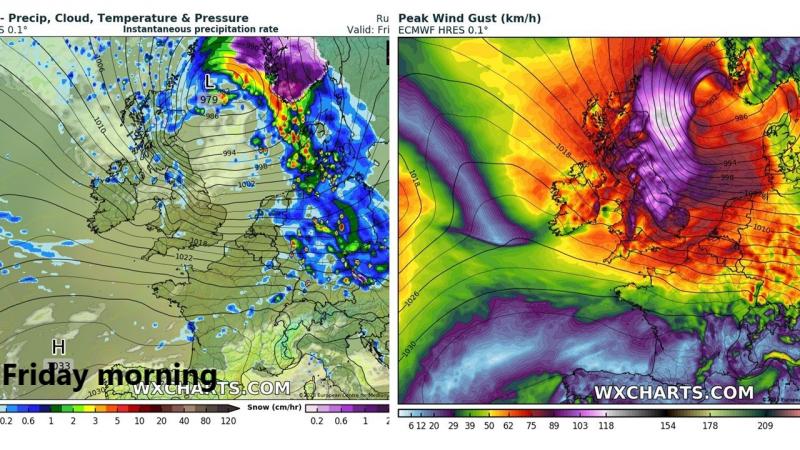
Credit: wxcharts.com
Some uncertainty over the track of a deepening low moving in off the Atlantic over the north Thursday night / early Friday morning. ECMWF model looks most intense, with gales developing overnight across the north, perhaps severe gales for a time Friday morning across Scotland as the low clears east out over the North Sea. It will be rather wet Thursday night and Friday morning too across Scotland – especially the north and west, where large rainfall totals could lead to some flooding. Elsewhere, windy with showers over NW England, N. Ireland and west Wales easing with most places bright or sunny but blustery. Winds easing in the evening as a ridge of high pressure builds in from the west. Temperatures both Thursday and Friday reaching 10-13C across the north, 12-15C across the south.
Northern areas may see another spell of wet and windy weather on Saturday, southern areas drier and brighter. Some uncertainty by Sunday, the rain in the north Saturday may sink across the south while turning drier and less mild across the north, or high pressure builds in across all parts bringing a dry and bright day for all.
Meanwhile, this week will see a Sudden Stratospheric Warming, the reversal of zonal (westerly) to easterly winds at 60N at 10 hPa level in the stratosphere taking place on Wednesday according to model forecasts. More on this in my blog issued yesterday:
Loading recent activity...











