For much of the UK, there will be little change in the weather as high pressure stays nearby. Dry and fair and a bit milder. Also a drier weekend for the far northwest, finally.
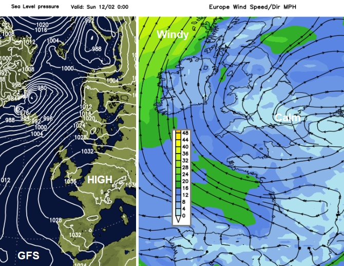
This week we have seen high pressure reaching over southern Britain. Under the slowly descending air, it has been calm, and cold overnight, where skies remained clear. Fog then formed, causing some travel issues. The air quality has suffered with moderate levels of air pollution in urban areas of England. Cloud amounts have varied but the dry weather has stayed over much of the UK, except the far NW. Most of the deep low centres have been well away to the north, affecting Iceland and the Arctic Circle. However, the strong winds and trailing weather fronts have impacted the north of the UK, particularly NW Scotland. Looking ahead to this weekend and even into next week, not a lot changes.
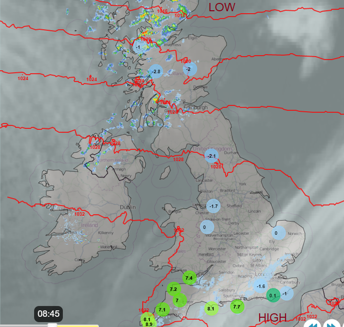
Thursday morning on the Netweather Radar. Inland chill with frost and mist
For some, February half-term will be starting this weekend. Others have to wait until the following weekend. February weather in the UK and across Europe can vary greatly from year to year. It can rain lots or bring warm spring sunshine. There can be storms or even snow. The next week looks pretty steady and similar to the past few days, with just the cloud amounts varying. Aberdeen at 10C with bright spells. Manchester also but with more cloud and light winds. London up to 12C and bright. Belfast will see more sunshine on Sunday.
There have been murmurings and discussions about happenings way up in the atmosphere. It is looking more likely that a Sudden Stratospheric Warming (SSW) event will happen this month. This is one of the steps in a particular winter setup which can lead to colder weather at the surface, for northern Europe and even the UK. However, there are lots of ifs and buts in all of this. Will the effects move down to the lower atmosphere after mid-February, how this event will behave and then where any potentially cold airflow ends up will depend on where a blocking anticyclone forms. If and when the process slots firmly into place, there will still be plenty of time to warn and inform people IF a colder spell is on the way.
Through the weekend and into next week there will be more chilly nights where the winds are light and clear spells appear. That means the risk of frost and fog continues. Further north and west, the breeze will continue to stir the air enough and keep the fog away.
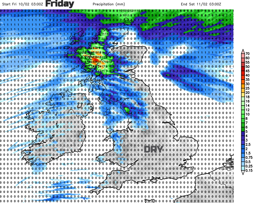
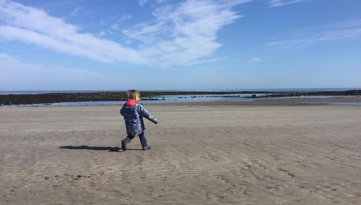
This weekend there will be plenty of dry weather, there is little rain in the forecast all week. Even the far northwest of the UK will finally dry up. Forecasting the cloud amounts is a more tricky area. There will be a lot of stubborn cloud trapped under the high which could make western shores feel a bit damp at times. Eastern areas, especially where there is more of a breeze from the southwest, will see bright or sunny spells. And it will feel warmer in those. Overall it will be a fair weekend, good for getting out in and mild enough for early February.
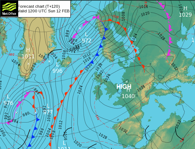
By Monday there looks to be a southerly flow for the western edge of Europe and temperatures begin to lift into double figures. Sunnier spots could reach 13C in the far south and western Britain and also through Ireland. By the middle of next week, there are some differences in the weather models. The ECM keeps high pressure over central Europe and the weather steady for England and Wales. The GFS allows weather systems to make progress in from the Atlantic after the middle of next week which include cooler air from Greenland and bands of rain from the west.
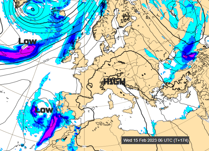
With high pressure centred over Europe, there will be more showery unsettled weather for the central Mediterranean. ALow pressure will bring cloud and rain to the Canaries, Madeira and then the Algarve midweek. Around the top and east of the high, colder air will be drawn down to Türkiye. In the earthquake hit region, there will be clear skies and warmer sunshine by day but still sub-zero by night.
After the fair, settled, milder start to next week it looks like the unsettled more changeable Atlantic weather could take hold more. Not just for the far northwest but affecting more parts of the UK later next week and pulling the daytime temperatures down too.
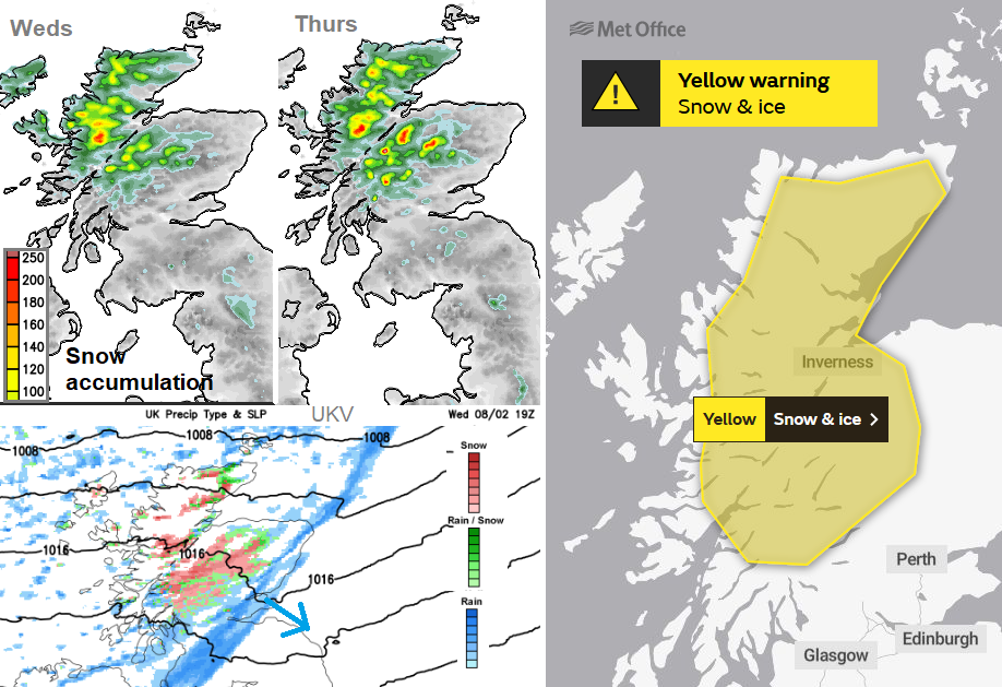
For those keeping an eye out for snow before half term, there was a weather warning for the Highlands of Scotland overnight into Thursday 9th. But that is about it. The blustery showers continue to bring a bit of snow over the Scottish mountains and a risk of ice to northern mainland Scotland on Thursday. It will feel cold in the wind.