It’s been a rather mild first 10 days of January, on the whole, particularly for England and Wales, though Scotland had a cold first 5 days – particularly the northern half.
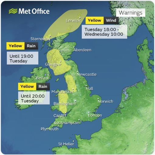
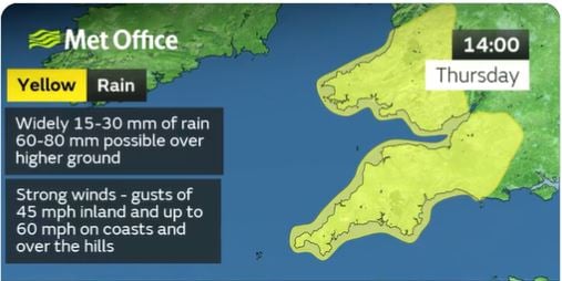
The rest of the week will see alternating mild and cool spells, as frontal systems cross west to east with their warm sectors and cooler polar maritime sectors. The fronts will bring a lot of rain too, falling on already saturated ground and increasing the risk for flooding, especially in the west.
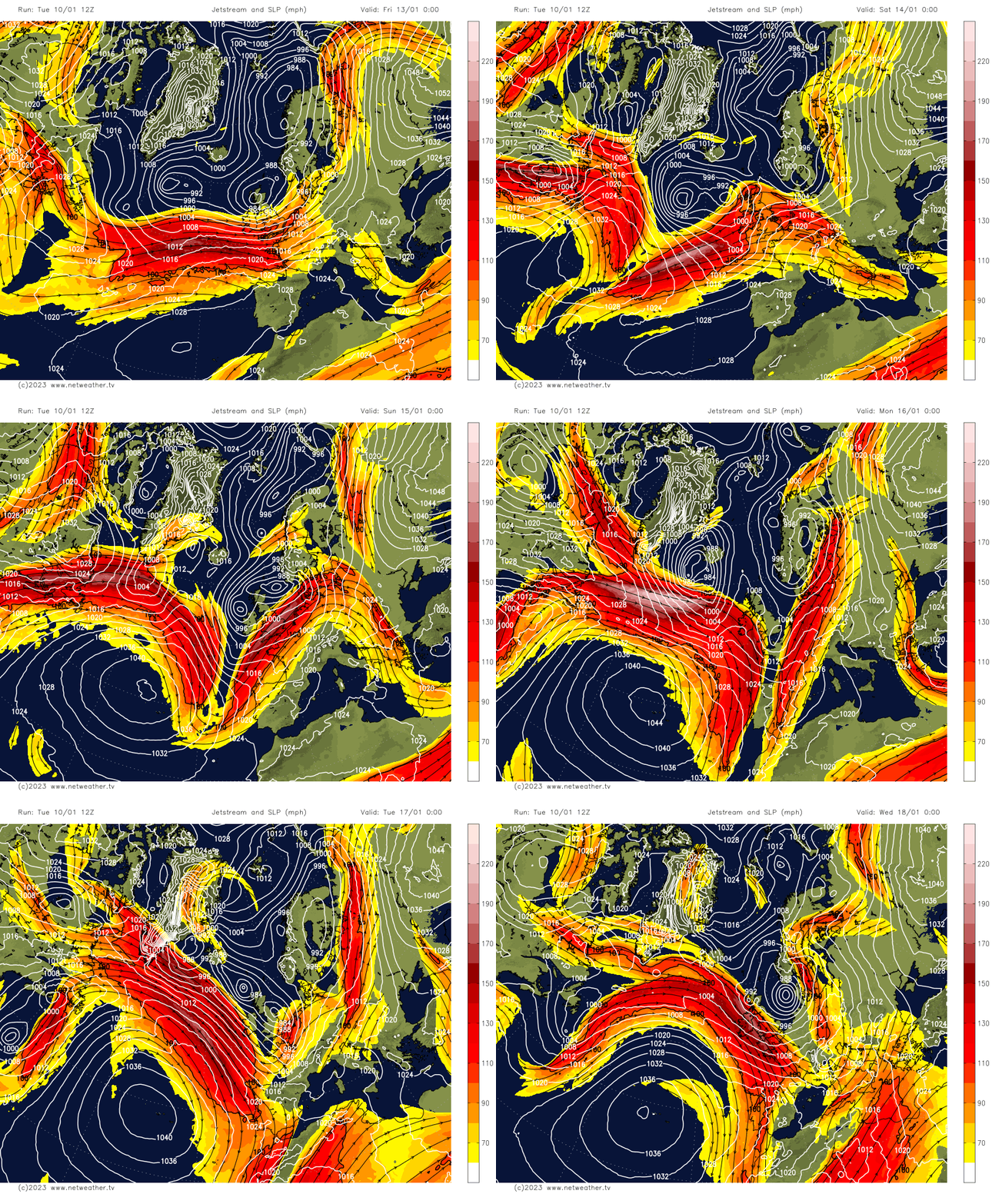
However, by early next week, the jet stream, which is zonal (west to east) flat across the Atlantic and NW Europe this week, buckles and digs south across western Europe and pushes north over the Atlantic to our west. This will allow the very cold air bottled up over Greenland to be released southeast over the far north Atlantic towards northwest Europe, but the cold air will be modified quite a lot by the relatively warm North Atlantic Ocean surface temperatures – which are warmed by the Gulf Stream.
Flat jet stream end of this week buckles by early next week, which will allow cold air to seep southeast from Greenland towards the UK from the weekend.
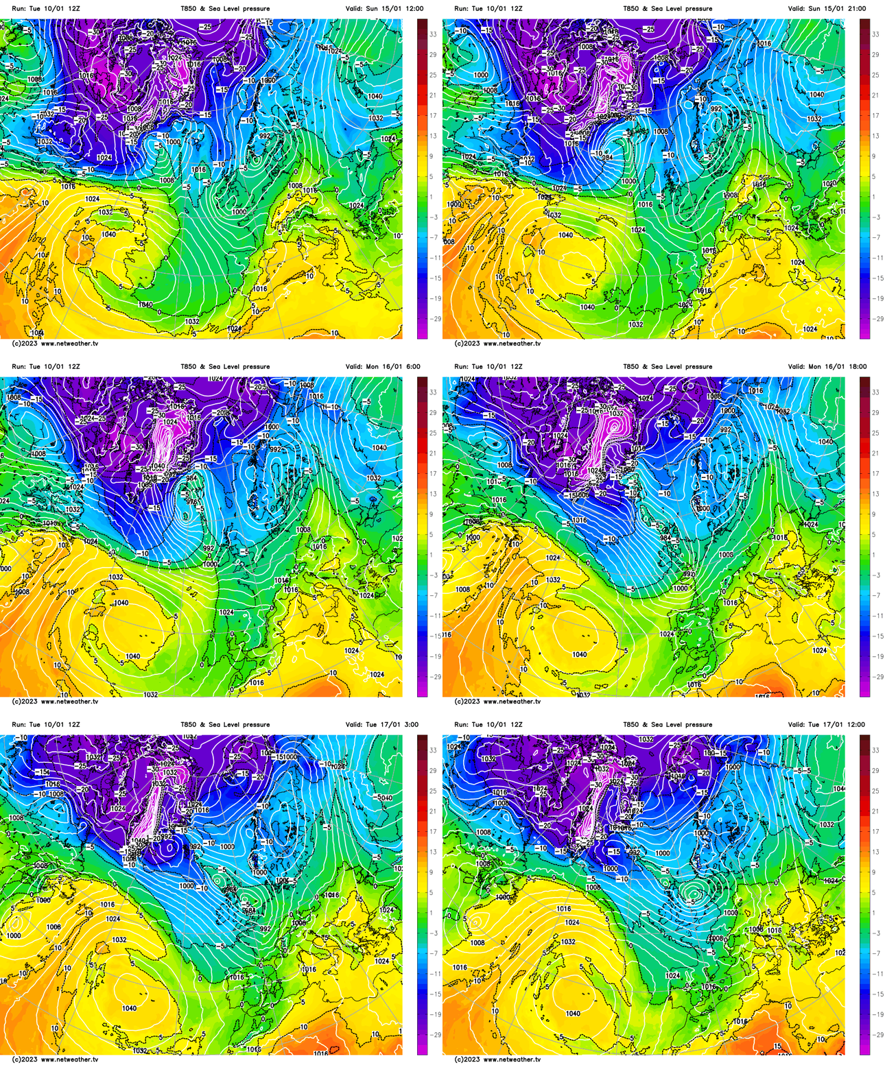
So, by the time the polar maritime air reaches the UK it won’t be near as cold as when it left Greenland, but it should still be cold enough to at least bring snow to higher ground in the north, but perhaps bring snow to lower levels in the north - should the airmass be sufficiently as cold as some models indicate at range. However, often models can be too cold air range with polar maritime flows and will ‘water down’ the depth of cold nearer the time. But not always, we will have to wait until nearer the time as newer data from observations to our northwest and satellite observations come in to determine if the air will be cold enough at the surface, after all the moderation over its sea track, for snow to fall to lower elevations away from the favoured higher ground in the north and west.
12z GFS 850-1000mb thickness Tuesday next week, below 129dm usually suffice for snow to fall, but doesn't guarantee it will settle:
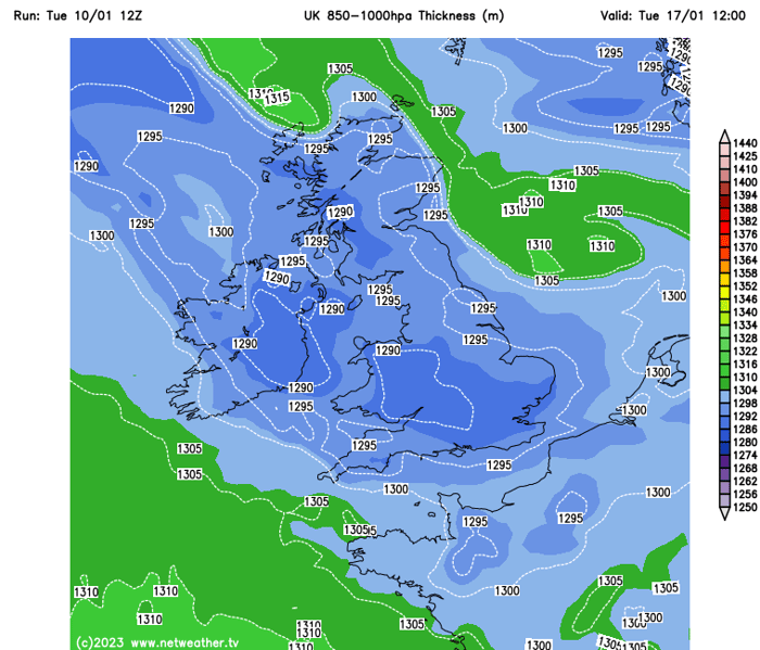
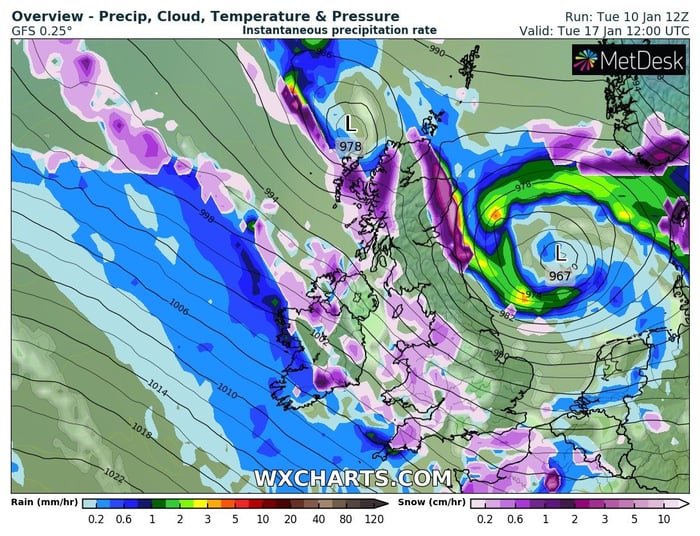
12z GFS and ECMWF indicate snow falling at lower elevations as well as high ground in southern Britain next Tuesday. GFS shows the 850-1000 mb (partial) thickness of the polar maritime flow iwill be cold enough, 129 dm or below for snow to fall, though not a guarantee to settle. However, 7 days is a long time in weather forecasting, particularly forecasting snow, which is futile at that range. But we can, at least, by looking at all model output, get a rough idea that it will become cold and perhaps cold enough for lowland snow, albeit in a polar maritime flow, an snow that settles more likely at night and unlikely to stick around for long away from higher ground.
12z GFS and ECMWFfor Tuesd ay next week (chart courtesy of wxcharts.com):
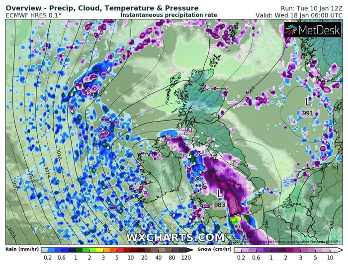
Indications from recent cross model runs and their ensembles suggests the colder conditions, with risk of snow in places along with ice forming at night, could last through much of next week.
Before the usual depression sets in, we need to exercise patience. We are seeing the initial effects originating from the stratosphere, with a high-pressure system—characterized by descending air—forming between Iceland and Scandinavia. This is a...
Weardale ski club was open yesterday, nice covering up there!
A mostly dry morning but cloudy and fairly misty Temp 6.3C, Barometer 983mb rising slowly, Wind F1 Variable, Rainfall 1.8mm
First decent snowfall here been snowing for a few hours but pretty hard to accumulate due to it being +1 but a little white outside now, and gonna be between -3C and +1 the next week or two
Still seems very mild here, at least if the weather reports from Windows are anything to go by. 11C around 9.30am rising to 13C by 12 (and presumably max temps are between 1-2pm so that isn't an absolute max) is perhaps 3C above what we would be...
25 minutes ago, mountain shadow said: Are we not looking too early for the SSW impacts anyway? It only occured on the 12th November and the general concensus is that we start to see the full impacts 4 to 6 weeks later at 1000hpa, which is around...