The feed from the west continues with nippy nights, showers and frontal rain from the Atlantic and blustery winds at times
This week it has been NW Scotland and Northern Ireland seeing a host of blustery showers with a bit more shelter for Co. Down and eastern Scotland. Some showers and rain bands will also affect Wales and SW England this week with more widespread rain by Saturday. There is a signal for next week that shows higher than average rainfall for southern and western England, Wales and around the Irish Sea.
It's been rather cool this week with more areas falling well down to single figures and daytime temperatures in the low teens. There have even been a few spots seeing their first air frost of the season early on Tuesday. Next week shows higher than average temperatures through a broad swathe of central Europe and SE Britain also looks warmer.
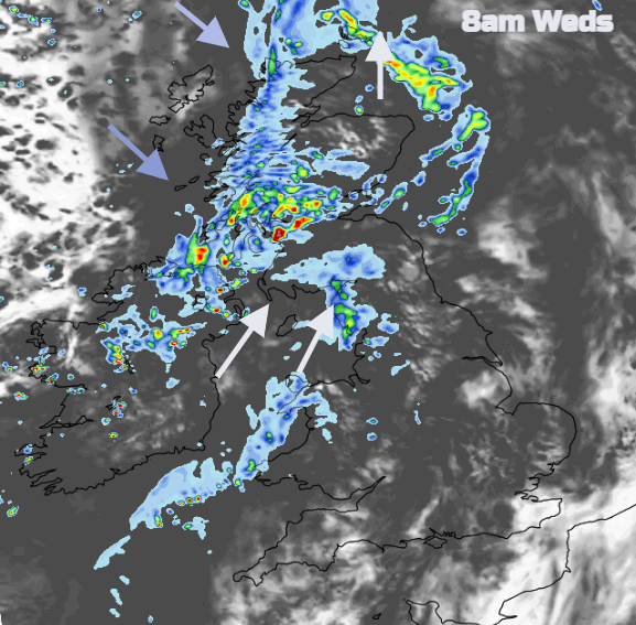
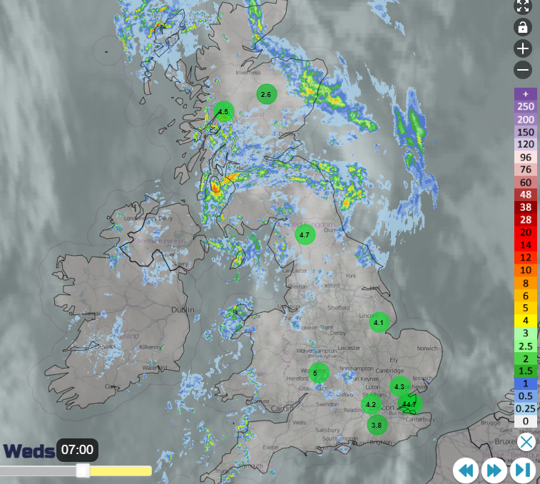
An Atlantic front, a cold front will work its way over Ireland during Tuesday night. There will be outbreaks of showery rain reaching western Scotland with fresh to strong southerly winds and gusts over 50mph. By Wednesday morning there will be heavy rain for Glasgow and Strathclyde, Argyll and Stirling with rain reaching Cumbria too. Northern Ireland will see some improvement through the morning but there will be more rain for the Central Belt and SW Scotland. The winds will veer to a colder north-westerly post-front as the skies clear.
Ahead of the front, SE England will have seen a fair start but again a nippy one with low temperatures and light winds. The cloud increases over Wales and England with outbreaks of rain for Wales, northern England, into the Midlands by lunchtime. The rain becomes more patchy into the afternoon and much of southern and eastern England will stay dry but lose any early sunshine. Temperatures ahead of the front will be in the mid-teens.
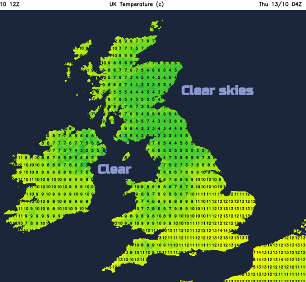
Skies will clear and again it will be cool but with more areas seeing light winds. There could be isolated fog patches, Cheshire looks likely early on Thursday. The last of the cold front cloud should clear way from the southeast and that leaves a fine, sunny start for many on Thursday.
However, the next Atlantic front will be moving in from the southwest bringing more cloud and rain. That rain looks to almost skirt along southern counties of England and the Channel coast heading east. Meanwhile, a deepening low pressure could bring strong southerly winds even gales to the Western Isles and west coast Scotland during Thursday afternoon.
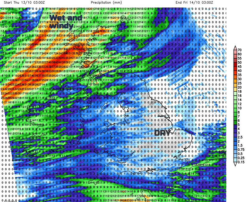
Heavy rain then works its way in again for NW Scotland affecting western Scotland and Northern Ireland later on Thursday. The models have been varying this week with the detail of this northern low. It looks like strong westerly winds will affect the far north of Scotland through Thursday night, gales for the Northern Isles with high gusts into Friday. More of Scotland will have windy weather but further south pressure will be rising and it will be more settled and feel a bit warmer for Friday afternoon.
It’s all looking very mobile with Atlantic fronts continuing to run in from the west.