Risk of thunderstorms for southern Britain today before an Atlantic low parks by western Scotland for the weekend. This will bring rain and blustery winds as further southeast stays dry and warm.
The weekend is looking more unsettled for the north-western half of the UK with blustery winds and rain. For the south-eastern half, there will be more dry, bright weather and warmth, but not the oppressive heat we experienced at the start of this week.
High pressure will slide passed southern England this weekend as a low pressure positions itself to the west of Scotland bringing blustery winds, cloud and frontal rain in from the west.
With harvest underway, we now have rain for parts of Britain. The main area on the radar is over the north Midlands into NW England with patchy light rain from the thick cloud, to the north and east. There is rain for mid-Wales and a few bright echoes in the English Channel. Everything is edging northwards.

Thunderstorms approaching the Isle of Wight and an occlusion bringing rain to northern England
The UK Met Office has a thunderstorm warning for Friday over SW Britain. It is the slow-moving nature of these storms which could cause impacts when heavy rain falls onto the dry, hard ground. Also, there would be lightning.
Fire and Rescue services continue to share fire risk messages after “working tirelessly under difficult conditions. The unprecedented number of calls and incidents put FRSs under severe strain, as they battled to get help to where it was needed most.” NFCC Chief earlier this week. This was part of the impacts which added into the issuing of the Amber and Red Extreme Heat warnings. These warnings are not just about temperature values.
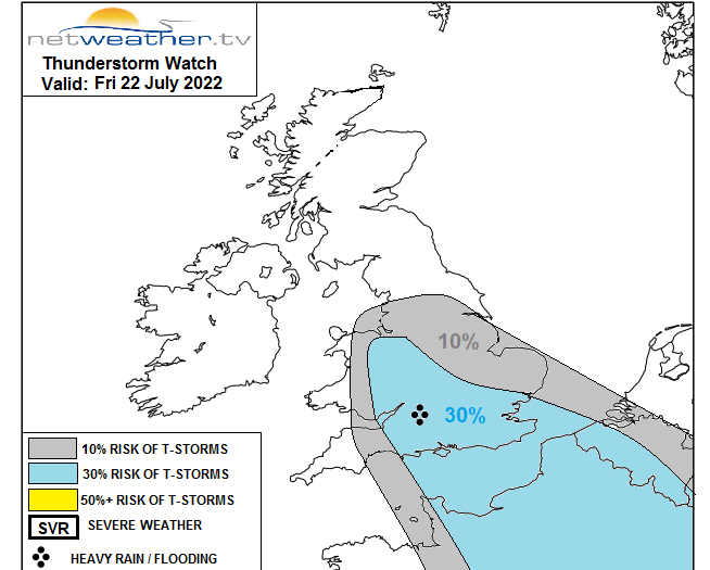
Thunderstorm warnings are always tricky. Today the Met Office have an area highlighted in yellow but within that many, even most people won’t see a thunderstorm. The convective forecast from Netweather shows risk areas, but both are highlighting that atmospheric ingredients are coming together and could produce a storm with heavy rain. That then could lead to flooding or lightning strike disruption. Meanwhile, other areas outside of that zone could still see a thunderstorm.
"an increase of mid-level convection spreading N into S England , with heavy showers and some thunderstorms spreading NE from the English Channel across S England, S Midlands and perhaps E Anglia through the day." Convective forecast
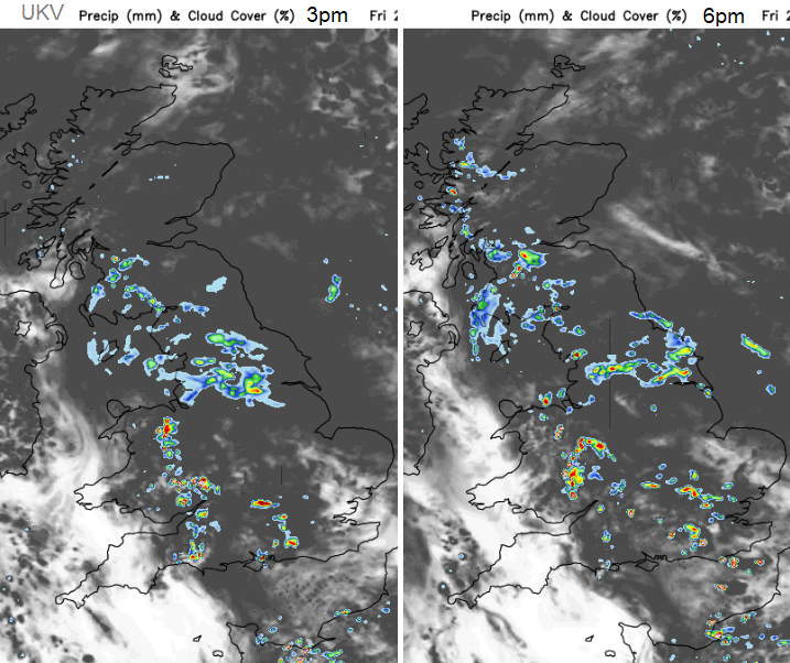
UKV model's forecast for heavy shower distribution
There is heat over inland northern France with smoke causing problems from wildfires. There is some movement of Britain’s heavy showers eastwards today and thundery showers continue to develop over northern France and move up through the eastern Channel later on. Northern Ireland should have a dry day with a sunny, dry end to the day for SW England and Wales. This is due to a brief rise in pressure and descending air ahead of the incoming warm front.
We have light winds today but with a slight easterly flow off the North Sea and that will subdue the temperatures a bit for Friday afternoon. Still strong sunshine though. Temperatures in the mid to high teens for most, low 20sC for inland SE Britain.
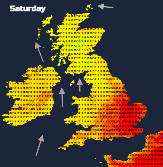
Proper frontal rain will reach Northern Ireland then western Scotland by Saturday morning with a freshening southerly wind. A fine warm morning with increasing cloud for much of Britain. There could just be scattered showers for East Anglia. The frontal rain then reaches more of western Britain with some hefty downpours with one band of heavy rain moving from western Scotland towards the north. Then another band swiping Northern Ireland on Saturday evening. This looks to develop as a secondary low overnight.
This moves up through SW and Central Scotland with heavy rain and gusty winds late into the evening and continues northwards overnight. Campers be aware.
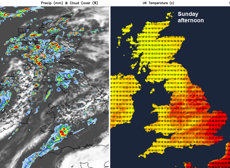
By Sunday there will be blustery showers from the west, making their way further inland. Some heavy even thundery in the north. Again, many parts of England and inland Wales stay dry with temperatures in the 20s Celsius, maybe 30C for inland eastern England.
During Monday, there will be a dig of cooler air from the north, so quite a change from the week before.