Temperatures over 40C and many records broken across Britain. The heat is clearing from eastern England with welcome rain. A risk of thunderstorms on Wednesday but fresher for all tonight.
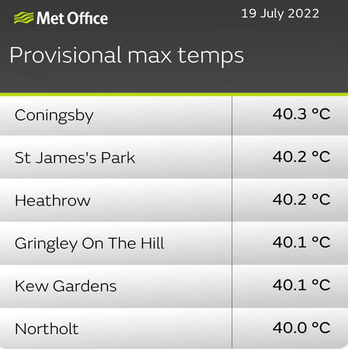
Well, what a week so far. That’s it for this extreme heat event. It’s over, you can open the curtains, although today will still be warm, feeling humid for some parts of Britain but we won’t be seeing those exceptional temperatures. The UK passed the 40 Celsius mark for the first time on record. Numerous local records were broken and we are awaiting more daily observations to come in at 09Z which could up some values. The UK smashed its maximum temperature record moving from 38.7C up to (a provisional) 40.3C for Coningsby, Lincolnshire. Scotland saw its hottest day on record, Charterhall in the Borders at 34.8C, even Lerwick in Shetland reached 23C, which is just below their record.
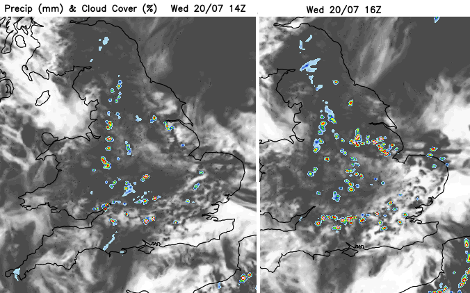
There has been welcome rain overnight, although not enough for the parched ground and dwindling streams. Thunderstorms are also being forecast for Wednesday although this kind of localised downpours is no good for replenishing water reserves. Ongoing significant frontal rains, often at other times of the year are important. The focus of the likelihood of storms is for SE Britain today with isolated to scattered storms for other parts of Britain.
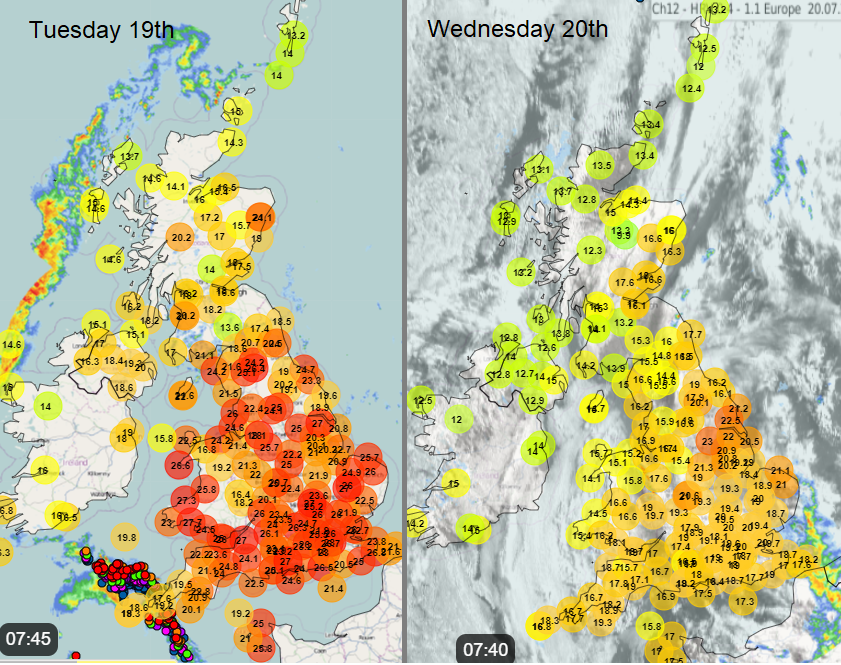
Suffolk has had rain this morning but the East Riding of Yorkshire is at 25C before 9am. There have been two cold front bands working their way over the UK to end this heatwave. One which moved over Northern Ireland and then Scotland on Tuesday and has almost stalled over Wales and northern England. Another moved up from the southwest with thunderstorms on Tuesday and this is clearing eastern England this morning.

We have an upper low moving east over southern England, so colder air aloft. Any sunshine will heat the ground and so the more humid air at the surface warms and becomes unstable. The convective chart shows a risk area, as always not all will see showers develop, nor thunderstorms.
“At the surface, a shallow trough will also move east, with one or two breeze convergence zones moving SE across E Wales and England through the day – which will be the trigger for heavy showers and thunderstorms from late morning through the afternoon and evening. “ Convective Forecast
Where there are heavy downpours there will be the risk of localised flooding as the ground is hard and dry, unable to quickly absorb the water.
Air pollution levels have been high due to Ozone amounts passing the thresholds. The forecast for the next few days remains at moderate so a slight improvement from the alert conditions in the high heat. The images of fires in the heat were most alarming, also adding to the air quality issues. The fire situation is repeated and magnified across western and southern Europe in this heatwave.
Today
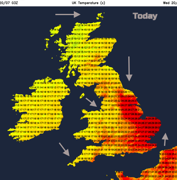
There will be more cloud about today with temperatures down on recent days. Eastern England will still be very warm at 25 to 29C perhaps even 30C. Which usually would be notable but not after yesterday. Wales around 20C, Northern Ireland 18C and for Scotland, Perth 22C and Lerwick back to 15C.
“Thunderstorms appear most likely from Gloucs/Worcs through the South Midlands and Thames Valley towards London and the Home Counties – drifting SE towards the south coast. Storms may train along breeze convergence”
The headline news for tonight is that it will be much cooler for everyone. Plenty of discussion and chat in the Netweather forum.