It's cooler for now but a spell of extreme heat is on the way and will begin to build this weekend, peaking early next week.
The UK is into a cooler airmass for the time being, but the main story everyone is watching is the build-up of significant heat coming this weekend and into the first part of next week. Current forecast model updates are still pointing toward a reasonable likelihood that the UK temperature record of 38.7c will fall, with a chance of temperatures exceeding 40c.
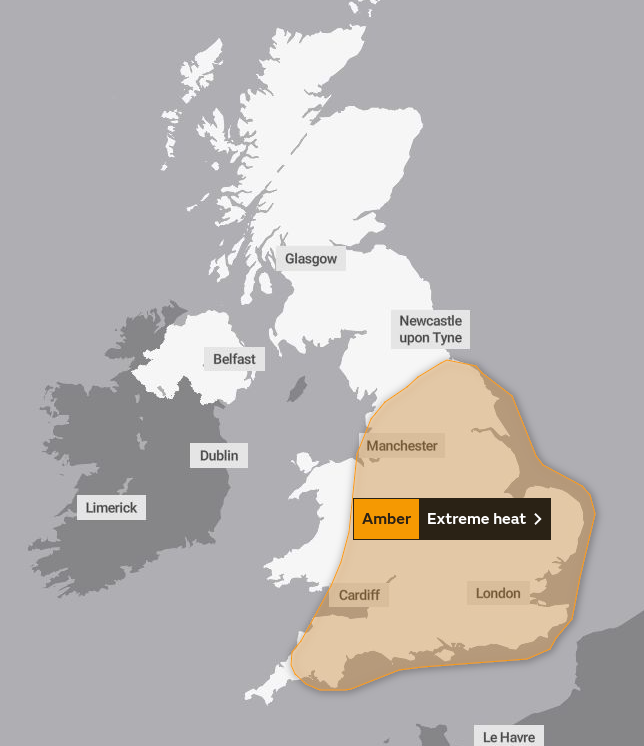
From a meteorological perspective, it's been an extraordinary period of forecast model watching, as the extreme heat forecasts have just kept coming, and now with the time nearing, it's potentially set to be a potentially historic spell of weather. From a health and wellbeing perspective, it's also likely to be very uncomfortable and for particularly but not exclusively, those who are vulnerable, a dangerously hot spell. This is why the Met Office has already issued an extreme heat warning for much of England and some of Wales, from Sunday through to Tuesday.
Quoting from the warning:
- Population-wide adverse health effects are likely to be experienced, not limited to those most vulnerable to extreme heat, leading to potential serious illness or danger to life. Government advice is that 999 services should be used in emergencies only; seek advice from 111 if you need non-emergency health advice
- Substantial changes in working practices and daily routines likely to be required
- Significantly more people are likely to visit coastal areas, lakes and rivers leading to increased risk of water safety incidents
- Delays on roads and road closures are possible, along with delays and cancellations to rail and air travel, with potential for significant welfare issues for those who experience even moderate delays
This morning's UKV model is showing temperatures exceeding 40c in parts of southern and eastern England. Although this isn't a guarantee of those temperatures, it is indicative of the level of heat that is possible, with the heat peaking on Monday or Tuesday.
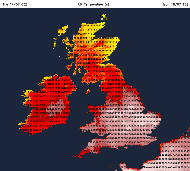
There's unlikely to be a great deal of respite overnight either, with minimum temperatures staying widely in the mid-high teens on Saturday night, but then Sunday and Monday night could see many parts of England and Wales not dropping below 20c. That's officially a 'tropical night' and certainly not conducive to a good night's rest.
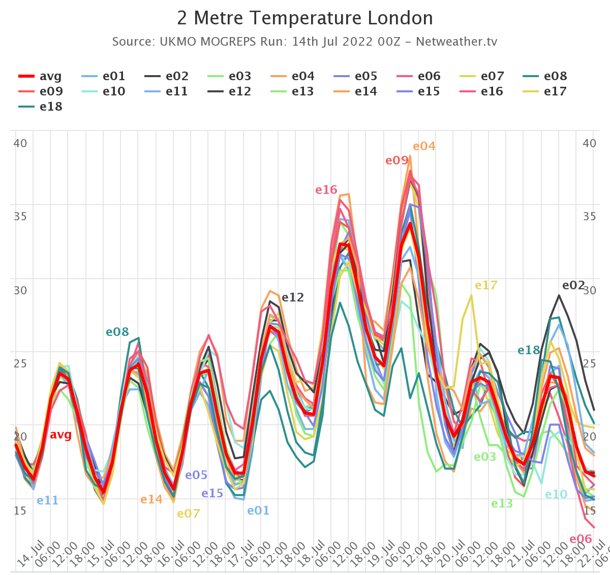
Taking London as an example, the MOGREPS ensemble model, doesn't have a single run where the temperature drops below 21c on Monday night - with the likelihood of it being a few degrees above that.
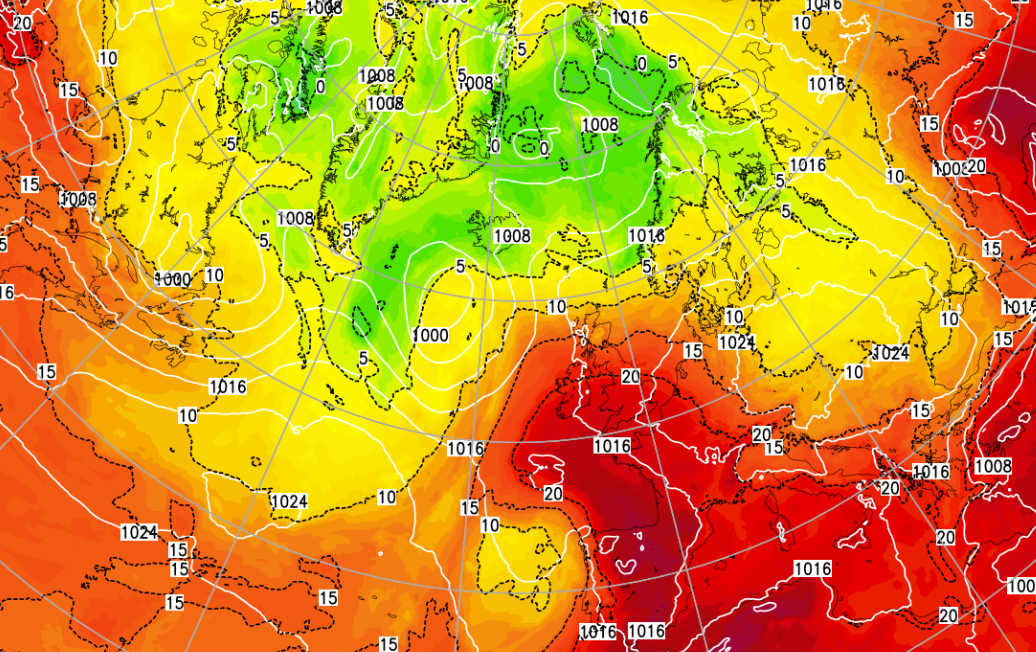
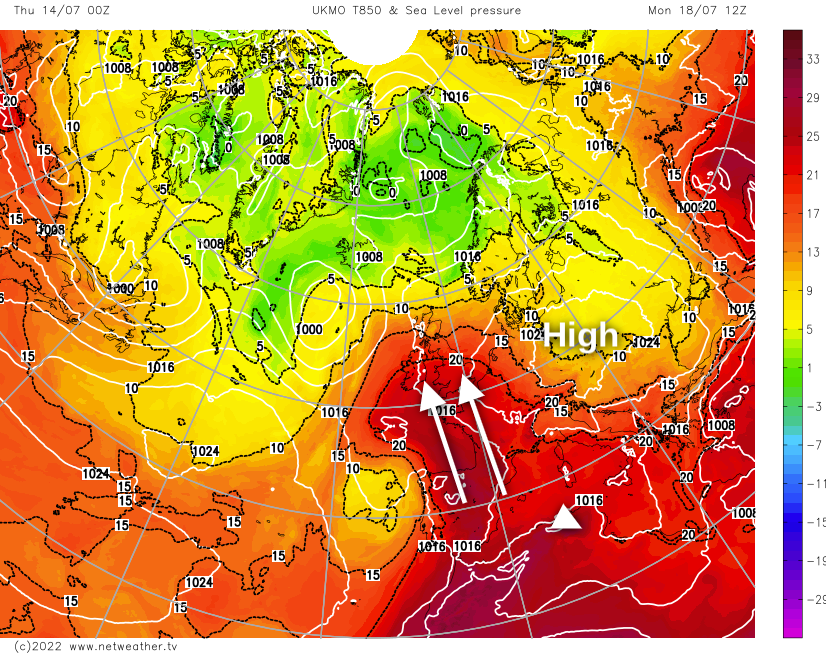
The reason for this burst of heat is the perfect storm of high pressure which is currently just off to the southwest of the UK, slowly moving east over the coming days. By Sunday it'll be moving over onto the continent, and it'll be starting to draw hot air up from the south across into the UK. Temperatures in France and Spain are likely to be well in excess of 40c at that point, with some of that extreme heat UK bound.
From mid next week the heat does look set to fade, at least. It could go with a bang, as some of the forecast models suggest thunderstorms will develop. This is a long way off though and very uncertain.