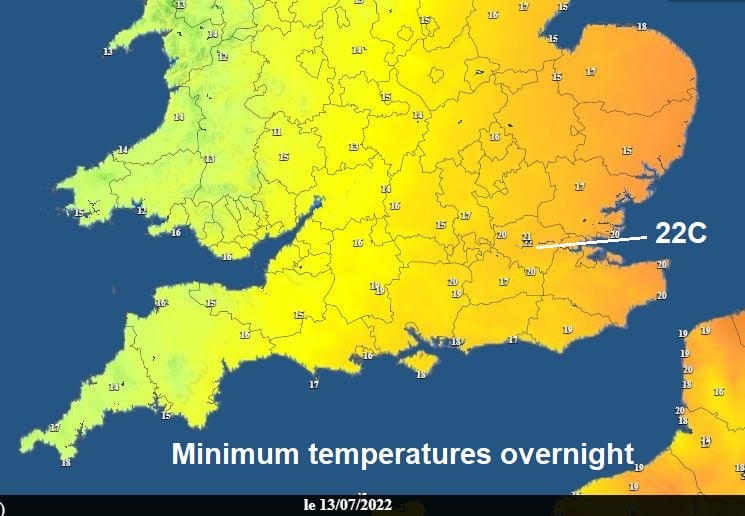
It’s been an uncomfortable night across the south, with temperatures falling no lower than 20C in places, in central London - no lower than 22C. The heatwave over large parts of the UK over the last few days has eased away, thanks to a cold front clearing southeast yesterday, which will introduce cooler and fresher conditions over the next few days. However, the heat still hangs on across the southeast of England today, with temperatures perhaps reaching 29C.
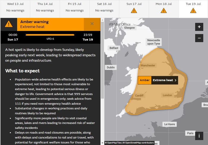
More comfortable for most on Thursday and Friday, with temperatures closer to average, though still warmer than average across southern England, but not as hot as it has been. But, heatwave part 2 looks to arrive on Sunday and looks to last until Wednesday and will bring hotter conditions than the last few days. Hence the Extreme Heat Warning issued by the Met Office for Sunday, Monday and now extended through Tuesday too. Tuesday, for now, looks to be the hottest day – with temperatures perhaps challenging the UK’s highest temperature record of 38.7C on 25 July 2019 in Cambridge Botanic Gardens.
Reason for update
Extended into Tuesday, with emphasis on the peak of the hot spell shifted to Monday/Tuesday
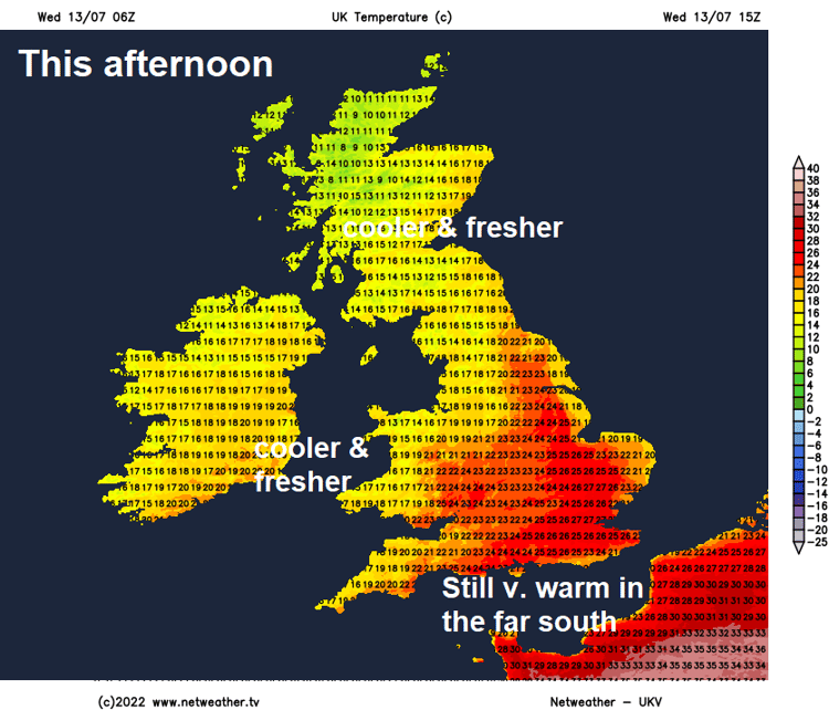
Back to this week, for most, Tuesday was a cooler day than Monday, a weakening cold front moving southeast brought more in the way of cloud and some rain for many, but it was still a hot day in the far south ahead of the front, temperatures reaching 31.7C at Wisley in Surrey. After an uncomfortable night across the south, temperature not falling below 22C in central London, once early cloud and the spot of rain along a weak cold front clears the south, it will turn sunny, very warm or hot again across the southeast of England – with temperatures reaching 27-29C. The north will see sunny spells and scattered showers, elsewhere it’s looking mostly dry and sunny. Temperatures reaching 19-24C.
Not as warm tonight, so a more comfortable night in the far south. Thursday will see sunny spells and scattered showers across the north, southern areas mostly dry with sunny spells. An occluded front will sweep southeast across the north on Friday, bringing cloudy skies and a spell of rain for a time, before drier and brighter conditions follow. High pressure continuing to keep the south dry with sunny spells. Still very warm in the south, temperatures reaching 24-27C, in the north 16-20C.
The weekend looks set fine for most, as an area of high pressure drifts east across the UK. Saturday’s looking dry and sunny for most, temperatures reaching highs of 19-25C in the north, 26-30C across the south. As the high moves east of the UK on Sunday, so we start to see hot air drawn north from Spain and France into England and Wales, with sunshine seeing temperatures soar to 30-32C quite widely inland away from coasts, in the north very warm too, with temperatures reaching 22-26C, though cloudier skies could bring a few showers across Scotland.
Plume of hot air spreads north to the UK from the weekend into early next weekend
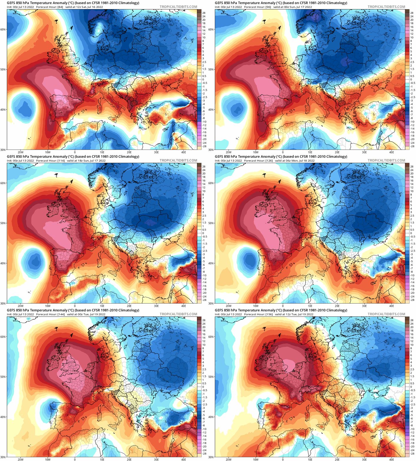
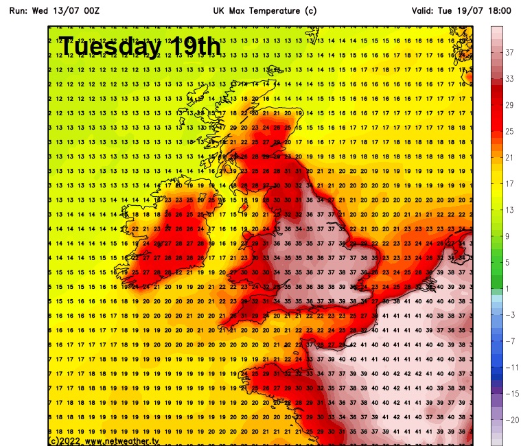
Sunday marks the start of the Met Office’s Amber Extreme Heat Warning – which extends through all of Monday and Tuesday too, but early next week looks to be hottest, Tuesday probably the hottest day before it cools down from the southwest, with a possible thundery breakdown, on Wednesday. Plenty of sunshine spreading north on Monday with a very warm southerly flow taking temperatures up to 23-28C across the north, 30-35C across the south. More very hot sunshine on Tuesday across the south, which could send temperatures in excess of 35C. Though some uncertainty, this far out, on high temperatures get, especially as the models are showing an upper trough and surface low moving up from the southwest – which could bring cloud and some thundery showers northeast by early evening. But we could be looking at the hottest day of the current heatwaves. The American GFS 00z run shows 38C across the southeast – which could challenge the U.K.’s highest temperature record, as mentioned above. But the model has been overcooking temperatures at range, with other models showing lower maximum temperatures – but still in the mid-30s degrees C.
Cooling off big time and turning much fresher next Wednesday, as an area of low pressure moves northeast bringing heavy thundery showers across many areas, perhaps longer spells of rain in the northwest, while winds turn westerly then eventually northwesterly through the day bringing in the lower temperatures.