Even warmer today with plenty of sunshine and dry weather. By Thursday showers will appear across the English Channel with the risk of torrential downpours and lightning.
For those heading off to Glastonbury today the weather couldn’t look better. Sunny, dry and very warm. However, it won’t last. The risk of torrential downpours and thunderstorms is mentioned for SW Britain tomorrow. It will have to be fingers crossed that they avoid Worthy Farm.
Much of England and Wales has seen sunshine and warmth already this week. Leconfield in East Riding of Yorkshire saw 26.6C, and Cardiff managed 24.7C yesterday. It’s not the intense June heat of last Friday when temperatures nearly reached 33C but still another taste of summer for parts of Britain.
There has been more cloud over Northern Ireland and Scotland. The top temperatures on the longest day were 20.1C for Northern Ireland and central Scotland saw 20.8C.
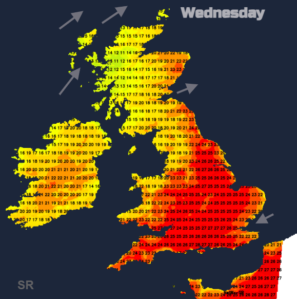
Today temperatures will be a touch higher reaching 25C to 28C in the brilliant sunshine. There is a deepening low pressure well away to the north which will bring blustery winds to northern Scotland and a moderate westerly channelling through the Central Belt. With more cloud about again today the temperatures will be 15 to 21C although Aberdeenshire could leap up to the mid 20sC in any sunny lee breaks.
The weak warm front will throw more cloud down across northern parts of the UK today with bright spells but the sunshine continues further south. There will be a fresher breeze coming off the Thames estuary and North Sea to East Anglian coasts and the north coast Kent.
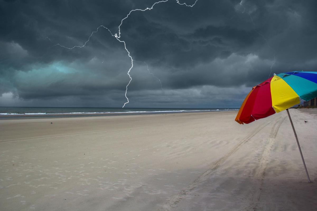
The heat builds again on Thursday but we’ll be watching developments from France. For many, it will be a fine, warm day with strong sunny spells. However, there will be heavy showers swirling up over England and Wales as a low pressure moves north to the English Channel. Swooping in from the northwest is the cold front from the other low with heat in between.
It has the ingredients for torrential downpours, thunderstorms (home-grown and imported in the plume) sudden gusty winds and hail with flash flooding from the heavy rain as it has been dry recently. Some areas will see these downpours and others know nothing about them, except if you are keeping an eye on the Netweather Radar. There is now a wide yellow warning for Thunderstorms out from the Met Office. We’ll have to wait for tomorrow for more detail.
The risk looks to start in the morning over SE England and spread over SE Britain by lunchtime, more of southern Britain in the afternoon and evening. Then reaching up through northern England into the night. So, Glastonbury could be affected on Thursday afternoon and evening but then there is a drift eastwards of the heavy shower threat.
Friday
For Friday morning there still could be clusters of heavy, even thundery shwoers over eastern Britain from The Wash up to The Forth. Moving from inland to eastern Counties and then spreading to eastern and northern mainland Scotland. Warm again with sunny spells but with temperatures of 17 to 22C, not as hot.
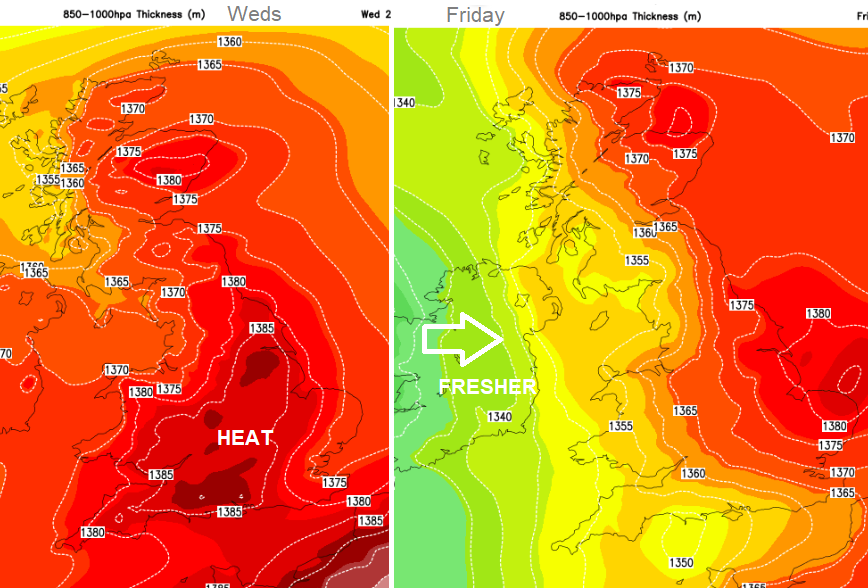
Through Friday the showery rain from the cold front begins to edge in from Ireland, looking to take until evening to reach Northern Ireland and the West Country. Behind this will be fresher conditions for the weekend with plenty of sunshine but blustery showers from the west.