


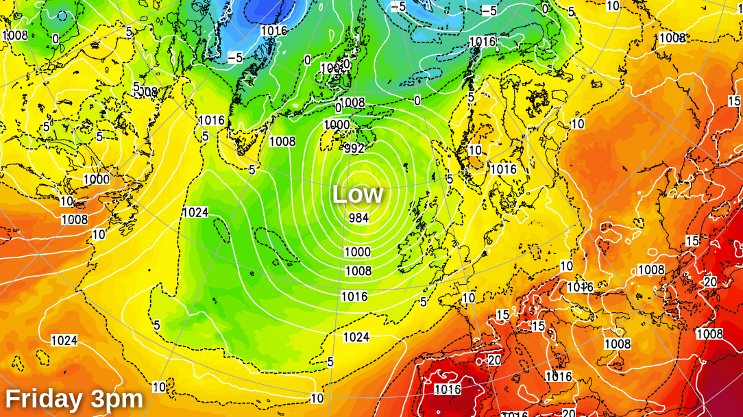
With low pressure near the northwest and later the north of the UK, there'll be a northwest-southeast split in the weather over the coming days. With those further south and east enjoying the warmer, drier and sunnier conditions.
As a general rule, the further East and South you are, the better the weather will be today and this coming weekend. As a result, Northern Ireland and the North and West of Scotland will bear the brunt of a large Atlantic depression centred to the North West of Britain.
But with the air coming from the South West and also containing remnants of ex-tropical storm Alex, it'll be quite warm, if windy at times, especially in the North and West.
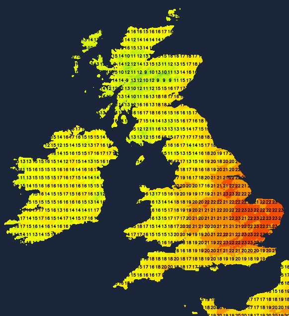
Early cloud today across the South East will soon clear, leaving much of England, Wales and South East Scotland as far North as Fife, fine with sunny spells. Many places will also be dry, although a few showers will develop by the afternoon, mostly in the West and South West. However, across Northern Ireland, Cumbria and the North and West of Scotland, showers will develop more widely, some becoming heavy, giving local hail and a crack of thunder.
A South to South West wind will be fresh or strong in the North and West, with gales likely along exposed West coasts of Scotland and across the Western Isles. Further East and South winds'll be somewhat lighter with maximum temperatures 11 to 18C in the North and North West and 18 to 23C more generally.
A fresh or strong South West wind brings more frequent showers, heavy and lengthy at times to North West Scotland, these spreading to Tyrone, Fermanagh and Derry after dark. Elsewhere expect fewer showers, mainly over the remaining parts of Northern Ireland, East Scotland and in the West and South West. There'll be clear spells, especially in central and eastern areas where winds'll be somewhat lighter on a mild night when temperatures shouldn't fall below 10 to 15C.
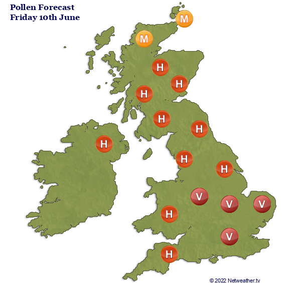
If you're a hayfever sufferer, pollen levels are currently high or very high across a good part of the UK and will stay that way across the weekend.
Much of Scotland and Northern Ireland see a plethora of showers on Saturday, some again heavy and lengthy, in a fresh to strong and gusty South to South West wind. Top temperatures here just 11 to 14C. England and Wales see fewer showers, these mainly over Cumbria and in the West, where some could also be heavy. But generally, the further East and South you are, it shouldn't be quite so windy, and you're more likely to stay dry. You'll also see the best of the sunny spells that'll be on offer, with top temperatures 18 to 24C.
Saturday evening and overnight, continue to see the bulk of the showers in the North and West, with the East and South continuing mainly dry with clear intervals. A South West wind remains blustery in the North and West but lighter further South in another mild night generally, when temperatures fall no lower than 9 to 14C.
The South and East continue to fare better than the North into Sunday and Monday, but there are signs next week of a more general, much warmer interval.
This probably won't last, though, breaking down into showers and perhaps thunderstorms before the end of the week.


