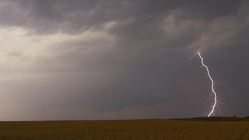
A look at the potential for some heavy downpours and thunderstorms affecting parts of the UK during the second half of the weekend and through next week.
The models have been indicating the potential for some heavy showers or even some thunderstorms to move up from the south across parts of England and Wales over the weekend. Although high pressure will bring a fine end to the week across the south and brings more widespread fine weather on Saturday, as the high drifts north across the U.K., the high will retreat far enough northeast by Sunday to allow an amplifying upper trough over the Atlantic to make further inroads towards the UK from the west. This will allow an elevated plume of warm and moist air to advect NE across western Europe as the flow backs - reaching southern England by Sunday. Showers and perhaps some thunderstorms are forecast to develop along the ‘nose’ of the plume as it moves up across southern England Saturday night, though there is still some uncertainty to the extent of destabilisation on the NW side of the plume across northern France, English Channel and southern England.
00z ECMWF Simulated IR images and 850 hPa wet-bulb potential temp (theta-w) loop shows warm moist plume (orange lines) spreading north later on Saturday into Sunday
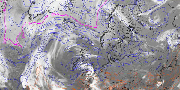
06z GFS theta-w charts also show plume spreading north out of France Saturday PM onwards:
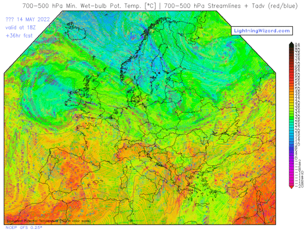
As the elevated plume of warm and moist air spreads north out of France, as shown by 850 hPa level wet-bulb potential temperature (theta-w) charts, there is varying extents of destabilisation of the plume in the mid-levels suggested by models, as colder air overruns the plume aloft with approach of upper trough from the west and also smaller upper vortex from the southwest, this process of destabilisation is known as ‘Differential Thermal Advection.’
How strong destabilisation will be, and thus whether there will be some elevated thunderstorms, varies between models and appears to depend on how far west or east a shortwave trough / meso-vortex tracks north on the eastern side of the upper trough to the west – as this will provide extra lift and colder air aloft for destabilisation of the northwest side of the plume moving north into S England.
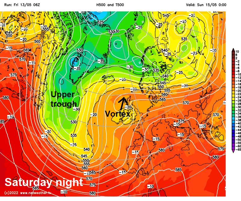
Water vapor imagery shows vortex / shortwave trough to the NW of Iberia, which will then swing NE over next 36 hours and will provide lift to help destabilise NW edge of theta-w plume moving in across the south
.jpg)
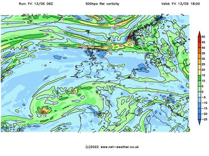
Vortex can be seen on GFS 500 hPa relative vorticity charts moving NE towards western Britain:
Colder air aloft (500 hPa) overruning the 850 hPa warm moist plume allowing some destabilisation in the mid-levels
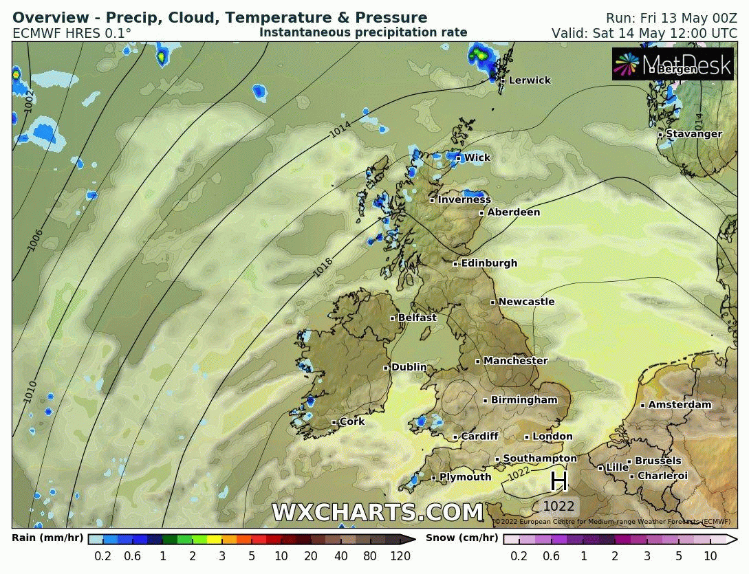
ECMWF high res and UKV high resolution models seem more bullish than GFS, ICON and ARPEGE models with breaking out heavy showers and perhaps some isolated thunderstorms from Saturday late evening across southern most counties of England initially, perhaps reaching the Midlands and East Anglia in the early hours.
00z ECMWF precipitation animation Saturday PM into Sunday
Given the model poor agreement between models over extent of rainfall developing and risk of thunderstorms Saturday night / early Sunday – pinpointing the risk for thunderstorms remains uncertain, even the more bullish ECMWF / UKV high res runs keep MUCAPE mostly over northern France. However, models notoriously struggle with this plume destabilisation scenarios, so it may not be apparent until nearer the time how much destabilisation and thus thunderstorms will occur. But for now, best assumption for Saturday night / early Sunday that they will be isolated and most likely confined to English Channel coasts and may not get far inland before losing electrical activity. Otherwise, some elevated heavy showers can be expected to spread north across parts of England and Wales Saturday night and through Sunday morning. Risk of isolated thunderstorms towards central southern and southeast England – where higher theta-w plume pushes in and destabilises, as mentioned.
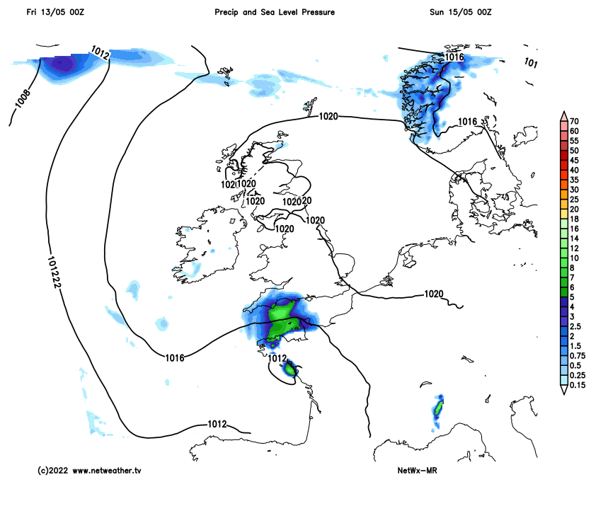
There will be a continued risk of heavy downpours and perhaps thunderstorms spreading north during Sunday and also through Monday too – as the warm and moist plume continues to spread north across England and Wales – while destabilising through differential thermal advection and also from surface heating. Perhaps a greater probability of thunderstorms than Saturday night, as the upper trough to the west further encroaches and one or two more shortwave troughs moving north or northeast interact with the plume and destabilise it in the mid-levels from time to time, bringing areas of heavy downpours and thunderstorms moving north. In fact, much of next week may see further spells of heavy thundery rain and thunderstorms spreading north at times, as the upper trough over the Atlantic stalls close to the west – with further shortwave troughs / fronts moving north and northeast.
Risk of thundery downpours continues Sunday and next week too, with low pressure stalling to the west:
There’ll be some welcome rain for some gardens across England and Wales, some of the rain could be torrential and lead to some localised flooding, but not everywhere may see a thundery downpour, as it the nature of these thundery showers.
A Netweather Thunderstorm Watch will likely be issued tomorrow, if it looks increasingly likely there will be a risk of thunderstorms Saturday night and Sunday.