More brightness today even sunny spells as a scattering of heavy showers, even an isolated thunderstorm. Warmer for Thursday and Friday in places, just into the low 20sC
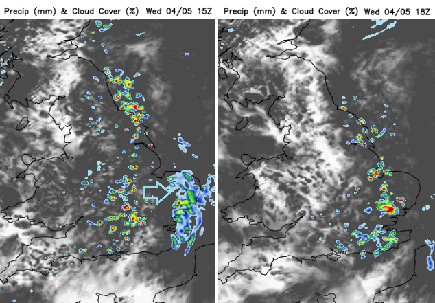
If you are missing the sunshine, there is a change on the way this afternoon. After some sharp showers, even the odd thunderstorm today the cloud cover is breaking up and there will be brighter skies, even sunshine. We have a damp and grey start in many places with showery rain moving eastwards. Brighter skies this morning for Northern Ireland and SW England. Pressure is trying to build in from the southwest today, but a cluster of heavier showers will begin to march across Britain by lunchtime. These continue to develop through the afternoon as they reach eastern/SE England this evening.
Behind this there will be fine weather, with sunny spells although a warm front will brush past the north coast of Northern Ireland, NW Scotland and the Northern Isles overnight. So, more cloud and a little patchy rain here, a SW breeze for the Western Isles into Thursday morning but for most it will be fine and dry later today and slightly cooler overnight with very light winds.
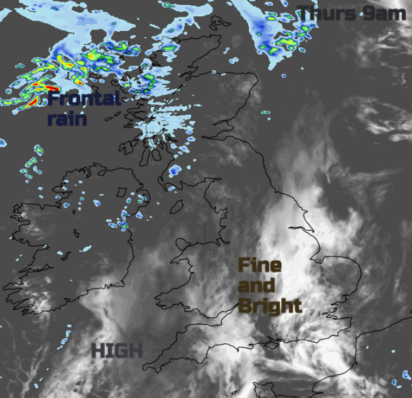
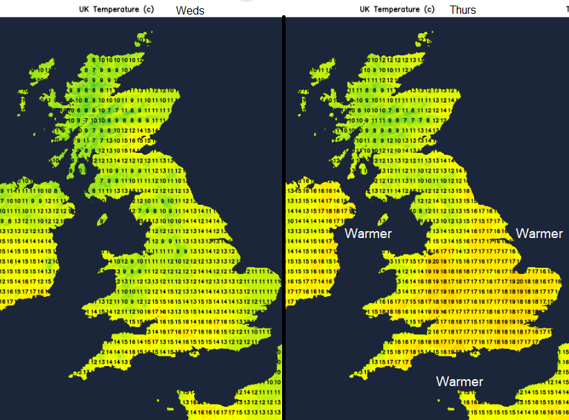
Thursday looks to be the warmest day of the week for many parts of the UK although that frontal band will continue to bring cloud and patchy rain to northwestern parts and more of a breeze, so the temperatures stay down. Friday will be warmer still in the southeast.
To the south and east of the rain in the far NW, it will be fine with bright or sunny spells, the temperatures will be in the mid to high teens, even tipping to 20 or 21C, so 70 F.
For many today the temperatures will be in the mid-teens but in some of the brighter, sunnier spots temperatures could reach 17 to 19C. As the warmth of the day gets going the convection builds, for SE Scotland and NE England late morning. North Yorkshire down into the Midlands and Cotswolds by lunchtime. There is the risk of an isolated thunderstorm, even hail. So many areas staying fine with brighter skies but there will be the risk of a few heavier showers. This risk extends eastwards over England through the afternoon and evening.

As an upper trough moves away eastwards over Britain this morning the cool air aloft, and warmth from the surface heating as sunshine appears, will create instability. "cumulonimbus clouds will likely grow taller and produce heavier showers with hail and locally thunder." There will be some heavy bursts of rain until the warmth of the day fades.
Friday will be warm again for eastern Scotland and much of England with a light westerly breeze. Inland southern England is more likely to see 17 to 20C with up to 22 or 23C possible for London. A fair weekend with warm sunshine but cooler at night.